- Population
- 967
- 967
- Elevation
- 513 m
- above sea level
- Local time
- UTC+01:00
- Europe/Bratislava · UTC+01:00
- Airports
- TAT Poprad-Tatry Airport41 km
- KSC Košice International Airport52 km
About Bijacovce
Bijacovce is a village. Location: Levoča District, Prešov Region. Population: 967. Elevation: 513 m.
Bijacovce (Hungarian: Szepesmindszent; German Biazowitz/Betendorf) is a village and municipality in Levoča District in the Prešov Region of central-eastern Slovakia. The village is along the famous Gothic Route and the church dates from the 13th century. The church is gothic with a rotunda to match. There is also a manor house from the 18th century in Bijacovce. The manor house was built between 1780 and 1785 by the Csaky family. The last renovation of the manor house was in 1955.
Source: Wikipedia · CC BY-SA 4.0
Population of Bijacovce over time
| 2017 | 949 | |
|---|---|---|
| 2021 | 967 | |
| 2024 | 971 | |
| 2025 | 968 |
Censuses and official estimates; source: Wikidata.
Climate of Bijacovce
Best months for sightseeingBest months for sightseeing: June–August.
This month · November
A cold month
Day 6° · Night -1° · Rain 54 mm
- Hottest month
- July (day 22°)
- Coldest month
- January (night -6°)
- Wettest month
- June (121 mm)
- Driest month
- February (35 mm)
Bars: average monthly low and high temperature. Below: precipitation. Monthly averages for 1970–2000 at about 18 km resolution, adjusted for elevation. Highlighted months are mild and relatively dry. Source: WorldClim 2.1 (CC BY 4.0).
Show values as a table
| Month | Jan | Feb | Mar | Apr | May | Jun | Jul | Aug | Sep | Oct | Nov | Dec |
|---|---|---|---|---|---|---|---|---|---|---|---|---|
| Average high (°C) | 1° | 2° | 7° | 12° | 18° | 21° | 22° | 22° | 18° | 13° | 6° | 2° |
| Average low (°C) | -6° | -5° | -2° | 3° | 7° | 10° | 12° | 11° | 8° | 4° | -1° | -5° |
| Precipitation (mm) | 47 | 35 | 40 | 64 | 93 | 121 | 110 | 92 | 68 | 54 | 54 | 48 |
How to get to Bijacovce
The nearest airport is Poprad-Tatry Airport (TAT), 41 km to the west as the crow flies. The nearest large city is Košice, 48 km to the southeast.
Airports
- Poprad-Tatry Airport (TAT) Poprad 41 kmwest
- Košice International Airport (KSC) Košice 52 kmsoutheast
- Sliač Airport (SLD) Sliač 130 kmwest
Nearby large cities
- Košice Population: 225K 48 kmsoutheast
- Miskolc Population: 154.5K 102 kmsouth
- Nyíregyháza Population: 117.7K 137 kmsoutheast
- Debrecen Population: 202.4K 177 kmsouth
- Satu Mare Population: 112.5K 205 kmsoutheast
Straight-line distances; road distances are longer. Airport data: OurAirports.
Day trips from Bijacovce
Within 100 km: 30 historic and cultural sites, 252 natural sites, 18 lakes, rivers and coasts.
0–25 km6 places
- Branisko Mountain 11 kmNE
- Spišská Kapitula Attraction 5 kmSW
- Spiš Castle Historic site 3 kmSW
- Levočské Vrchy Mountain 20 kmNW
25–60 km91 places
- Skalnaté pleso Lake 45 kmNW
- Popradské Pleso Lake 55 kmW
- Ostrá Mountain 59 kmW
- Vysoká Mountain 54 kmW
60–100 km203 places
- Čertovica Mountain 79 kmW
- Bystrá Mountain 72 kmW
- Baníkov Mountain 82 kmW
- Magura Mountain 64 kmW
Straight-line distances.
Nearby attractions & nature
Everything nearby-
Spiš Castle Historic site, Okres Spišská Nová Ves3.4 km SW
-
Spišská Kapitula Attraction, Levoča District5 km SW
-
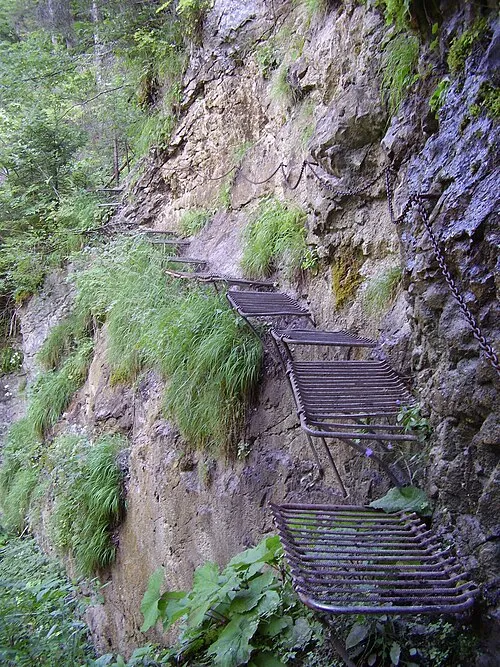 Prielom Hornádu Natural site, Czechia25 km W
-
Branisko Mountain, Prešov Region11 km NE
-
Levočské Vrchy Mountain, Prešov Region20 km NW
-
Hnilec River, Košice Region22 km SE
Sources & licences
Data last updated: · 2 independent sources