Spišské Podhradie
Located in Levoča District, Prešov Region Coordinates: 49°00′03″ N 20°45′11″ E

- Population
- 3,769
- 3.8K
- Elevation
- 434 m
- above sea level
- Local time
- UTC+01:00
- Europe/Bratislava · UTC+01:00
- Airports
- TAT Poprad-Tatry Airport38 km
- KSC Košice International Airport52 km
About Spišské Podhradie
Spišské Podhradie is a village. Location: Levoča District, Prešov Region. Population: 3,769. Elevation: 434 m.
Spišské Podhradie (; German: Kirchdrauf, Hungarian: Szepesváralja) is a town in Spiš in the Prešov Region of Slovakia. Its population is 3,775. Spišské Podhradie is situated at the foot of the hill of Spiš Castle. It had a Zipser German settlement, with its own church and priest, in 1174. Just above, and adjacent to, the town is the ecclesiastical settlement of Spišská Kapitula (hence an old German name Kirchdorf, meaning "church town"). The town contains a number of Renaissance merchants' houses.
Source: Wikipedia · CC BY-SA 4.0
Photos of Spišské Podhradie
-

Spiš Castle Andrei Stroe · CC BY-SA 4.0

Population of Spišské Podhradie over time
| 2017 | 4,026 | |
|---|---|---|
| 2021 | 3,791 | |
| 2024 | 3,730 | |
| 2025 | 3,715 |
Censuses and official estimates; source: Wikidata.
Climate of Spišské Podhradie
Best months for sightseeingBest months for sightseeing: June–August.
This month · November
A cold month
Day 6° · Night 0° · Rain 54 mm
- Hottest month
- July (day 23°)
- Coldest month
- January (night -6°)
- Wettest month
- June (121 mm)
- Driest month
- February (35 mm)
Bars: average monthly low and high temperature. Below: precipitation. Monthly averages for 1970–2000 at about 18 km resolution, adjusted for elevation. Highlighted months are mild and relatively dry. Source: WorldClim 2.1 (CC BY 4.0).
Show values as a table
| Month | Jan | Feb | Mar | Apr | May | Jun | Jul | Aug | Sep | Oct | Nov | Dec |
|---|---|---|---|---|---|---|---|---|---|---|---|---|
| Average high (°C) | 1° | 3° | 7° | 13° | 18° | 21° | 23° | 23° | 18° | 13° | 6° | 2° |
| Average low (°C) | -6° | -5° | -1° | 3° | 8° | 11° | 12° | 12° | 9° | 4° | 0° | -4° |
| Precipitation (mm) | 47 | 35 | 40 | 64 | 93 | 121 | 110 | 92 | 68 | 54 | 54 | 48 |
How to get to Spišské Podhradie
The nearest airport is Poprad-Tatry Airport (TAT), 38 km to the west as the crow flies. The nearest large city is Košice, 49 km to the southeast.
Airports
- Poprad-Tatry Airport (TAT) Poprad 38 kmwest
- Košice International Airport (KSC) Košice 52 kmsoutheast
- Sliač Airport (SLD) Sliač 126 kmwest
Nearby large cities
- Košice Population: 225K 49 kmsoutheast
- Miskolc Population: 154.5K 100 kmsouth
- Nyíregyháza Population: 117.7K 136 kmsoutheast
- Debrecen Population: 202.4K 176 kmsouth
- Satu Mare Population: 112.5K 206 kmsoutheast
Straight-line distances; road distances are longer. Airport data: OurAirports.
Day trips from Spišské Podhradie
Within 100 km: 27 historic and cultural sites, 240 natural sites, 17 lakes, rivers and coasts.
0–25 km6 places
- Branisko Mountain 15 kmNE
- Spišská Kapitula Attraction 1 kmW
- Spiš Castle Historic site 1 kmE
- Levočské Vrchy Mountain 20 kmNW
25–60 km98 places
- Skalnaté pleso Lake 43 kmNW
- Popradské Pleso Lake 52 kmW
- Ostrá Mountain 56 kmW
- Vysoká Mountain 52 kmW
60–100 km180 places
- Čertovica Mountain 75 kmW
- Bystrá Mountain 70 kmW
- Baníkov Mountain 79 kmW
- Magura Mountain 62 kmNW
Straight-line distances.
Nearby attractions & nature
Everything nearby-
Spišská Kapitula Attraction, Levoča District0.9 km W
-
Spiš Castle Historic site, Okres Spišská Nová Ves1.1 km E
-
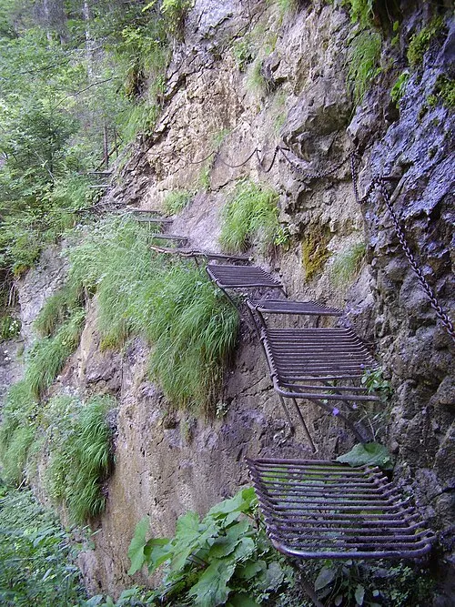 Prielom Hornádu Natural site, Czechia21 km W
-
 Branisko Mountain, Prešov Region15 km NE
-
 Levočské Vrchy Mountain, Prešov Region20 km NW
-
 Hnilec River, Košice Region23 km SE
Other cities and towns in Levoča District


Sources & licences
Data last updated: · 2 independent sources