- Population
- 26,669
- 26.7K
- Elevation
- 404 m
- above sea level
- Local time
- UTC+01:00
- Europe/Bratislava · UTC+01:00
- Places inside
- 11
- listed under Okres Myjava
- Airports
- BTS M. R. Štefánik Airport70 km
- BRQ Brno-Tuřany Airport79 km
About Okres Myjava
Okres Myjava is a district. Location: Trenčín Region, Slovakia. Population: 26,669.
Myjava District (Slovak: okres Myjava, Hungarian: Milavai járás) is a district in the Trenčín Region of western Slovakia. It is located in the area of the Myjava Hills. Myjava district belongs to the smaller districts in Slovakia and the population density is slightly under the country average. In the north it borders with the Czech Republic. Myjava district was established in 1923 and in its present borders exists from 1996.
Source: Wikipedia · CC BY-SA 4.0
Places bordering Okres Myjava
- Nové Mesto nad Váhom District
- Piešťany District
- Trnava District
- Senica District
- Skalica District
Population of Okres Myjava over time
| 2017 | 26,669 | |
|---|---|---|
| 2021 | 25,678 | |
| 2024 | 24,809 | |
| 2025 | 24,551 |
Censuses and official estimates; source: Wikidata.
Climate of Okres Myjava
Best months for sightseeingBest months for sightseeing: June–August.
This month · November
A cold month
Day 6° · Night 0° · Rain 54 mm
- Hottest month
- July (day 23°)
- Coldest month
- January (night -5°)
- Wettest month
- June (90 mm)
- Driest month
- February (36 mm)
Bars: average monthly low and high temperature. Below: precipitation. Monthly averages for 1970–2000 at about 18 km resolution, adjusted for elevation. Highlighted months are mild and relatively dry. Source: WorldClim 2.1 (CC BY 4.0).
Show values as a table
| Month | Jan | Feb | Mar | Apr | May | Jun | Jul | Aug | Sep | Oct | Nov | Dec |
|---|---|---|---|---|---|---|---|---|---|---|---|---|
| Average high (°C) | 1° | 3° | 7° | 13° | 19° | 21° | 23° | 23° | 18° | 13° | 6° | 2° |
| Average low (°C) | -5° | -4° | -1° | 3° | 8° | 11° | 12° | 12° | 9° | 4° | 0° | -3° |
| Precipitation (mm) | 38 | 36 | 36 | 48 | 73 | 90 | 83 | 83 | 63 | 47 | 54 | 51 |
How to get to Okres Myjava
The nearest airport is M. R. Štefánik Airport (BTS), 70 km to the southwest as the crow flies. The nearest large city is Bratislava, 76 km to the southwest.
Airports
- M. R. Štefánik Airport (BTS) Bratislava 70 kmsouthwest
- Brno-Tuřany Airport (BRQ) Brno 79 kmnorthwest
- Vienna International Airport (VIE) Vienna 103 kmsouthwest
Nearby large cities
- Bratislava Population: 423.7K 76 kmsouthwest
- Brno Population: 404.3K 87 kmnorthwest
- Győr Population: 129.3K 119 kmsouth
- Székesfehérvár Population: 101.6K 184 kmsouth
- Graz Population: 303.3K 246 kmsouthwest
Straight-line distances; road distances are longer. Airport data: OurAirports.
Day trips from Okres Myjava
Within 100 km: 102 historic and cultural sites, 624 natural sites, 138 lakes, rivers and coasts.
0–25 km12 places
- Velký Lopeník Mountain 24 kmNE
- Březová Dolina Natural site 21 kmNE
- Vyzkum Mountain 17 kmNW
- Kobyla Mountain 15 kmNW
25–60 km75 places
- Tríbeč Mountain 59 kmSE
- Záruby Mountain 29 kmSW
- Klokoč Mountain 37 kmSW
- Chvojnica River 32 kmW
60–100 km777 places
- Strážov Mountain 68 kmE
- Devínska Kobyla Mountain 76 kmSW
- Mirbach Palace Historic site 76 kmSW
- Bratislava Castle Historic site 76 kmSW
Straight-line distances.
Places in Okres Myjava
11 places- 1 Myjava 10.6K
- 2 Brezová pod Bradlom 4.6K
- 3 Krajné 1.5K
- 4 Vrbovce 1.4K
- 5 Brestovec 949
- 6 Stará Myjava 761
- 7 Košariská-Priepasné 378
- 8 Chvojnica 317
- 9 Kostolné 250
- 10 Podkylava 244
Bar: population relative to the most populous place in this list.
Cities & villages1
- Poriadie · Village
Nearby attractions & nature
Everything nearby-
Kamenná Vrata Mountain, Javorník9.3 km N
-
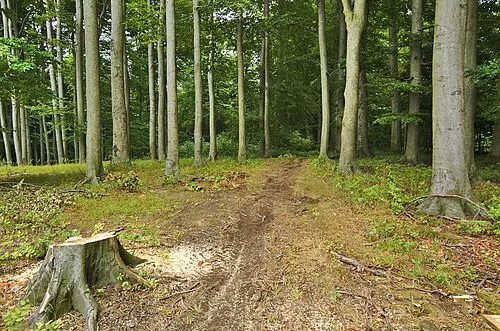 Hradisko Mountain, Javorník12 km N
-
Žalostina Mountain, South Moravian14 km NW
-
Kobyla Mountain, Hrubá Vrbka15 km NW
-
Háj [Velká nad Veličkou] Mountain, Velká nad Veličkou16 km N
-
Vyzkum Mountain, Hroznová Lhota17 km NW
Sources & licences
Data last updated: · 2 independent sources