- Population
- 1,928
- 1.9K
- Elevation
- 765 m
- above sea level
- Local time
- UTC+01:00
- Europe/Bratislava · UTC+01:00
- Airports
- TAT Poprad-Tatry Airport50 km
- SLD Sliač Airport78 km
About Zuberec
Zuberec is a village. Location: Tvrdošín District, Žilina Region. Population: 1,928. Elevation: 765 m.
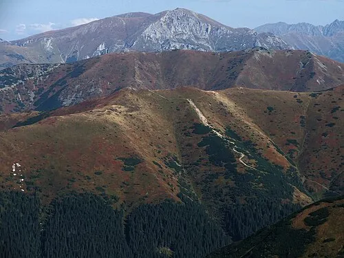
Zuberec (Hungarian: Bölényfalu) is a village in northern Slovakia and a popular tourist center at the foothills of the Western Tatras. Zuberec features numerous accommodation facilities, restaurants, museum and a tourist information office. The village is the place of several cultural and sporting events including Podroháčske folklórne slávnosti (folk festival), Goralský klobúčik (alpine skiing), Oravaman (triathlon) and WSA Eurocup Zuberec (dogsled racing).
Source: Wikipedia · CC BY-SA 4.0
Population of Zuberec over time
| 2017 | 1,841 | |
|---|---|---|
| 2021 | 1,913 | |
| 2024 | 1,928 | |
| 2025 | 1,926 |
Censuses and official estimates; source: Wikidata.
Climate of Zuberec
Best months for sightseeingBest months for sightseeing: June–August.
This month · November
A cold month
Day 5° · Night -2° · Rain 70 mm
- Hottest month
- August (day 21°)
- Coldest month
- January (night -7°)
- Wettest month
- July (139 mm)
- Driest month
- February (56 mm)
Bars: average monthly low and high temperature. Below: precipitation. Monthly averages for 1970–2000 at about 18 km resolution, adjusted for elevation. Highlighted months are mild and relatively dry. Source: WorldClim 2.1 (CC BY 4.0).
Show values as a table
| Month | Jan | Feb | Mar | Apr | May | Jun | Jul | Aug | Sep | Oct | Nov | Dec |
|---|---|---|---|---|---|---|---|---|---|---|---|---|
| Average high (°C) | 1° | 2° | 5° | 10° | 16° | 19° | 21° | 21° | 16° | 11° | 5° | 1° |
| Average low (°C) | -7° | -7° | -4° | 0° | 5° | 8° | 9° | 9° | 6° | 2° | -2° | -6° |
| Precipitation (mm) | 58 | 56 | 58 | 71 | 108 | 133 | 139 | 119 | 91 | 66 | 70 | 66 |
How to get to Zuberec
The nearest airport is Poprad-Tatry Airport (TAT), 50 km to the southeast as the crow flies. For international flights: Kraków John Paul II International Airport (KRK) (92 km). The nearest large city is Košice, 135 km to the southeast.
Airports
- Poprad-Tatry Airport (TAT) Poprad 50 kmsoutheast
- Sliač Airport (SLD) Sliač 78 kmsouthwest
- Kraków John Paul II International Airport (KRK) Balice 92 kmnorth
Nearby large cities
- Košice Population: 225K 135 kmsoutheast
- Miskolc Population: 154.5K 155 kmsoutheast
- Nyíregyháza Population: 117.7K 212 kmsoutheast
- Brno Population: 404.3K 219 kmwest
- Bratislava Population: 423.7K 222 kmsouthwest
Straight-line distances; road distances are longer. Airport data: OurAirports.
Day trips from Zuberec
Within 100 km: 42 historic and cultural sites, 382 natural sites, 14 lakes, rivers and coasts.
0–25 km37 places
- Bystrá Mountain 19 kmSE
- Baníkov Mountain 10 kmSE
- Orava Castle Historic site 19 kmW
- Nádrž Liptovská Mara Lake 19 kmS
25–60 km197 places
- Skalnaté pleso Lake 46 kmE
- Popradské Pleso Lake 36 kmE
- Ostrá Mountain 32 kmE
- Vysoká Mountain 36 kmE
60–100 km204 places
- Korňa River 75 kmW
- Branisko Mountain 97 kmE
- Strážov Mountain 91 kmW
- Poľana Mountain 70 kmS
Straight-line distances.
Nearby attractions & nature
Everything nearby
Sources & licences
Data last updated: · 2 independent sources