Lukanja
Located in Municipality of Slovenska Bistrica, Slovenia Coordinates: 46°27′22″ N 15°22′53″ E

- Population
- 7
- 7
- Elevation
- 1,269 m
- above sea level
- Local time
- UTC+01:00
- Europe/Ljubljana · UTC+01:00
- Airports
- MBX Maribor Edvard Rusjan Airport24 km
- GRZ Graz Airport60 km
About Lukanja
Lukanja is a village. Location: Municipality of Slovenska Bistrica, Slovenia. Population: 7. Elevation: 1,269 m.
Lukanja (pronounced [luˈkaːnja]) is a dispersed settlement in the Pohorje Hills in the Municipality of Slovenska Bistrica in northeastern Slovenia. Some of the Rogla ski resort facilities extend into the territory of Lukanja. The area is part of the traditional region of Styria. It is now included with the rest of the municipality in the Drava Statistical Region.
Source: Wikipedia · CC BY-SA 4.0
At a glance
- Area
- 22.2 km²
Source: Wikidata
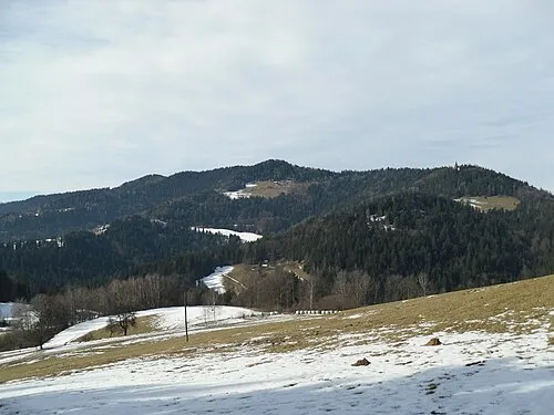
Photos of Lukanja
-

Rogla Doremo · CC BY-SA 4.0

Climate of Lukanja
Best months for sightseeingBest months for sightseeing: July–August.
This month · November
A wet month
Day 3° · Night -4° · Rain 109 mm
- Hottest month
- July (day 19°)
- Coldest month
- January (night -9°)
- Wettest month
- June (147 mm)
- Driest month
- January (53 mm)
Bars: average monthly low and high temperature. Below: precipitation. Monthly averages for 1970–2000 at about 18 km resolution, adjusted for elevation. Highlighted months are mild and relatively dry. Source: WorldClim 2.1 (CC BY 4.0).
Show values as a table
| Month | Jan | Feb | Mar | Apr | May | Jun | Jul | Aug | Sep | Oct | Nov | Dec |
|---|---|---|---|---|---|---|---|---|---|---|---|---|
| Average high (°C) | -1° | 1° | 5° | 9° | 14° | 17° | 19° | 19° | 15° | 10° | 3° | -1° |
| Average low (°C) | -9° | -8° | -5° | -1° | 3° | 7° | 8° | 8° | 5° | 1° | -4° | -7° |
| Precipitation (mm) | 53 | 58 | 79 | 95 | 107 | 147 | 139 | 130 | 116 | 115 | 109 | 81 |
How to get to Lukanja
The nearest airport is Maribor Edvard Rusjan Airport (MBX), 24 km to the east as the crow flies. For international flights: Graz Airport (GRZ) (60 km). The nearest large city is Graz, 68 km to the north.
Airports
- Maribor Edvard Rusjan Airport (MBX) Maribor 24 kmeast
- Graz Airport (GRZ) Feldkirchen bei Graz 60 kmnorth
- Ljubljana Jože Pučnik Airport (LJU) Zgornji Brnik 76 kmwest
Nearby large cities
- Graz Population: 303.3K 68 kmnorth
- Ljubljana Population: 272.2K 81 kmsouthwest
- Klagenfurt Population: 100.3K 85 kmwest
- Zagreb Population: 663.6K 85 kmsoutheast
- Rijeka Population: 108K 145 kmsouthwest
Straight-line distances; road distances are longer. Airport data: OurAirports.
Day trips from Lukanja
Within 100 km: 185 historic and cultural sites, 682 natural sites, 349 lakes, rivers and coasts.
0–25 km10 places
- Ribnica Lake Lake 10 kmNW
- Pohorje Mountain 11 kmNE
- Rogla Mountain 4 kmW
- Črni Vrh Mountain 12 kmW
25–60 km296 places
- Lake Ptuj Lake 41 kmE
- Jezero Pernica Lake 30 kmNE
- Lake Žovnek Lake 34 kmSW
- Raduha Mountain 49 kmW
60–100 km910 places
- Kašina River 95 kmSE
- Lake Bled Lake 99 kmW
- Šmarna gora Mountain 79 kmSW
- Mrzla Gora Mountain 62 kmW
Straight-line distances.
Nearby attractions & nature
Everything nearby-
Rogla Mountain, Municipality of Slovenska Bistrica3.8 km W
-
 Pongrac Mountain, Eibiswald23 km N
-
Montikogel Mountain, Leutschach an der Weinstraße23 km N
-
Kozjak Mountain, Austria19 km N
-
Remschnigg Mountain, Austria23 km N
-
 Pohorje Mountain, Municipality of Ruše11 km NE
Other cities and towns in Municipality of Slovenska Bistrica
-
 Cezlak Village, Municipality of Slovenska Bistrica6.3 km SE
-
Koritno Village, Municipality of Slovenska Bistrica6.9 km SE
-
 Kebelj Village, Municipality of Slovenska Bistrica8.1 km SE
-
Smrečno Village, Municipality of Slovenska Bistrica9.1 km E
-
 Bojtina Village, Municipality of Slovenska Bistrica9.2 km E
-
Malo Tinje Village, Municipality of Slovenska Bistrica9.7 km SE
Sources & licences
Data last updated: · 2 independent sources