- Elevation
- 1,067 m
- above sea level
- Local time
- UTC+01:00
- Europe/Ljubljana · UTC+01:00
- Airports
- LJU Ljubljana Jože Pučnik Airport22 km
- KLU Klagenfurt Airport26 km
About Karawanken
Karawanken is a mountain. Location: Municipality of Tržič, Slovenia. Elevation: 1,067 m.
The Karawanks or Karavankas or Karavanks (Slovene: Karavanke; German: Karawanken, German pronunciation: [kaʁaˈvaŋkŋ̍] ) are a mountain range of the Southern Limestone Alps on the border between Slovenia to the south and Austria to the north. With a total length of 120 kilometres (75 mi) in an east–west direction, the Karawanks chain is one of the longest ranges in Europe. It is traversed by important trade routes and has a great tourist significance.
Source: Wikipedia · CC BY-SA 4.0
At a glance
- Length
- 120 km
- Area
- 5,227 km²
Source: Wikidata
Photos of Karawanken
-
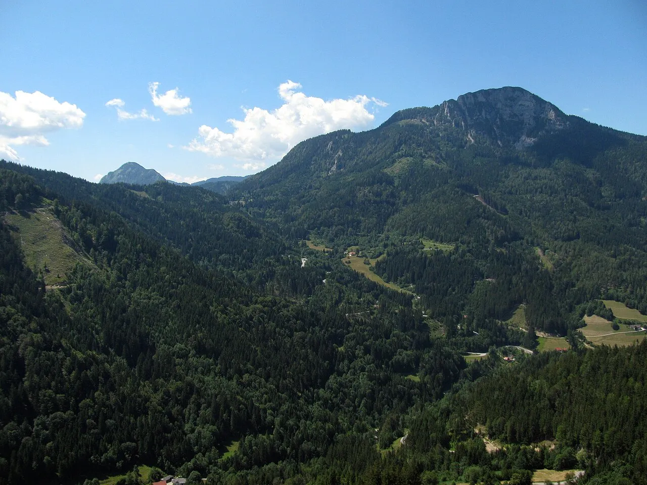
Kärntner Storschitz niksnut · CC BY-SA 2.0 -
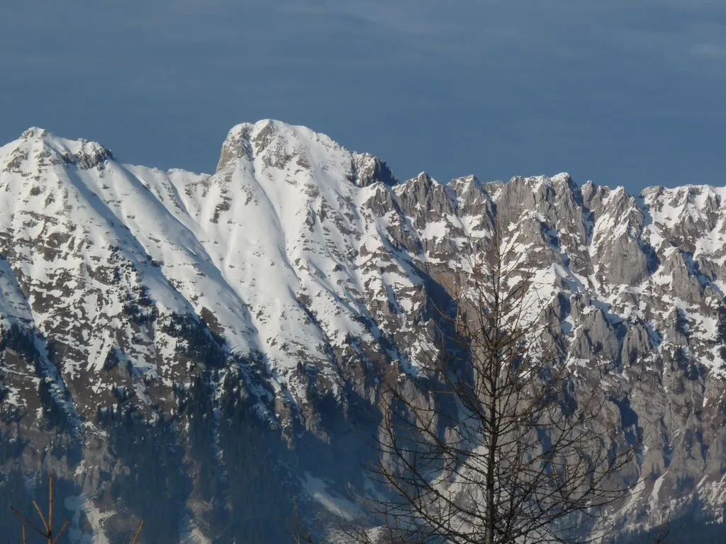
Koschutnikturm Miran Hladnik · CC BY-SA 2.5 si -
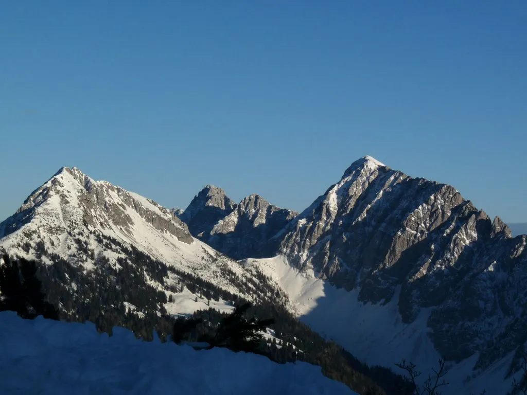
Hajnzturm Miran Hladnik · CC BY-SA 2.5 si -
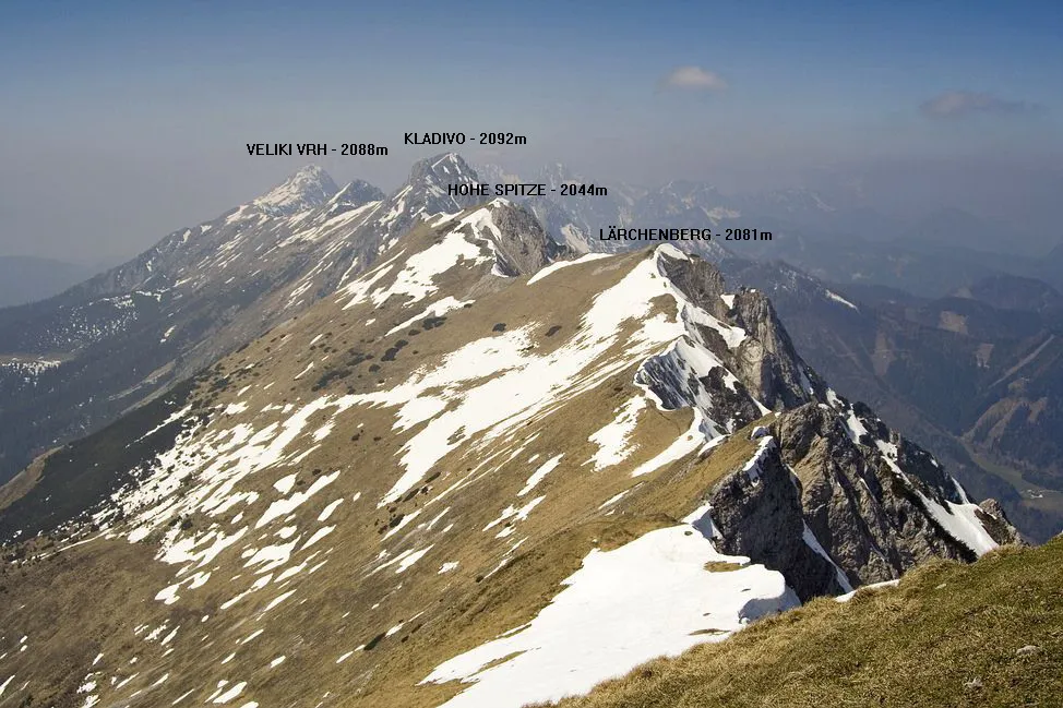
Lärchenberg Supervht at Czech Wikipedia · Public domain -

Trögener Klamm JOADL · CC BY-SA 3.0


Climate of Karawanken
Best months for sightseeingBest months for sightseeing: July–August.
This month · November
A wet month
Day 5° · Night -2° · Rain 177 mm
- Hottest month
- July (day 20°)
- Coldest month
- January (night -7°)
- Wettest month
- June (187 mm)
- Driest month
- February (84 mm)
Bars: average monthly low and high temperature. Below: precipitation. Monthly averages for 1970–2000 at about 18 km resolution, adjusted for elevation. Highlighted months are mild and relatively dry. Source: WorldClim 2.1 (CC BY 4.0).
Show values as a table
| Month | Jan | Feb | Mar | Apr | May | Jun | Jul | Aug | Sep | Oct | Nov | Dec |
|---|---|---|---|---|---|---|---|---|---|---|---|---|
| Average high (°C) | 1° | 2° | 5° | 9° | 14° | 18° | 20° | 20° | 16° | 11° | 5° | 1° |
| Average low (°C) | -7° | -7° | -4° | 0° | 4° | 8° | 10° | 9° | 6° | 3° | -2° | -6° |
| Precipitation (mm) | 92 | 84 | 118 | 149 | 151 | 187 | 164 | 152 | 159 | 171 | 177 | 126 |
How to get to Karawanken
The nearest airport is Ljubljana Jože Pučnik Airport (LJU), 22 km to the south as the crow flies. The nearest large city is Klagenfurt, 25 km to the north.
Airports
- Ljubljana Jože Pučnik Airport (LJU) Zgornji Brnik 22 kmsouth
- Klagenfurt Airport (KLU) Klagenfurt am Wörthersee 26 kmnorth
- Maribor Edvard Rusjan Airport (MBX) Maribor 98 kmeast
Nearby large cities
- Klagenfurt Population: 100.3K 25 kmnorth
- Ljubljana Population: 272.2K 41 kmsouth
- Graz Population: 303.3K 107 kmnortheast
- Rijeka Population: 108K 121 kmsouth
- Zagreb Population: 663.6K 138 kmsoutheast
Straight-line distances; road distances are longer. Airport data: OurAirports.
Day trips from Karawanken
Within 100 km: 165 historic and cultural sites, 972 natural sites, 368 lakes, rivers and coasts.
0–25 km217 places
- Mrzla Gora Mountain 14 kmSE
- Grintavec Mountain 11 kmSE
- Hochstuhl Mountain 19 kmW
- Kalški Greben Mountain 13 kmSE
25–60 km367 places
- Lake Bohinj Lake 45 kmW
- Lake Bled Lake 25 kmW
- Triglav Mountain 45 kmW
- Šmarna gora Mountain 32 kmS
60–100 km921 places
- Raša River 78 kmSW
- Ribnica Lake Lake 66 kmE
- Veliki Snežnik Mountain 93 kmS
- Prestreljenik Mountain 73 kmW
Straight-line distances.
Nearest towns and villages
-
Jelendol Village, Municipality of Tržič2.1 km W
-
Zell Municipality, Politischer Bezirk Klagenfurt Land6.2 km NW
-
Grahovše Village, Municipality of Tržič6.3 km SW
-
Spodnje Jezersko Village, Municipality of Jezersko5.3 km SE
-
Dolina Village, Municipality of Tržič6.7 km W
-
Zell-Freibach Village, Zell5.7 km N
Nearby attractions & nature
Everything nearby-
Petschounik Mountain, Carinthia2.1 km E
-
Pleschiwetz Mountain, Carinthia2.3 km NE
-
Koschutnikturm Mountain, Zell3.3 km N
-
Lärchenberg Mountain, Zell3.5 km NW
-
Saukogel Mountain, Eisenkappel-Vellach3.1 km NE
-
Mala-Kosuta Mountain, Austria3.4 km NE
-
Tolsta-Kosuta Mountain, Austria3.5 km N
-
Hohe Spitze Mountain, Austria3.7 km NW
Sources & licences
Data last updated: · 2 independent sources