- Elevation
- 500 m
- above sea level
- Local time
- UTC+01:00
- Europe/Madrid · UTC+01:00
- Airports
- LEI Almería Airport62 km
- GRX F.G.L. Airport Granada-Jaén Airport70 km
About Caserío Río Ugijar
Caserío Río Ugijar is a village. Location: Alcolea, Almeria. Elevation: 500 m. The best months to visit are April–May, October. The nearest airport is Almería Airport (62 km). Nearby sights include Rambla la Carchulina and Río Nechite.
Climate of Caserío Río Ugijar
Best months for sightseeingBest months for sightseeing: April–May, October.
This month · November
Outside the best season
Day 18° · Night 8° · Rain 50 mm
Better nearby cities in November
- Almería · 54 km east20°
- Málaga · 125 km west20°
- Cartagena · 197 km east21°
- Hottest month
- July (day 34°)
- Coldest month
- January (night 4°)
- Wettest month
- December (55 mm)
- Driest month
- July (4 mm)
Bars: average monthly low and high temperature. Below: precipitation. Monthly averages for 1970–2000 at about 18 km resolution, adjusted for elevation. Highlighted months are mild and relatively dry. Source: WorldClim 2.1 (CC BY 4.0).
Show values as a table
| Month | Jan | Feb | Mar | Apr | May | Jun | Jul | Aug | Sep | Oct | Nov | Dec |
|---|---|---|---|---|---|---|---|---|---|---|---|---|
| Average high (°C) | 14° | 16° | 19° | 20° | 25° | 30° | 34° | 34° | 30° | 24° | 18° | 15° |
| Average low (°C) | 4° | 5° | 6° | 9° | 12° | 16° | 19° | 19° | 16° | 12° | 8° | 5° |
| Precipitation (mm) | 53 | 43 | 43 | 44 | 34 | 18 | 4 | 4 | 19 | 43 | 50 | 55 |
How to get to Caserío Río Ugijar
The nearest airport is Almería Airport (LEI), 62 km to the east as the crow flies. For international flights: Málaga-Costa del Sol Airport (AGP) (133 km). The nearest large city is Almería, 54 km to the east.
Airports
- Almería Airport (LEI) Almería 62 kmeast
- F.G.L. Airport Granada-Jaén Airport (GRX) Granada 70 kmnorthwest
- Málaga-Costa del Sol Airport (AGP) Málaga 133 kmwest
Nearby large cities
- Almería Population: 196.9K 54 kmeast
- Granada Population: 233.5K 56 kmnorthwest
- Jaén Population: 113.5K 112 kmnorthwest
- Málaga Population: 592.3K 125 kmwest
- Marbella Population: 156.3K 171 kmwest
Straight-line distances; road distances are longer. Airport data: OurAirports.
Day trips from Caserío Río Ugijar
Within 100 km: 251 historic and cultural sites, 134 natural sites, 244 lakes, rivers and coasts.
0–25 km40 places
- Playa de San Nicolás Beach 23 kmS
- Playa La Rábita Beach 25 kmSW
- Cerro del Molinero Mountain 12 kmSE
- Las Alpujarras Mountain 22 kmSW
25–60 km266 places
- Playa Granada Beach 52 kmSW
- Playa Castell Del Ferro - Sotillo Beach 38 kmSW
- Playa de Nueva Almería Beach 56 kmE
- Playa de Poniente Beach 51 kmSW
60–100 km323 places
- Laguna Playa Beach 97 kmW
- La Cala el Cañuelo Beach Beach 70 kmW
- Playa Ancón Beach 80 kmE
- Cala Rajá Beach 82 kmE
Straight-line distances.
Nearby attractions & nature
Everything nearby-
Rambla la Carchulina River, Alcolea1.7 km N
-
Río Nechite River, Alcolea1.8 km NW
-
Río de Laroles River, Spain4.7 km NE
-
Arroyo de Valor River, Alcolea6.8 km NW
-
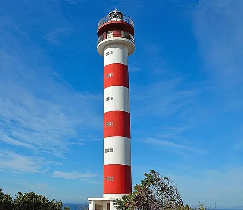 Adra Lighthouse Landmark, Adra22 km S
-
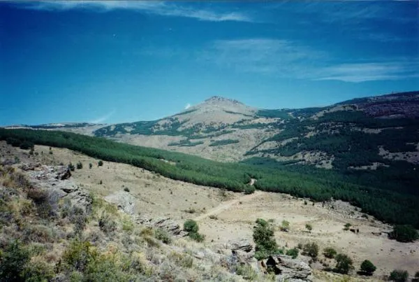 Cerro del Almirez Mountain, Fiñana20 km NE
Sources & licences
Data last updated: