Chiclana de la Frontera
Located in Cadiz, Andalusia Coordinates: 36°24′05″ N 6°07′40″ W

- Population
- 81,113
- 81.1K
- Elevation
- 30 m
- above sea level
- Local time
- UTC+01:00
- Europe/Madrid · UTC+01:00
- Places inside
- 32
- listed under Chiclana de la Frontera
- Airports
- XRY Jerez Airport39 km
- GIB Gibraltar Airport75 km
About Chiclana de la Frontera
Chiclana de la Frontera is a municipality. Location: Cadiz, Andalusia. Population: 81,113. Elevation: 30 m.
Chiclana de la Frontera (Spanish pronunciation: [tʃiˈklana ðe la fɾonˈteɾa]) is a town and municipality in southwest Spain, in the province of Cádiz, Andalucía, near the Gulf of Cádiz. It belongs to the association of municipalities of the Bay of Cádiz (Bahía de Cádiz), the provincial capital of Cádiz, Jerez de la Frontera, San Fernando, El Puerto de Santa María, Puerto Real and Rota which form the third largest metropolitan area in Andalusia, behind Seville and Málaga, and the twelfth largest in Spain.
Source: Wikipedia · CC BY-SA 4.0
Photos of Chiclana de la Frontera
-
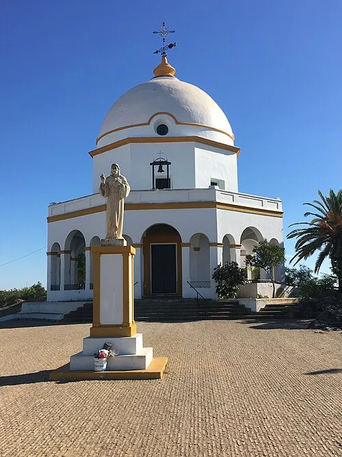
Ermita de Santa Ana Pablo Moratinos from Irun, Gipuzkoa, España · CC BY-SA 2.0 -
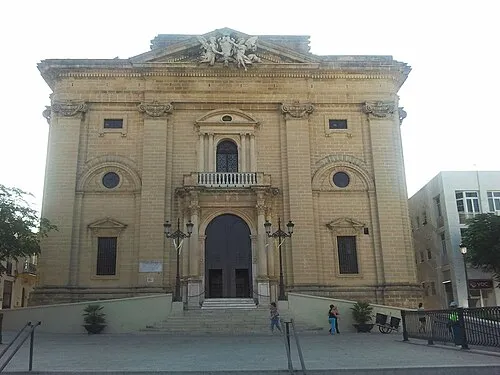
Iglesia de San Juan Bautista Oscar Sanchez · CC BY-SA 3.0 es -
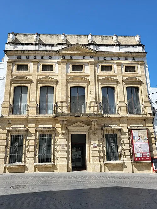
Museo de Chiclana Xemenendura · CC BY-SA 4.0


Places bordering Chiclana de la Frontera
- Puerto Real
- Vejer de la Frontera
- Conil de la Frontera
Population of Chiclana de la Frontera over time
| 2014 | 82,298 | |
|---|---|---|
| 2015 | 82,777 | |
| 2016 | 82,645 | |
| 2017 | 83,148 | |
| 2018 | 83,831 | |
| 2019 | 84,489 | |
| 2020 | 85,150 | |
| 2021 | 86,306 | |
| 2022 | 87,493 | |
| 2023 | 88,709 | |
| 2024 | 89,794 | |
| 2025 | 90,864 |
Censuses and official estimates; source: Wikidata.
Climate of Chiclana de la Frontera
Best months for sightseeingBest months for sightseeing: April–June, October.
This month · November
Outside the best season
Day 19° · Night 12° · Rain 99 mm
Better nearby cities in November
- Dos Hermanas · 100 km north20°
- Seville · 110 km north20°
- Málaga · 157 km east20°
- Hottest month
- July (day 30°)
- Coldest month
- January (night 8°)
- Wettest month
- December (106 mm)
- Driest month
- July (1 mm)
Bars: average monthly low and high temperature. Below: precipitation. Monthly averages for 1970–2000 at about 18 km resolution, adjusted for elevation. Highlighted months are mild and relatively dry. Source: WorldClim 2.1 (CC BY 4.0).
Show values as a table
| Month | Jan | Feb | Mar | Apr | May | Jun | Jul | Aug | Sep | Oct | Nov | Dec |
|---|---|---|---|---|---|---|---|---|---|---|---|---|
| Average high (°C) | 16° | 17° | 19° | 20° | 23° | 26° | 30° | 30° | 28° | 24° | 19° | 17° |
| Average low (°C) | 8° | 9° | 10° | 11° | 14° | 17° | 20° | 20° | 18° | 15° | 12° | 9° |
| Precipitation (mm) | 90 | 73 | 58 | 52 | 34 | 14 | 1 | 3 | 18 | 67 | 99 | 106 |
Other places to visit in this season: April May June October
How to get to Chiclana de la Frontera
The nearest airport is Jerez Airport (XRY), 39 km to the north as the crow flies. For international flights: Gibraltar Airport (GIB) (75 km). The nearest large city is Cadiz, 20 km to the northwest.
Airports
- Jerez Airport (XRY) Jerez de la Frontera 39 kmnorth
- Gibraltar Airport (GIB) Gibraltar 75 kmeast
- Tangier Ibn Battuta Airport (TNG) Tangier 77 kmsouth
Nearby large cities
- Cadiz Population: 117K 20 kmnorthwest
- Jerez de la Frontera Population: 212.9K 32 kmnorth
- Algeciras Population: 121.4K 68 kmsoutheast
- Dos Hermanas Population: 122.9K 100 kmnorth
- Seville Population: 686.7K 110 kmnorth
Straight-line distances; road distances are longer. Airport data: OurAirports.
Day trips from Chiclana de la Frontera
Within 100 km: 292 historic and cultural sites, 167 natural sites, 338 lakes, rivers and coasts.
0–25 km147 places
- Playa de Zahora Beach 24 kmS
- Playa de la Victoria Beach 18 kmNW
- Playa de Levante Beach 19 kmNW
- Caleta Beach Beach 21 kmNW
25–60 km211 places
- Playa de las Tres Piedras Beach 43 kmNW
- Playa de las Canteras Beach 47 kmNW
- Playa de Atlanterra Beach 41 kmSE
- Playa del Bajo Beach 49 kmNW
60–100 km439 places
- Jebel Zem Zem Mountain 91 kmSE
- Kasbah Mosque Attraction 74 kmSE
- Grand Mosque of Tangier Attraction 74 kmSE
- Baie De Tanger Natural site 75 kmSE
Straight-line distances.
Chiclana de la Frontera and similar cities
Side by side with cities of similar size in the same country: population, elevation and climate.
| Measure | Chiclana de la Frontera | Pontevedra | Ceuta | Palencia |
|---|---|---|---|---|
| Population | 81.1K | 82.8K | 83.2K | 78.6K |
| Elevation | 30 m | 29 m | 22 m | 739 m |
| Summer day (hottest month) | 30° | 25° | 27° | 29° |
| Winter night (coldest month) | 8° | 7° | 10° | 0° |
| Annual rainfall | 615 mm | 1,700 mm | 647 mm | 418 mm |
| Best months | Apr–Jun, Oct | Jun–Sep | May–Oct | May–Jun, Sep |
| Distance | — | 704 km | 92 km | 638 km |
Climate values are 1970–2000 monthly averages; straight-line distance.
Places in Chiclana de la Frontera
32 placesBar: population relative to the most populous place in this list.
Cities & villages8
- Campano · Village
- Hozanejos · Village
- La Barossa · Village
- Novo Sancti Petri · Village
- Pago del Humo · Village
- Sancti Petri · Village
- Urb Cr La Soledad · Neighbourhood
- Urb. Cr. Santa Rita · Neighbourhood
Mountains & nature5
- Centro de Educación Infantil Municipal Huerta del Rosario · Natural site
- Cerro de la Cueva · Mountain
- Pinar Publico de La Barrosa · Natural site
- Plaza Victimas del Terrorismo · Natural site
- Santa Ana Park · Natural site
Lakes, rivers & coasts9
- Arroyo de Ahogarratones · River
- Arroyo de la Salineta · River
- Arroyo Guerra · River
- Arroyo Salado · River
- Isla de León · Island
- Laguna de Jeli · Lake
- Playa de las Piedras · Beach
- Playa Mambo · Beach
- Río Salado · River
Heritage & sights9
- Castillo de Sancti Petri · Historic site
- ERA Cultura · Museum
- Ermita de Santa Ana · Attraction
- Iglesia de San Juan Bautista · Attraction
- Marín Dolls Museum-Factory · Museum
- Museo de Chiclana · Museum
- Museo Municipal Taurino Francisco Montes · Museum
- Parroquia de San Sebastián · Attraction
- Teatro Moderno · Attraction
Nearby attractions & nature
Everything nearby-
Playa de la Barrosa Beach, Cadiz6.8 km SW
-
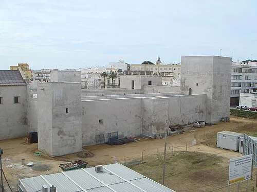 Castillo de San Romualdo Historic site, San Fernando9.4 km NW
-
Museo Naval de San Fernando Museum, San Fernando9.4 km NW
-
Playa de Conil Beach, Cadiz11 km S
-
Batería de San Genís Historic site, San Fernando7.8 km W
-
Punta del Boquerón Natural site, San Fernando7.8 km W
-
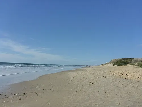 Playa de Roche Beach, Conil de la Frontera10 km S
-
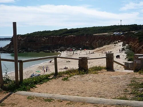 Playa Cala del Aceite Beach, Cadiz12 km S
Other cities and towns in Cadiz
-
 Jerez de la Frontera Municipality, Cadiz33 km N
-
Puerto de Santa María, El Municipality, Cadiz25 km N
-
Medina-Sidonia Municipality, Cadiz23 km E
-
 Paterna de Rivera Municipality, Cadiz28 km NE
-
Barbate Municipality, Cadiz29 km SE
-
Conil de la Frontera Town, Conil de la Frontera14 km S
Sources & licences
Data last updated: · 2 independent sources