Centro de Interpretación de la Cultura
Located in Puerto Real, Cadiz Coordinates: 36°31′44″ N 6°11′27″ W
- Local time
- UTC+01:00
- Europe/Madrid · UTC+01:00
- Elevation
- 16 m
- above sea level
- Airports
- XRY Jerez Airport27 km
- GIB Gibraltar Airport86 km
About Centro de Interpretación de la Cultura
Centro de Interpretación de la Cultura is a museum. Location: Puerto Real, Cadiz. The best months to visit are April–June, October. The nearest airport is Jerez Airport (27 km). Nearby sights include Teatro Principal and Parroquia De San Sebastián.
Photos of Centro de Interpretación de la Cultura
-
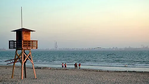
Playa de Valdegrana Emilio J. Rodríguez Posada · CC BY-SA 2.0 -
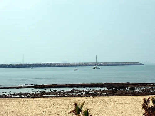
Playa de la Puntilla Emilio J. Rodríguez Posada · CC BY-SA 2.5 es -
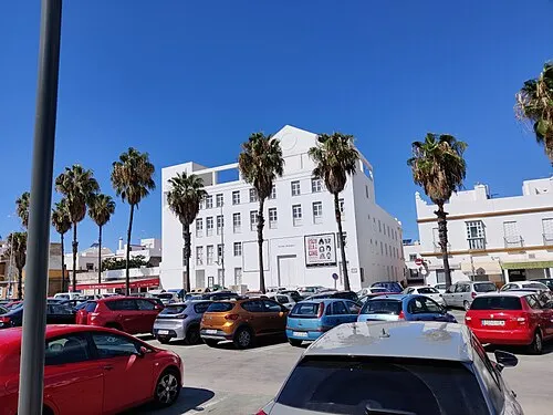
Teatro Principal El Pantera · CC BY-SA 4.0 -
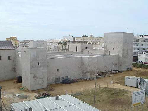
Castillo de San Romualdo Xemenendura · CC BY 3.0


Climate of Centro de Interpretación de la Cultura
Best months for sightseeingBest months for sightseeing: April–June, October.
This month · November
Outside the best season
Day 19° · Night 11° · Rain 85 mm
Better nearby cities in November
- Dos Hermanas · 87 km north20°
- Seville · 97 km north20°
- Málaga · 159 km east20°
- Hottest month
- July (day 30°)
- Coldest month
- January (night 7°)
- Wettest month
- December (97 mm)
- Driest month
- July (1 mm)
Bars: average monthly low and high temperature. Below: precipitation. Monthly averages for 1970–2000 at about 18 km resolution, adjusted for elevation. Highlighted months are mild and relatively dry. Source: WorldClim 2.1 (CC BY 4.0).
Show values as a table
| Month | Jan | Feb | Mar | Apr | May | Jun | Jul | Aug | Sep | Oct | Nov | Dec |
|---|---|---|---|---|---|---|---|---|---|---|---|---|
| Average high (°C) | 16° | 17° | 19° | 21° | 23° | 27° | 30° | 30° | 28° | 24° | 19° | 16° |
| Average low (°C) | 7° | 9° | 10° | 11° | 14° | 17° | 20° | 20° | 18° | 15° | 11° | 9° |
| Precipitation (mm) | 83 | 61 | 43 | 48 | 32 | 14 | 1 | 4 | 16 | 62 | 85 | 97 |
Other places to visit in this season: April May June October
How to get to Centro de Interpretación de la Cultura
The nearest airport is Jerez Airport (XRY), 27 km to the northeast as the crow flies. For international flights: Gibraltar Airport (GIB) (86 km). The nearest large city is Cadiz, 9 km to the west.
Airports
- Jerez Airport (XRY) Jerez de la Frontera 27 kmnortheast
- Gibraltar Airport (GIB) Gibraltar 86 kmsoutheast
- Tangier Ibn Battuta Airport (TNG) Tangier 92 kmsouth
Nearby large cities
- Cadiz Population: 117K 9 kmwest
- Jerez de la Frontera Population: 212.9K 18 kmnorth
- Algeciras Population: 121.4K 80 kmsoutheast
- Dos Hermanas Population: 122.9K 87 kmnorth
- Seville Population: 686.7K 97 kmnorth
Straight-line distances; road distances are longer. Airport data: OurAirports.
Day trips from Centro de Interpretación de la Cultura
Within 100 km: 366 historic and cultural sites, 173 natural sites, 340 lakes, rivers and coasts.
0–25 km165 places
- Playa de la Victoria Beach 8 kmW
- Playa de Levante Beach 4 kmNW
- Caleta Beach Beach 10 kmW
- Playa de la Barrosa Beach 20 kmS
25–60 km181 places
- Playa de Zahora Beach 39 kmS
- Playa de las Tres Piedras Beach 29 kmNW
- Playa de las Canteras Beach 32 kmNW
- Playa de Atlanterra Beach 56 kmSE
60–100 km533 places
- Kasbah Mosque Attraction 89 kmSE
- Grand Mosque of Tangier Attraction 89 kmSE
- Baie De Tanger Natural site 90 kmSE
- Jbel Moussa Mountain 99 kmSE
Straight-line distances.
Nearby attractions & nature
Everything nearby-
Teatro Principal Attraction, Puerto Real0.2 km SW
-
Parroquia De San Sebastián Attraction, Puerto Real0.1 km E
-
La Cachucha beach Beach, Andalusia0.7 km SE
-
Isla Verde Island, San Fernando2.8 km S
-
Río San Pedro River, Cadiz2.6 km W
-
Castillo de San Romualdo Historic site, San Fernando6.8 km S
-
Museo Naval de San Fernando Museum, San Fernando6.8 km S
-
Puente Marqués De Ureña Landmark, San Fernando4.8 km S
Nearest towns and villages
-
Puerto Real Town, Puerto Real0.1 km SE
-
San Fernando Town, San Fernando5.9 km S
-
Cadiz Municipality, Cadiz7.6 km SW
-
El Puerto de Santa María Town, Puerto de Santa María, El8.1 km NW
Sources & licences
Data last updated: