Villanueva del Trabuco
Located in Malaga, Andalusia Coordinates: 37°02′52″ N 4°19′20″ W

- Population
- 5,482
- 5.5K
- Elevation
- 773 m
- above sea level
- Local time
- UTC+01:00
- Europe/Madrid · UTC+01:00
- Places inside
- 1
- listed under Villanueva del Trabuco
- Airports
- AGP Málaga-Costa del Sol Airport44 km
- GRX F.G.L. Airport Granada-Jaén Airport51 km
About Villanueva del Trabuco
Villanueva del Trabuco is a municipality. Location: Malaga, Andalusia. Population: 5,482. Elevation: 773 m.
Villanueva del Trabuco is a town and municipality in the province of Málaga, part of the autonomous community of Andalusia in southern Spain. It is situated in the northeast of the province. Villanueva del Trabuco is located in the comarca of Nororma. The municipality is situated approximately 45 kilometres from the provincial capital of Málaga and 34 from Antequera. It has a population of approximately 5,000 residents. The natives are called Trabuqueños.
Source: Wikipedia · CC BY-SA 4.0
Places bordering Villanueva del Trabuco
- Archidona
- Alfarnate
Population of Villanueva del Trabuco over time
| 2014 | 5,270 | |
|---|---|---|
| 2015 | 5,246 | |
| 2016 | 5,313 | |
| 2017 | 5,327 | |
| 2018 | 5,300 | |
| 2019 | 5,299 | |
| 2020 | 5,308 | |
| 2021 | 5,360 | |
| 2022 | 5,340 | |
| 2023 | 5,360 | |
| 2024 | 5,410 | |
| 2025 | 5,521 |
Censuses and official estimates; source: Wikidata.
Climate of Villanueva del Trabuco
Best months for sightseeingBest months for sightseeing: May, October.
This month · November
Outside the best season
Day 16° · Night 6° · Rain 80 mm
Better nearby cities in November
- Málaga · 37 km south20°
- Dos Hermanas · 144 km west20°
- Seville · 151 km west20°
- Hottest month
- July (day 33°)
- Coldest month
- January (night 2°)
- Wettest month
- December (88 mm)
- Driest month
- July (4 mm)
Bars: average monthly low and high temperature. Below: precipitation. Monthly averages for 1970–2000 at about 18 km resolution, adjusted for elevation. Highlighted months are mild and relatively dry. Source: WorldClim 2.1 (CC BY 4.0).
Show values as a table
| Month | Jan | Feb | Mar | Apr | May | Jun | Jul | Aug | Sep | Oct | Nov | Dec |
|---|---|---|---|---|---|---|---|---|---|---|---|---|
| Average high (°C) | 12° | 14° | 17° | 19° | 23° | 28° | 33° | 33° | 28° | 22° | 16° | 13° |
| Average low (°C) | 2° | 3° | 5° | 7° | 10° | 14° | 16° | 17° | 14° | 10° | 6° | 4° |
| Precipitation (mm) | 84 | 69 | 66 | 61 | 43 | 20 | 4 | 5 | 23 | 60 | 80 | 88 |
How to get to Villanueva del Trabuco
The nearest airport is Málaga-Costa del Sol Airport (AGP), 44 km to the south as the crow flies. The nearest large city is Málaga, 37 km to the south.
Airports
- Málaga-Costa del Sol Airport (AGP) Málaga 44 kmsouth
- F.G.L. Airport Granada-Jaén Airport (GRX) Granada 51 kmeast
- Córdoba Airport (ODB) Córdoba 100 kmnorthwest
Nearby large cities
- Málaga Population: 592.3K 37 kmsouth
- Granada Population: 233.5K 65 kmeast
- Marbella Population: 156.3K 78 kmsouthwest
- Jaén Population: 113.5K 93 kmnortheast
- Córdoba Population: 325.7K 102 kmnorthwest
Straight-line distances; road distances are longer. Airport data: OurAirports.
Day trips from Villanueva del Trabuco
Within 100 km: 440 historic and cultural sites, 191 natural sites, 403 lakes, rivers and coasts.
0–25 km55 places
- Sierra del Torcal Mountain 22 kmSW
- Sierra del Pedroso Mountain 14 kmN
- La Torrecilla Mountain 23 kmE
- Sierra del Jobo Mountain 7 kmS
25–60 km392 places
- Playa de la Caleta Beach 37 kmS
- Laguna Playa Beach 40 kmSE
- La Cala el Cañuelo Beach Beach 58 kmSE
- Platja Rincón de la Victoria Beach 37 kmS
60–100 km587 places
- Playa Granada Beach 77 kmSE
- Playa Castell Del Ferro - Sotillo Beach 93 kmSE
- Playa de Poniente Beach 79 kmSE
- Playa Molino Beach 74 kmSE
Straight-line distances.
Places in Villanueva del Trabuco
1 placeBar: population relative to the most populous place in this list.
Nearby attractions & nature
Everything nearby-
Sierra de Gibaltón Mountain, Loja5.9 km NE
-
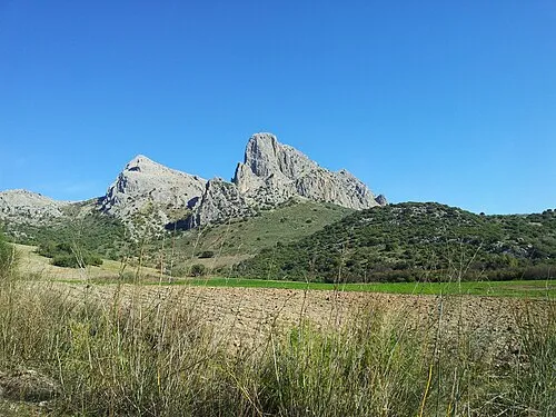 Sierra de Camorolos Mountain, Colmenar9 km S
-
Sierra del Jobo Mountain, Alfarnate7.3 km S
-
Río Cerezo River, Antequera7.2 km SW
-
Arroyo de la Negra River, Antequera7.4 km NW
-
Río Parroso River, Antequera8.9 km SW
-
Cerro de Santa Lucía Mountain, Loja10 km E
-
Sierra Gorda Mountain, Loja11 km E
Other cities and towns in Malaga
-
Villanueva de Algaidas Municipality, Malaga17 km NW
-
 Villanueva de Tapia Municipality, Malaga15 km N
-
 Periana Municipality, Malaga17 km SE
-
 Casabermeja Municipality, Malaga22 km SW
-
 Antequera Municipality, Malaga24 km W
-
Alfarnatejo Municipality, Malaga10 km SE
Sources & licences
Data last updated: · 2 independent sources