- Elevation
- 1,093 m
- above sea level
- Local time
- UTC+01:00
- Europe/Madrid · UTC+01:00
- Airports
- PMI Palma de Mallorca Airport24 km
- MAH Menorca Airport125 km
About Puig de l'Ofre
Puig de l'Ofre is a mountain. Location: Escorca, Balearic Islands. Elevation: 1,093 m. The best months to visit are June–August. The nearest airport is Palma de Mallorca Airport (24 km). Nearby sights include Puig de na Franquesa and Puig des Verger.
Photos of Puig de l'Ofre
-
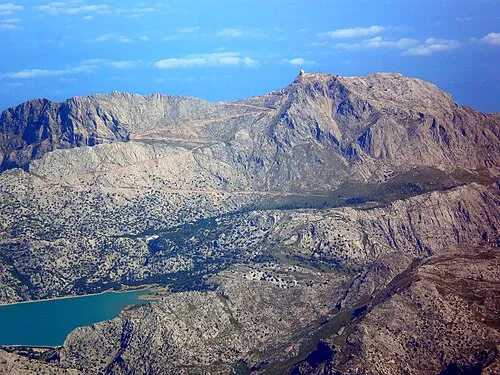
Puig Major Carlos Delgado editado por Xavigivax · CC BY-SA 3.0 -
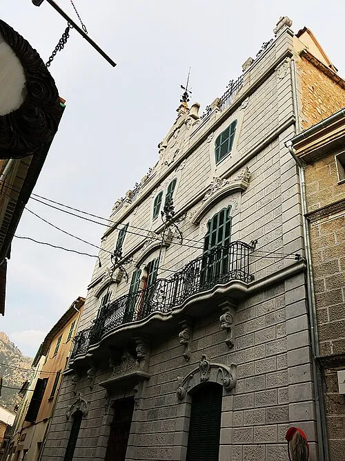
Can Prunera Enric · CC BY-SA 4.0


Climate of Puig de l'Ofre
Best months for sightseeingBest months for sightseeing: June–August.
This month · November
A cold month
Day 12° · Night 3° · Rain 82 mm
Better nearby cities in November
- Alicante · 322 km southwest20°
- Elche · 343 km southwest20°
- Orihuela · 371 km southwest20°
- Hottest month
- August (day 24°)
- Coldest month
- January (night -1°)
- Wettest month
- October (94 mm)
- Driest month
- July (11 mm)
Bars: average monthly low and high temperature. Below: precipitation. Monthly averages for 1970–2000 at about 18 km resolution, adjusted for elevation. Highlighted months are mild and relatively dry. Source: WorldClim 2.1 (CC BY 4.0).
Show values as a table
| Month | Jan | Feb | Mar | Apr | May | Jun | Jul | Aug | Sep | Oct | Nov | Dec |
|---|---|---|---|---|---|---|---|---|---|---|---|---|
| Average high (°C) | 8° | 8° | 10° | 12° | 16° | 20° | 24° | 24° | 20° | 16° | 12° | 9° |
| Average low (°C) | -1° | -1° | 1° | 2° | 6° | 10° | 13° | 13° | 11° | 8° | 3° | 1° |
| Precipitation (mm) | 68 | 53 | 55 | 59 | 44 | 24 | 11 | 28 | 63 | 94 | 82 | 75 |
How to get to Puig de l'Ofre
The nearest airport is Palma de Mallorca Airport (PMI), 24 km to the south as the crow flies. The nearest large city is Palma, 24 km to the southwest.
Airports
- Palma de Mallorca Airport (PMI) Palma de Mallorca 24 kmsouth
- Menorca Airport (MAH) Mahón (Maó) 125 kmeast
- Ibiza Airport (IBZ) Ibiza (Eivissa) 156 kmsouthwest
Nearby large cities
- Palma Population: 438.2K 24 kmsouthwest
- L'Hospitalet de Llobregat Population: 257K 186 kmnorth
- Barcelona Population: 1.7M 188 kmnorth
- Sant Martí Population: 235.7K 190 kmnorth
- Badalona Population: 217.7K 192 kmnorth
Straight-line distances; road distances are longer. Airport data: OurAirports.
Day trips from Puig de l'Ofre
Within 100 km: 160 historic and cultural sites, 68 natural sites, 139 lakes, rivers and coasts.
0–25 km109 places
- Es Baluard Museum of modern and contemporary art Museum 24 kmSW
- Puig de sa Rateta Mountain 2 kmNE
- Puig des Tossals Verds Mountain 5 kmNE
- Puig de na Franquesa Mountain 1 kmNE
25–60 km215 places
- Majorca Island 27 kmSE
- Playa Llombards Beach 58 kmSE
- Playa Mondrago Beach 58 kmSE
- Mondragó Natural Park Natural site 58 kmSE
60–100 km43 places
- Playa Santandría Beach 95 kmE
- Casa Senyorial Squella Historic site 95 kmE
- Son Saura Natural site 98 kmE
- Playa des Talaier Beach 99 kmE
Straight-line distances.
Nearest towns and villages
Nearby attractions & nature
Everything nearby-
Puig de na Franquesa Mountain, Escorca0.9 km NE
-
Puig des Verger Mountain, Escorca1.2 km N
-
Cornador Gran Mountain, Sóller1.8 km W
-
Puig de sa Rateta Mountain, Escorca1.8 km NE
-
Puig Major Mountain, Escorca5.4 km NE
-
Puig d'Alaró Mountain, Alaró4.1 km SE
-
Pla d'Almallutx Mountain, Escorca4.4 km NE
-
Penya de Migdia Mountain, Escorca4.4 km N
More nature in Spain
-
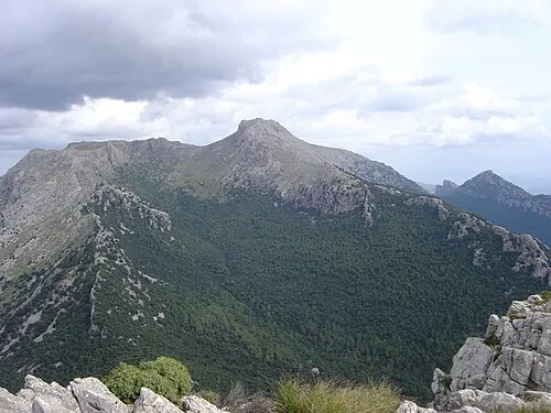 Puig de Massanella Mountain, Escorca8.7 km NE
-
Puig des Tossals Verds Mountain, Escorca5.1 km NE
-
Puig de sa Plana Mountain, Escorca5.3 km NE
-
Puig de ses Vinyes Mountain, Escorca5.9 km NE
-
Es Castellot Mountain, Escorca7 km N
-
Puig de ses Bassetes Mountain, Escorca7.7 km NE
Sources & licences
Data last updated: