S'illot-Cala Morlanda
Located in Manacor, Balearic Islands Coordinates: 39°33′45″ N 3°22′20″ E
- Elevation
- 13 m
- above sea level
- Local time
- UTC+01:00
- Europe/Madrid · UTC+01:00
- Airports
- PMI Palma de Mallorca Airport54 km
- MAH Menorca Airport80 km
About S'illot-Cala Morlanda
S'illot-Cala Morlanda is a village. Location: Manacor, Balearic Islands. Elevation: 13 m. The best months to visit are May–June, October. The nearest airport is Palma de Mallorca Airport (54 km). Nearby sights include Playa Moreia and Es Fogons.
Photos of S'illot-Cala Morlanda
-
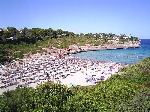
Cala Mandia Carlos Delgado · Public domain -
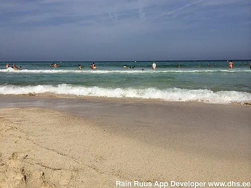
Platja de Sant Llorens RainRuus · CC BY 3.0 -
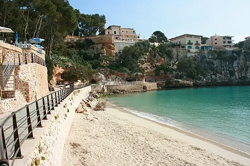
Playa Manacor Frank Vincentz · CC BY-SA 3.0 -
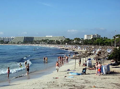
Es Fogons Olaf Tausch · CC BY-SA 3.0


Climate of S'illot-Cala Morlanda
Best months for sightseeingBest months for sightseeing: May–June, October.
This month · November
Outside the best season
Day 19° · Night 10° · Rain 88 mm
Better nearby cities in November
- Alicante · 360 km west20°
- Elche · 381 km west20°
- Alicante · 359 km west20°
- Hottest month
- August (day 30°)
- Coldest month
- January (night 6°)
- Wettest month
- October (98 mm)
- Driest month
- July (9 mm)
Bars: average monthly low and high temperature. Below: precipitation. Monthly averages for 1970–2000 at about 18 km resolution, adjusted for elevation. Highlighted months are mild and relatively dry. Source: WorldClim 2.1 (CC BY 4.0).
Show values as a table
| Month | Jan | Feb | Mar | Apr | May | Jun | Jul | Aug | Sep | Oct | Nov | Dec |
|---|---|---|---|---|---|---|---|---|---|---|---|---|
| Average high (°C) | 15° | 15° | 17° | 19° | 22° | 26° | 30° | 30° | 27° | 23° | 19° | 16° |
| Average low (°C) | 6° | 6° | 7° | 9° | 13° | 16° | 19° | 20° | 18° | 14° | 10° | 8° |
| Precipitation (mm) | 72 | 57 | 57 | 61 | 39 | 17 | 9 | 26 | 63 | 98 | 88 | 78 |
How to get to S'illot-Cala Morlanda
The nearest airport is Palma de Mallorca Airport (PMI), 54 km to the west as the crow flies. The nearest large city is Palma, 62 km to the west.
Airports
- Palma de Mallorca Airport (PMI) Palma de Mallorca 54 kmwest
- Menorca Airport (MAH) Mahón (Maó) 80 kmnortheast
- Ibiza Airport (IBZ) Ibiza (Eivissa) 189 kmsouthwest
Nearby large cities
- Palma Population: 438.2K 62 kmwest
- L'Hospitalet de Llobregat Population: 257K 227 kmnorthwest
- Barcelona Population: 1.7M 227 kmnorthwest
- Sant Martí Population: 235.7K 229 kmnorthwest
- Badalona Population: 217.7K 230 kmnorthwest
Straight-line distances; road distances are longer. Airport data: OurAirports.
Day trips from S'illot-Cala Morlanda
Within 100 km: 193 historic and cultural sites, 87 natural sites, 170 lakes, rivers and coasts.
0–25 km51 places
- Cala Romantica Beach 7 kmSW
- Cala Murada Beach 15 kmSW
- Cala Antena Beach 13 kmSW
- Church of Felanitx Attraction 22 kmSW
25–60 km179 places
- Majorca Island 31 kmW
- Playa Llombards Beach 33 kmSW
- Na Pobra Island 53 kmSW
- Na Plana Island 53 kmSW
60–100 km220 places
- Minorca Island 76 kmNE
- Cala Biniancolla Beach 81 kmE
- Camp de Mar Beach 82 kmW
- Platja dde S'Oratori Beach 69 kmW
Straight-line distances.
Nearby attractions & nature
Everything nearby-
Playa Moreia Beach, Manacor0.4 km N
-
Es Fogons Beach, Sant Llorenç des Cardassar1.5 km N
-
Cala Morlanda Beach, Balearic Islands0.8 km S
-
Safari Zoo Sa Coma Attraction, Sant Llorenç des Cardassar2.4 km N
-
Playa Manacor Beach, Manacor3.9 km SW
-
Castillo de sa Punta de n'Amer Historic site, Sant Llorenç des Cardassar2.8 km NE
Sources & licences
Data last updated: