Maria de la Salut
Located in Balearic Islands, Balearic Islands Coordinates: 39°39′44″ N 3°04′16″ E
- Population
- 2,152
- 2.2K
- Elevation
- 119 m
- above sea level
- Local time
- UTC+01:00
- Europe/Madrid · UTC+01:00
- Places inside
- 1
- listed under Maria de la Salut
- Airports
- PMI Palma de Mallorca Airport31 km
- MAH Menorca Airport101 km
About Maria de la Salut
Maria de la Salut is a municipality. Location: Balearic Islands, Balearic Islands. Population: 2,152. Elevation: 119 m. The best months to visit are May–June, October. The nearest airport is Palma de Mallorca Airport (31 km). Nearby sights include Museu Parroquial de Santa Maria de Sineu and Majorca.
Climate of Maria de la Salut
Best months for sightseeingBest months for sightseeing: May–June, October.
This month · November
Outside the best season
Day 18° · Night 9° · Rain 80 mm
Better nearby cities in November
- Alicante · 340 km southwest20°
- Elche · 361 km southwest20°
- Orihuela · 389 km southwest20°
- Hottest month
- August (day 30°)
- Coldest month
- January (night 5°)
- Wettest month
- October (93 mm)
- Driest month
- July (10 mm)
Bars: average monthly low and high temperature. Below: precipitation. Monthly averages for 1970–2000 at about 18 km resolution, adjusted for elevation. Highlighted months are mild and relatively dry. Source: WorldClim 2.1 (CC BY 4.0).
Show values as a table
| Month | Jan | Feb | Mar | Apr | May | Jun | Jul | Aug | Sep | Oct | Nov | Dec |
|---|---|---|---|---|---|---|---|---|---|---|---|---|
| Average high (°C) | 15° | 15° | 16° | 18° | 22° | 26° | 30° | 30° | 27° | 23° | 18° | 16° |
| Average low (°C) | 5° | 5° | 6° | 8° | 11° | 15° | 18° | 19° | 16° | 13° | 9° | 6° |
| Precipitation (mm) | 66 | 52 | 52 | 57 | 38 | 18 | 10 | 27 | 62 | 93 | 80 | 71 |
How to get to Maria de la Salut
The nearest airport is Palma de Mallorca Airport (PMI), 31 km to the southwest as the crow flies. The nearest large city is Palma, 38 km to the west.
Airports
- Palma de Mallorca Airport (PMI) Palma de Mallorca 31 kmsouthwest
- Menorca Airport (MAH) Mahón (Maó) 101 kmeast
- Ibiza Airport (IBZ) Ibiza (Eivissa) 171 kmsouthwest
Nearby large cities
- Palma Population: 438.2K 38 kmwest
- L'Hospitalet de Llobregat Population: 257K 206 kmnorthwest
- Barcelona Population: 1.7M 207 kmnorth
- Sant Martí Population: 235.7K 208 kmnorth
- Badalona Population: 217.7K 210 kmnorth
Straight-line distances; road distances are longer. Airport data: OurAirports.
Day trips from Maria de la Salut
Within 100 km: 171 historic and cultural sites, 73 natural sites, 159 lakes, rivers and coasts.
0–25 km71 places
- Majorca Island 8 kmSW
- Ermita Sant Honorat Attraction 20 kmSW
- Iglesia San Miguel Attraction 25 kmSW
- Bisbat de Mallorca Attraction 25 kmSW
25–60 km258 places
- Playa Llombards Beach 38 kmS
- Na Pobra Island 52 kmS
- Na Plana Island 52 kmS
- Cabrera Island 59 kmS
60–100 km74 places
- Minorca Island 93 kmE
- Playa Dragonera Beach 62 kmW
- El Pantaleu Island 63 kmW
- Illa Mitjana Island 64 kmW
Straight-line distances.
Places in Maria de la Salut
1 placeBar: population relative to the most populous place in this list.
Nearby attractions & nature
Everything nearby-
Museu Parroquial de Santa Maria de Sineu Museum, Sineu5.6 km W
-
Majorca Island, Balearic Islands7.9 km SW
-
Balearic Islands Island, Balearic Islands8.1 km SW
-
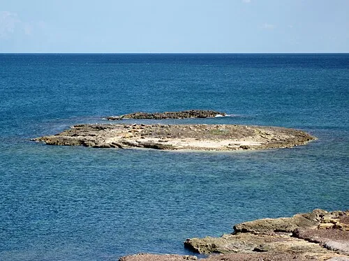 Illa d'en Porros Island, Balearic Islands14 km NE
-
Museu de Ciencies Naturals Museum, Costitx11 km W
-
Playa De Muro Beach, Balearic Islands14 km NE
-
Bananas Playa Beach, Santa Margalida14 km NE
-
Platja de Muro Beach, Balearic Islands15 km N
Sources & licences
Data last updated: