Sant Rafel de Forca
Located in Municipio de San Antonio, Balearic Islands Coordinates: 38°57′42″ N 1°23′59″ E
- Elevation
- 125 m
- above sea level
- Local time
- UTC+01:00
- Europe/Madrid · UTC+01:00
- Airports
- IBZ Ibiza Airport10 km
- PMI Palma de Mallorca Airport133 km
About Sant Rafel de Forca
Sant Rafel de Forca is a village. Location: Municipio de San Antonio, Balearic Islands. Elevation: 125 m. The best months to visit are May, October. The nearest airport is Ibiza Airport (10 km). Nearby sights include esglèsia Sant Rafel and CF Sant Rafel.
Photos of Sant Rafel de Forca
-
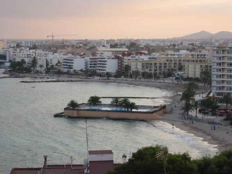
Playa Figueretes K C from Jersey City, USA · CC BY 2.0 -
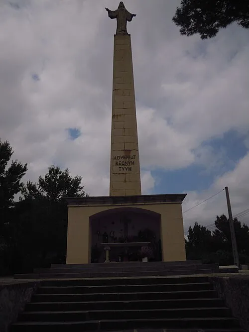
Sagrat Cor de Jesus Sobrassada · CC BY 3.0


Climate of Sant Rafel de Forca
Best months for sightseeingBest months for sightseeing: May, October.
This month · November
Outside the best season
Day 19° · Night 10° · Rain 50 mm
Better nearby cities in November
- Alicante · 177 km west20°
- Elche · 198 km west20°
- Orihuela · 226 km southwest20°
- Hottest month
- August (day 31°)
- Coldest month
- January (night 6°)
- Wettest month
- October (69 mm)
- Driest month
- July (6 mm)
Bars: average monthly low and high temperature. Below: precipitation. Monthly averages for 1970–2000 at about 18 km resolution, adjusted for elevation. Highlighted months are mild and relatively dry. Source: WorldClim 2.1 (CC BY 4.0).
Show values as a table
| Month | Jan | Feb | Mar | Apr | May | Jun | Jul | Aug | Sep | Oct | Nov | Dec |
|---|---|---|---|---|---|---|---|---|---|---|---|---|
| Average high (°C) | 15° | 16° | 18° | 20° | 23° | 27° | 30° | 31° | 28° | 23° | 19° | 16° |
| Average low (°C) | 6° | 7° | 8° | 9° | 13° | 17° | 20° | 20° | 18° | 14° | 10° | 8° |
| Precipitation (mm) | 43 | 34 | 40 | 35 | 27 | 14 | 6 | 19 | 50 | 69 | 50 | 58 |
How to get to Sant Rafel de Forca
The nearest airport is Ibiza Airport (IBZ), 10 km to the south as the crow flies. The nearest large city is Palma, 127 km to the northeast.
Airports
- Ibiza Airport (IBZ) Ibiza (Eivissa) 10 kmsouth
- Palma de Mallorca Airport (PMI) Palma de Mallorca 133 kmnortheast
- Valencia Airport (VLC) Valencia 173 kmwest
Nearby large cities
- Palma Population: 438.2K 127 kmnortheast
- Valencia Population: 824.3K 164 kmwest
- Castellon Population: 183.7K 169 kmnorthwest
- Alicante Population: 348.9K 177 kmwest
- Elche Population: 234.8K 199 kmwest
Straight-line distances; road distances are longer. Airport data: OurAirports.
Day trips from Sant Rafel de Forca
Within 100 km: 30 historic and cultural sites, 21 natural sites, 76 lakes, rivers and coasts.
0–25 km106 places
- Ibiza Island 1 kmN
- Eivissa i Formentera Island 5 kmSW
- Playa S'Argamassa Beach 15 kmE
- Cala Conta Beach Beach 16 kmW
25–60 km21 places
- Formentera Island 30 kmS
- Playa de La Savina Beach 26 kmS
- Estanque Pudent Lake 26 kmS
- Can Marroig Natural site 27 kmS
Straight-line distances.
Nearby attractions & nature
Everything nearby-
esglèsia Sant Rafel Attraction, Sant Josep de sa Talaia0.2 km SE
-
CF Sant Rafel Landmark, Sant Josep de sa Talaia0.6 km NE
-
Ibiza Island, Balearic Islands1.4 km N
-
Sagrat Cor de Jesus Landmark, Santa Eulària des Riu3 km SE
-
Eivissa i Formentera Island, Sant Josep de sa Talaia4.7 km SW
-
Playa Figueretes Beach, Ibiza6.6 km S
Other cities and towns in Municipio de San Antonio
-
 Santa Agnès de Corona Village, Municipio de San Antonio9.8 km NW
-
Cami Vell de Sant Mateu Village, Municipio de San Antonio6.3 km N
-
Ses Paisses Village, Municipio de San Antonio6.9 km W
-
Sant Mateu d'Albarca Village, Municipio de San Antonio8.6 km N
-
Es Caló des Moro Village, Municipio de San Antonio9.4 km W
-
Cala Gració Village, Municipio de San Antonio10 km W
Sources & licences
Data last updated: