Hornillos de Cerrato
Located in Palencia, Castille and León Coordinates: 41°59′51″ N 4°15′29″ W

- Population
- 115
- 115
- Elevation
- 859 m
- above sea level
- Local time
- UTC+01:00
- Europe/Madrid · UTC+01:00
- Places inside
- 1
- listed under Hornillos de Cerrato
- Airports
- VLL Valladolid Airport59 km
- LEN León Airport133 km
About Hornillos de Cerrato
Hornillos de Cerrato is a municipality. Location: Palencia, Castille and León. Population: 115. Elevation: 859 m.
Hornillos de Cerrato is a municipality located in the province of Palencia, Castile and León, Spain. According to the 2004 census (INE), the municipality has a population of 118 inhabitants.
Source: Wikipedia · CC BY-SA 4.0
Places bordering Hornillos de Cerrato
- Torquemada
- Villaviudas
Population of Hornillos de Cerrato over time
| 2014 | 119 | |
|---|---|---|
| 2015 | 137 | |
| 2016 | 137 | |
| 2017 | 145 | |
| 2018 | 143 | |
| 2019 | 141 | |
| 2020 | 143 | |
| 2021 | 143 | |
| 2022 | 153 | |
| 2023 | 171 | |
| 2024 | 170 | |
| 2025 | 171 |
Censuses and official estimates; source: Wikidata.
Climate of Hornillos de Cerrato
Best months for sightseeingBest months for sightseeing: May–June, September.
This month · November
A cold month
Day 12° · Night 3° · Rain 45 mm
- Hottest month
- July (day 29°)
- Coldest month
- January (night -1°)
- Wettest month
- May (49 mm)
- Driest month
- August (15 mm)
Bars: average monthly low and high temperature. Below: precipitation. Monthly averages for 1970–2000 at about 18 km resolution, adjusted for elevation. Highlighted months are mild and relatively dry. Source: WorldClim 2.1 (CC BY 4.0).
Show values as a table
| Month | Jan | Feb | Mar | Apr | May | Jun | Jul | Aug | Sep | Oct | Nov | Dec |
|---|---|---|---|---|---|---|---|---|---|---|---|---|
| Average high (°C) | 7° | 10° | 14° | 15° | 19° | 25° | 29° | 29° | 25° | 18° | 12° | 8° |
| Average low (°C) | -1° | 0° | 2° | 4° | 7° | 10° | 13° | 13° | 10° | 7° | 3° | 1° |
| Precipitation (mm) | 38 | 32 | 29 | 40 | 49 | 41 | 17 | 15 | 21 | 42 | 45 | 45 |
How to get to Hornillos de Cerrato
The nearest airport is Valladolid Airport (VLL), 59 km to the southwest as the crow flies. The nearest large city is Valladolid, 54 km to the southwest.
Airports
- Valladolid Airport (VLL) Valladolid 59 kmsouthwest
- León Airport (LEN) La Virgen del Camino 133 kmnorthwest
- Salamanca Airport (SLM) Salamanca 156 kmsouthwest
Nearby large cities
- Valladolid Population: 300.6K 54 kmsouthwest
- Burgos Population: 176.4K 60 kmnortheast
- León Population: 124.8K 127 kmnorthwest
- Logroño Population: 151.2K 158 kmeast
- Vitoria-Gasteiz Population: 257.4K 161 kmnortheast
Straight-line distances; road distances are longer. Airport data: OurAirports.
Day trips from Hornillos de Cerrato
Within 100 km: 138 historic and cultural sites, 65 natural sites, 304 lakes, rivers and coasts.
0–25 km33 places
- Arroyo de Fuente Palacios River 21 kmN
- Arroyo de Fuentehornos River 11 kmSE
- Río Franco River 21 kmNE
- Arroyo de los Frailes River 24 kmNW
25–60 km219 places
- Cuchillejo Mountain 54 kmSE
- Robledaña Mountain 53 kmSE
- Valdeherrera Mountain 33 kmS
- Montes de Torozos Natural site 50 kmSW
60–100 km255 places
- Playa fluvial Fuente del Prior Beach 62 kmNE
- Pantano de Ruesga Lake 99 kmN
- Pantano del Arlanzón Lake 81 kmE
- Lagunas de Carcedo Lake 63 kmNE
Straight-line distances.
Places in Hornillos de Cerrato
1 placeBar: population relative to the most populous place in this list.
Nearby attractions & nature
Everything nearby-
Arroyo del Castillo River, Torquemada3.3 km N
-
Río Arlanzón River, Spain5.9 km NW
-
Arroyo del Pozuelo River, Palenzuela5.6 km E
-
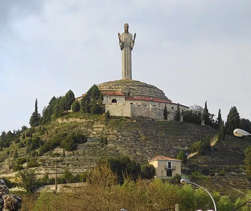 Cristo del Otero Landmark, Palencia23 km W
-
Arroyo de Valdesalce River, Torquemada6.9 km NW
-
Arroyo del Prado River, Villamediana8.9 km W
-
San Juan de Baños Attraction, Venta de Baños20 km SW
-
Estadio la Balastera Landmark, Palencia21 km W
Other cities and towns in Palencia
-
 Cordovilla la Real Municipality, Palencia11 km N
-
 Quintana del Puente Municipality, Palencia12 km NE
-
 Villamediana Municipality, Palencia11 km NW
-
 Reinoso de Cerrato Municipality, Palencia11 km W
-
 Tabanera de Cerrato Municipality, Palencia13 km E
-
 Valle de Cerrato Municipality, Palencia13 km SW
Sources & licences
Data last updated: · 2 independent sources