- Elevation
- 737 m
- above sea level
- Local time
- UTC+01:00
- Europe/Madrid · UTC+01:00
- Airports
- VLL Valladolid Airport42 km
- LEN León Airport98 km
About Río Valdeginate
Río Valdeginate is a river. Location: Mazariegos, Palencia. The best months to visit are May–June, September. The nearest airport is Valladolid Airport (42 km). Nearby sights include Arroyo del Retortillo and Arroyo de Valdeveinte.
Climate of Río Valdeginate
Best months for sightseeingBest months for sightseeing: May–June, September.
This month · November
Outside the best season
Day 12° · Night 3° · Rain 47 mm
- Hottest month
- July (day 29°)
- Coldest month
- January (night 0°)
- Wettest month
- May (52 mm)
- Driest month
- August (16 mm)
Bars: average monthly low and high temperature. Below: precipitation. Monthly averages for 1970–2000 at about 18 km resolution, adjusted for elevation. Highlighted months are mild and relatively dry. Source: WorldClim 2.1 (CC BY 4.0).
Show values as a table
| Month | Jan | Feb | Mar | Apr | May | Jun | Jul | Aug | Sep | Oct | Nov | Dec |
|---|---|---|---|---|---|---|---|---|---|---|---|---|
| Average high (°C) | 8° | 11° | 14° | 16° | 20° | 25° | 29° | 29° | 25° | 18° | 12° | 9° |
| Average low (°C) | 0° | 1° | 2° | 4° | 7° | 11° | 14° | 13° | 11° | 7° | 3° | 1° |
| Precipitation (mm) | 39 | 34 | 32 | 41 | 52 | 42 | 18 | 16 | 20 | 45 | 47 | 48 |
How to get to Río Valdeginate
The nearest airport is Valladolid Airport (VLL), 42 km to the south as the crow flies. The nearest large city is Valladolid, 45 km to the south.
Airports
- Valladolid Airport (VLL) Valladolid 42 kmsouth
- León Airport (LEN) La Virgen del Camino 98 kmnorthwest
- Salamanca Airport (SLM) Salamanca 140 kmsouthwest
Nearby large cities
- Valladolid Population: 300.6K 45 kmsouth
- Burgos Population: 176.4K 88 kmeast
- León Population: 124.8K 93 kmnorthwest
- Salamanca Population: 144.8K 146 kmsouthwest
- Oviedo Population: 220K 172 kmnorthwest
Straight-line distances; road distances are longer. Airport data: OurAirports.
Day trips from Río Valdeginate
Within 100 km: 156 historic and cultural sites, 65 natural sites, 251 lakes, rivers and coasts.
0–25 km39 places
- Arroyo de Laisa River 13 kmNE
- Arroyo de la Huerga River 21 kmNW
- Arroyo Geroa River 19 kmNE
- Arroyo de los Frailes River 15 kmE
25–60 km131 places
- Valdeherrera Mountain 56 kmSE
- Montes de Torozos Natural site 29 kmS
- Campo Grande Natural site 46 kmS
- Parque Covaresa Natural site 50 kmS
60–100 km302 places
- Playa fluvial Fuente del Prior Beach 91 kmE
- Pantano de Ruesga Lake 90 kmN
- Pantano Requejada Lake 96 kmN
- Pantano de Camporredondo Lake 93 kmN
Straight-line distances.
Nearest towns and villages
-
Mazariegos Village, Mazariegos4.2 km S
-
 Fuentes de Nava Municipality, Palencia6.2 km NW
-
Villamartín de Campos Municipality, Palencia6 km S
-
Villamartín de Campos Village, Villamartín de Campos6 km SE
-
Becerril de Campos Village, Becerril de Campos7 km NE
-
Fuentes de Nava Village, Fuentes de Nava7.2 km W
Nearby attractions & nature
Everything nearby-
Arroyo del Retortillo River, Mazariegos0.1 km N
-
Arroyo de Valdeveinte River, Villamartín de Campos1.8 km E
-
Arroyo de Bayoto River, Mazariegos2.1 km N
-
Arroyo del Salón River, Villamartín de Campos3.6 km SE
-
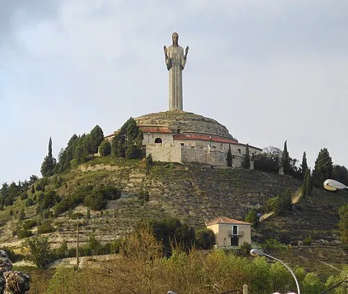 Cristo del Otero Landmark, Palencia15 km E
-
Arroyo de Pedrueco River, Valle del Retortillo12 km N
-
Arroyo de Puente Canto River, Valle del Retortillo12 km N
-
Arroyo de Laisa River, Becerril de Campos13 km NE
Sources & licences
Data last updated: