Tariego de Cerrato
Located in Palencia, Castille and León Coordinates: 41°53′24″ N 4°28′24″ W

- Population
- 529
- 529
- Elevation
- 788 m
- above sea level
- Local time
- UTC+01:00
- Europe/Madrid · UTC+01:00
- Airports
- VLL Valladolid Airport38 km
- LEN León Airport125 km
About Tariego de Cerrato
Tariego de Cerrato is a municipality. Location: Palencia, Castille and León. Population: 529. Elevation: 788 m.
Tariego de Cerrato is a municipality located in the province of Palencia, Castile and León, Spain. According to the 2018 census (INE), the municipality has a population of 490 inhabitants.
Source: Wikipedia · CC BY-SA 4.0
Population of Tariego de Cerrato over time
| 2014 | 528 | |
|---|---|---|
| 2015 | 526 | |
| 2016 | 515 | |
| 2017 | 513 | |
| 2018 | 490 | |
| 2019 | 481 | |
| 2020 | 476 | |
| 2021 | 485 | |
| 2022 | 478 | |
| 2023 | 483 | |
| 2024 | 501 | |
| 2025 | 504 |
Censuses and official estimates; source: Wikidata.
Climate of Tariego de Cerrato
Best months for sightseeingBest months for sightseeing: May–June, September.
This month · November
Outside the best season
Day 12° · Night 3° · Rain 44 mm
- Hottest month
- July (day 29°)
- Coldest month
- January (night 0°)
- Wettest month
- May (49 mm)
- Driest month
- August (15 mm)
Bars: average monthly low and high temperature. Below: precipitation. Monthly averages for 1970–2000 at about 18 km resolution, adjusted for elevation. Highlighted months are mild and relatively dry. Source: WorldClim 2.1 (CC BY 4.0).
Show values as a table
| Month | Jan | Feb | Mar | Apr | May | Jun | Jul | Aug | Sep | Oct | Nov | Dec |
|---|---|---|---|---|---|---|---|---|---|---|---|---|
| Average high (°C) | 8° | 11° | 14° | 16° | 20° | 25° | 29° | 29° | 25° | 18° | 12° | 8° |
| Average low (°C) | 0° | 1° | 2° | 4° | 7° | 11° | 13° | 13° | 11° | 7° | 3° | 1° |
| Precipitation (mm) | 35 | 30 | 31 | 40 | 49 | 42 | 16 | 15 | 17 | 42 | 44 | 43 |
How to get to Tariego de Cerrato
The nearest airport is Valladolid Airport (VLL), 38 km to the southwest as the crow flies. The nearest large city is Valladolid, 33 km to the southwest.
Airports
- Valladolid Airport (VLL) Valladolid 38 kmsouthwest
- León Airport (LEN) La Virgen del Camino 125 kmnorthwest
- Salamanca Airport (SLM) Salamanca 135 kmsouthwest
Nearby large cities
- Valladolid Population: 300.6K 33 kmsouthwest
- Burgos Population: 176.4K 81 kmnortheast
- León Population: 124.8K 120 kmnorthwest
- Salamanca Population: 144.8K 143 kmsouthwest
- Alcobendas Population: 116K 165 kmsoutheast
Straight-line distances; road distances are longer. Airport data: OurAirports.
Day trips from Tariego de Cerrato
Within 100 km: 138 historic and cultural sites, 56 natural sites, 289 lakes, rivers and coasts.
0–25 km30 places
- Arroyo de los Frailes River 23 kmN
- Arroyo de Cerrato River 14 kmE
- Arroyo del Castillo River 24 kmNE
- Río Carrión River 5 kmW
25–60 km208 places
- Cuchillejo Mountain 55 kmSE
- Robledaña Mountain 54 kmSE
- Valdeherrera Mountain 30 kmSE
- Montes de Torozos Natural site 29 kmW
60–100 km245 places
- Playa fluvial Fuente del Prior Beach 84 kmNE
- Lagunas de Carcedo Lake 84 kmNE
- Rubio Mountain 77 kmSE
- Medela Mountain 98 kmN
Straight-line distances.
Nearby attractions & nature
Everything nearby-
San Juan de Baños Attraction, Venta de Baños3.4 km N
-
Río Carrión River, Dueñas4.6 km W
-
Monte Viejo transmitter Landmark, Villamuriel de Cerrato7.6 km NW
-
Arroyo del Maderano River, Spain6.7 km SW
-
Arroyo de La Raya River, Hontoria de Cerrato4.8 km NE
-
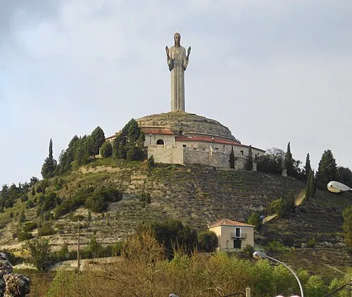 Cristo del Otero Landmark, Palencia16 km N
-
Arroyo del Rabanillo River, Cevico de la Torre6.5 km SE
-
Arroyo de Valdesanjuán River, Dueñas7.2 km W
Other cities and towns in Palencia
-
 Hontoria de Cerrato Municipality, Palencia5.9 km NE
-
 Soto de Cerrato Municipality, Palencia7.3 km NE
-
Dueñas Municipality, Palencia6.9 km W
-
 Magaz de Pisuerga Municipality, Palencia11 km N
-
Palencia Municipality, Palencia13 km NW
-
 Valle de Cerrato Municipality, Palencia10 km E
Sources & licences
Data last updated: · 2 independent sources