- Population
- 189
- 189
- Elevation
- 752 m
- above sea level
- Local time
- UTC+01:00
- Europe/Madrid · UTC+01:00
- Airports
- BGC Bragança Airport58 km
- SLM Salamanca Airport87 km
About Pino del Oro
Pino del Oro is a municipality. Location: Zamora, Castille and León. Population: 189. Elevation: 752 m.
Pino del Oro, formerly known as Pino, is a Spanish municipality in the province of Zamora, Castile and León. It has a population of 203 (2006) and an area of 30 km². A bridge links Pino del Oro and Villadepera.
Source: Wikipedia · CC BY-SA 4.0
Places bordering Pino del Oro
- Muelas del Pan
- Villalcampo
- Villadepera
Population of Pino del Oro over time
| 2014 | 191 | |
|---|---|---|
| 2015 | 231 | |
| 2016 | 215 | |
| 2017 | 213 | |
| 2018 | 200 | |
| 2019 | 195 | |
| 2020 | 183 | |
| 2021 | 183 | |
| 2022 | 180 | |
| 2023 | 178 | |
| 2024 | 175 | |
| 2025 | 173 |
Censuses and official estimates; source: Wikidata.
Climate of Pino del Oro
Best months for sightseeingBest months for sightseeing: June, August–September.
This month · November
Outside the best season
Day 12° · Night 4° · Rain 97 mm
- Hottest month
- July (day 29°)
- Coldest month
- January (night 0°)
- Wettest month
- December (116 mm)
- Driest month
- July (18 mm)
Bars: average monthly low and high temperature. Below: precipitation. Monthly averages for 1970–2000 at about 18 km resolution, adjusted for elevation. Highlighted months are mild and relatively dry. Source: WorldClim 2.1 (CC BY 4.0).
Show values as a table
| Month | Jan | Feb | Mar | Apr | May | Jun | Jul | Aug | Sep | Oct | Nov | Dec |
|---|---|---|---|---|---|---|---|---|---|---|---|---|
| Average high (°C) | 8° | 10° | 14° | 15° | 19° | 24° | 29° | 28° | 25° | 18° | 12° | 9° |
| Average low (°C) | 0° | 1° | 3° | 5° | 8° | 11° | 14° | 13° | 11° | 7° | 4° | 2° |
| Precipitation (mm) | 108 | 101 | 61 | 66 | 65 | 45 | 18 | 18 | 44 | 88 | 97 | 116 |
How to get to Pino del Oro
The nearest airport is Bragança Airport (BGC), 58 km to the northwest as the crow flies. The nearest large city is Salamanca, 78 km to the southeast.
Airports
- Bragança Airport (BGC) Bragança 58 kmnorthwest
- Salamanca Airport (SLM) Salamanca 87 kmsoutheast
- Valladolid Airport (VLL) Valladolid 106 kmeast
Nearby large cities
- Salamanca Population: 144.8K 78 kmsoutheast
- Valladolid Population: 300.6K 117 kmeast
- León Population: 124.8K 122 kmnorth
- Ourense Population: 105.2K 167 kmnorthwest
- Braga Population: 193.3K 192 kmwest
Straight-line distances; road distances are longer. Airport data: OurAirports.
Nearby attractions & nature
Everything nearby-
Arroyo de Fuentelarraya River, Villadepera2.1 km SW
-
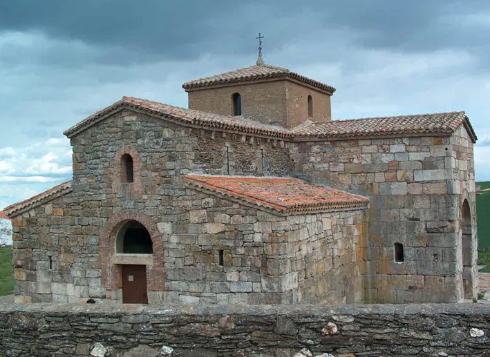 San Pedro de la Nave Attraction, San Pedro de la Nave-Almendra13 km E
-
Valle del Duero Natural site, Torregamones16 km SW
-
Arroyo de los Molinos River, Fariza8.4 km W
-
Río Esla River, Spain13 km SE
-
Viaducto Martín Gil Landmark, Palacios del Pan20 km NE
-
Fuerte Nuevo de Torregamones Historic site, Torregamones15 km SW
-
Embalse del Esla Lake, Montamarta17 km E
Sources & licences
Data last updated: · 2 independent sources