- Elevation
- 821 m
- above sea level
- Local time
- UTC+01:00
- Europe/Madrid · UTC+01:00
- Airports
- VLC Valencia Airport172 km
- RMU Region of Murcia International Airport183 km
About El Verduzal
El Verduzal is a village. Location: Munera, Albacete. Elevation: 821 m. The best months to visit are May, October. The nearest airport is Valencia Airport (172 km). Nearby sights include Alto del Águila and Auditorio Municipal de Munera.
Climate of El Verduzal
Best months for sightseeingBest months for sightseeing: May, October.
This month · November
Outside the best season
Day 14° · Night 3° · Rain 49 mm
Better nearby cities in November
- Murcia · 167 km southeast20°
- Orihuela · 171 km southeast20°
- Elche · 175 km southeast20°
- Hottest month
- July (day 35°)
- Coldest month
- January (night 0°)
- Wettest month
- December (58 mm)
- Driest month
- August (9 mm)
Bars: average monthly low and high temperature. Below: precipitation. Monthly averages for 1970–2000 at about 18 km resolution, adjusted for elevation. Highlighted months are mild and relatively dry. Source: WorldClim 2.1 (CC BY 4.0).
Show values as a table
| Month | Jan | Feb | Mar | Apr | May | Jun | Jul | Aug | Sep | Oct | Nov | Dec |
|---|---|---|---|---|---|---|---|---|---|---|---|---|
| Average high (°C) | 10° | 12° | 16° | 18° | 23° | 29° | 35° | 34° | 29° | 21° | 14° | 11° |
| Average low (°C) | 0° | 1° | 2° | 5° | 9° | 13° | 17° | 16° | 12° | 7° | 3° | 1° |
| Precipitation (mm) | 45 | 40 | 32 | 50 | 49 | 31 | 11 | 9 | 24 | 50 | 49 | 58 |
How to get to El Verduzal
The nearest airport is Valencia Airport (VLC), 172 km to the east as the crow flies. The nearest large city is Albacete, 49 km to the east.
Airports
- Valencia Airport (VLC) Valencia 172 kmeast
- Region of Murcia International Airport (RMU) Corvera 183 kmsoutheast
- Adolfo Suárez Madrid–Barajas Airport (MAD) Madrid 184 kmnorthwest
Nearby large cities
- Albacete Population: 173K 49 kmeast
- Murcia Population: 472K 167 kmsoutheast
- Orihuela Population: 101.3K 171 kmsoutheast
- Parla Population: 115.6K 171 kmnorthwest
- Alcalá de Henares Population: 193.8K 173 kmnorthwest
Straight-line distances; road distances are longer. Airport data: OurAirports.
Day trips from El Verduzal
Within 100 km: 102 historic and cultural sites, 161 natural sites, 151 lakes, rivers and coasts.
0–25 km24 places
- Los Barreros Mountain 18 kmS
- Cerro de la Encantada Mountain 24 kmW
- Barrax Mountain 20 kmE
- Alto del Águila Mountain 8 kmN
25–60 km118 places
- Laguna Tinajas Lake 41 kmSW
- Laguna San Pedro Lake 42 kmSW
- Laguna del Rey Lake 44 kmW
- Laguna Redondilla Lake 42 kmSW
60–100 km272 places
- Laguna del Taray Lake 92 kmNW
- Pantano de Talave Lake 81 kmSE
- Laguna Salada de Pétrola Lake 79 kmE
- Laguna Larga Lake 96 kmNW
Straight-line distances.
Nearby attractions & nature
Everything nearby-
Alto del Águila Mountain, Villarrobledo8.3 km N
-
Auditorio Municipal de Munera Attraction, Munera9.4 km SW
-
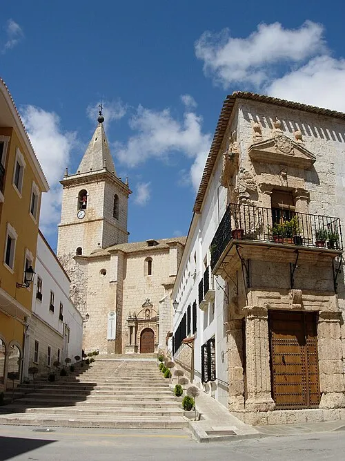 Church of El Salvador o de la Transfiguración Attraction, La Roda24 km NE
-
Río Ojuelo River, Bonillo, El10 km SW
-
Monasterio de Ntra. Sra. del Carmen Attraction, Villarrobledo24 km NW
-
Monumento Vidas Truncadas Landmark, Villarrobledo24 km NW
Sources & licences
Data last updated: