- Elevation
- 677 m
- above sea level
- Local time
- UTC+01:00
- Europe/Madrid · UTC+01:00
- Airports
- ODB Córdoba Airport155 km
- MAD Adolfo Suárez Madrid–Barajas Airport169 km
About Sierra Lucia
Sierra Lucia is a mountain. Location: Miguelturra, Ciudad Real. Elevation: 677 m. The best months to visit are April–May, October. The nearest airport is Córdoba Airport (155 km). Nearby sights include Pilar Park and Parque Gasset.
Climate of Sierra Lucia
Best months for sightseeingBest months for sightseeing: April–May, October.
This month · November
Outside the best season
Day 15° · Night 4° · Rain 44 mm
Better nearby cities in November
- Málaga · 257 km south20°
- Seville · 259 km southwest20°
- Murcia · 259 km southeast20°
- Hottest month
- July (day 35°)
- Coldest month
- January (night 1°)
- Wettest month
- December (56 mm)
- Driest month
- August (7 mm)
Bars: average monthly low and high temperature. Below: precipitation. Monthly averages for 1970–2000 at about 18 km resolution, adjusted for elevation. Highlighted months are mild and relatively dry. Source: WorldClim 2.1 (CC BY 4.0).
Show values as a table
| Month | Jan | Feb | Mar | Apr | May | Jun | Jul | Aug | Sep | Oct | Nov | Dec |
|---|---|---|---|---|---|---|---|---|---|---|---|---|
| Average high (°C) | 11° | 13° | 17° | 19° | 24° | 30° | 35° | 34° | 29° | 21° | 15° | 11° |
| Average low (°C) | 1° | 2° | 4° | 6° | 10° | 14° | 17° | 17° | 13° | 8° | 4° | 2° |
| Precipitation (mm) | 42 | 35 | 28 | 43 | 42 | 27 | 8 | 7 | 21 | 46 | 44 | 56 |
How to get to Sierra Lucia
The nearest airport is Córdoba Airport (ODB), 155 km to the southwest as the crow flies. For international flights: Adolfo Suárez Madrid–Barajas Airport (MAD) (169 km). The nearest large city is Jaén, 135 km to the south.
Airports
- Córdoba Airport (ODB) Córdoba 155 kmsouthwest
- Adolfo Suárez Madrid–Barajas Airport (MAD) Madrid 169 kmnorth
- F.G.L. Airport Granada-Jaén Airport (GRX) Granada 199 kmsouth
Nearby large cities
- Jaén Population: 113.5K 135 kmsouth
- Parla Population: 115.6K 139 kmnorth
- Fuenlabrada Population: 190.5K 145 kmnorth
- Córdoba Population: 325.7K 147 kmsouthwest
- Getafe Population: 187.5K 147 kmnorth
Straight-line distances; road distances are longer. Airport data: OurAirports.
Day trips from Sierra Lucia
Within 100 km: 154 historic and cultural sites, 101 natural sites, 187 lakes, rivers and coasts.
0–25 km49 places
- Laguna Romani Lake 10 kmNW
- Laguna de La Nava Lake 13 kmNE
- Laguna de Fuentillejo Lake 21 kmW
- Laguna de Escoplillo Lake 21 kmNE
25–60 km103 places
- Laguna de Valparaíso Lake 52 kmW
- Laguna de Retamar Lake 51 kmSW
- Laguna de la Perdiguera Lake 39 kmW
- Laguna de Navalagrulla Lake 32 kmSE
60–100 km290 places
- Pantano del Torcón Lake 85 kmNW
- Laguna Tinajas Lake 86 kmE
- Laguna del Taray Lake 75 kmNE
- Laguna San Pedro Lake 85 kmE
Straight-line distances.
Nearest towns and villages
-
Carrión de Calatrava Village, Carrión de Calatrava4.3 km N
-
Miguelturra Town, Miguelturra6.3 km W
-
Torralba de Calatrava Village, Torralba de Calatrava7.3 km NE
-
Carrión de Calatrava Municipality, Ciudad Real8.8 km N
-
 Torralba de Calatrava Municipality, Ciudad Real10 km N
-
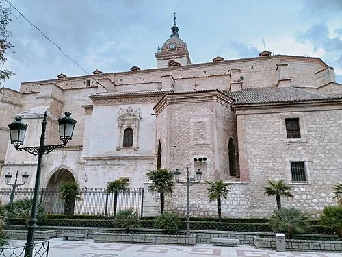 Ciudad Real City, Ciudad Real9.4 km W
Nearby attractions & nature
Everything nearby-
Pilar Park Natural site, Ciudad Real8.4 km W
-
Parque Gasset Natural site, Ciudad Real9.8 km W
-
Laguna Romani Lake, Ciudad Real9.6 km NW
-
Sierra de los Gatos Mountain, Miguelturra23 km NW
-
Laguna de Argamasilla Lake, Almagro9.6 km S
-
Cerro Gordo Mountain, Valenzuela de Calatrava18 km S
-
Laguna de La Nava Lake, Daimiel13 km NE
-
Cerro Yezosa Mountain, Almagro20 km SE
Sources & licences
Data last updated: