Iglesia de Robledillo
Located in Robledillo de Mohernando, Guadalajara Coordinates: 40°51′13″ N 3°14′14″ W
- Local time
- UTC+01:00
- Europe/Madrid · UTC+01:00
- Elevation
- 899 m
- above sea level
- Airports
- MAD Adolfo Suárez Madrid–Barajas Airport49 km
- VLL Valladolid Airport165 km
About Iglesia de Robledillo
Iglesia de Robledillo is a tourist attraction. Location: Robledillo de Mohernando, Guadalajara. The best months to visit are May–June, September. The nearest airport is Adolfo Suárez Madrid–Barajas Airport (49 km). Nearby sights include Plaza de toros de Robledillo de Mohernando and Arroyo Grande.
Climate of Iglesia de Robledillo
Best months for sightseeingBest months for sightseeing: May–June, September.
This month · November
Outside the best season
Day 12° · Night 3° · Rain 45 mm
Better nearby cities in November
- Elche · 361 km southeast20°
- Orihuela · 365 km southeast20°
- Alicante · 365 km southeast20°
- Hottest month
- July (day 30°)
- Coldest month
- January (night -1°)
- Wettest month
- October (48 mm)
- Driest month
- July (13 mm)
Bars: average monthly low and high temperature. Below: precipitation. Monthly averages for 1970–2000 at about 18 km resolution, adjusted for elevation. Highlighted months are mild and relatively dry. Source: WorldClim 2.1 (CC BY 4.0).
Show values as a table
| Month | Jan | Feb | Mar | Apr | May | Jun | Jul | Aug | Sep | Oct | Nov | Dec |
|---|---|---|---|---|---|---|---|---|---|---|---|---|
| Average high (°C) | 8° | 10° | 13° | 15° | 19° | 25° | 30° | 29° | 25° | 18° | 12° | 9° |
| Average low (°C) | -1° | 0° | 2° | 4° | 7° | 11° | 15° | 15° | 11° | 7° | 3° | 1° |
| Precipitation (mm) | 33 | 32 | 25 | 39 | 44 | 32 | 13 | 14 | 30 | 48 | 45 | 39 |
How to get to Iglesia de Robledillo
The nearest airport is Adolfo Suárez Madrid–Barajas Airport (MAD), 49 km to the southwest as the crow flies. The nearest large city is Alcalá de Henares, 43 km to the south.
Airports
- Adolfo Suárez Madrid–Barajas Airport (MAD) Madrid 49 kmsouthwest
- Valladolid Airport (VLL) Valladolid 165 kmnorthwest
- Salamanca Airport (SLM) Salamanca 191 kmwest
Nearby large cities
- Alcalá de Henares Population: 193.8K 43 kmsouth
- Alcobendas Population: 116K 48 kmsouthwest
- Torrejón de Ardoz Population: 118.2K 48 kmsouthwest
- Chamartin Population: 140K 57 kmsouthwest
- Ciudad Lineal Population: 228.2K 57 kmsouthwest
Straight-line distances; road distances are longer. Airport data: OurAirports.
Nearby attractions & nature
Everything nearby-
Plaza de toros de Robledillo de Mohernando Attraction, Robledillo de Mohernando0.4 km N
-
Arroyo Grande River, Mohernando2.1 km E
-
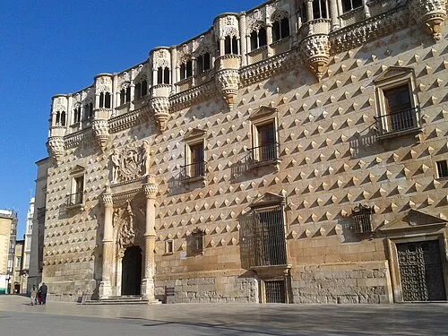 Museo de Guadalajara Museum, Guadalajara25 km S
-
Zoo Guadalajara Attraction, Guadalajara24 km S
-
Antigua iglesia de los Remedios Attraction, Guadalajara25 km S
-
Palacio de Los Condes de Moriana Historic site, Galápagos19 km SW
-
Río Sorbe River, Alarilla8.8 km E
-
Casar Mountain, Casar, El24 km SW
Nearest towns and villages
-
Robledillo de Mohernando Village, Robledillo de Mohernando0.5 km SE
-
Malaguilla Municipality, Guadalajara2.9 km SW
-
Malaguilla Village, Malaguilla4 km S
-
Puebla de Beleña Village, Puebla de Beleña4.2 km NE
Sources & licences
Data last updated: