Palomera
Located in Province of Cuenca, Castille-La Mancha Coordinates: 40°04′10″ N 2°01′22″ W

- Population
- 196
- 196
- Elevation
- 1,114 m
- above sea level
- Local time
- UTC+01:00
- Europe/Madrid · UTC+01:00
- Places inside
- 2
- listed under Palomera
- Airports
- MAD Adolfo Suárez Madrid–Barajas Airport140 km
- VLC Valencia Airport147 km
About Palomera
Palomera is a municipality. Location: Province of Cuenca, Castille-La Mancha. Population: 196. Elevation: 1,114 m.
Palomera is a municipality in Cuenca, Castile-La Mancha, Spain. It has a population of 184.
Source: Wikipedia · CC BY-SA 4.0
At a glance
- Area
- 50 km²
Source: Wikidata
Places bordering Palomera
- Buenache de la Sierra
Population of Palomera over time
| 2014 | 183 | |
|---|---|---|
| 2015 | 186 | |
| 2016 | 167 | |
| 2017 | 159 | |
| 2018 | 159 | |
| 2019 | 171 | |
| 2020 | 160 | |
| 2021 | 157 | |
| 2022 | 169 | |
| 2023 | 189 | |
| 2024 | 191 | |
| 2025 | 187 |
Censuses and official estimates; source: Wikidata.
Climate of Palomera
Best months for sightseeingBest months for sightseeing: May–June, September.
This month · November
Outside the best season
Day 12° · Night 2° · Rain 51 mm
Better nearby cities in November
- Elche · 231 km southeast20°
- Alicante · 233 km southeast20°
- Orihuela · 240 km southeast20°
- Hottest month
- July (day 30°)
- Coldest month
- January (night -2°)
- Wettest month
- May (62 mm)
- Driest month
- July (17 mm)
Bars: average monthly low and high temperature. Below: precipitation. Monthly averages for 1970–2000 at about 18 km resolution, adjusted for elevation. Highlighted months are mild and relatively dry. Source: WorldClim 2.1 (CC BY 4.0).
Show values as a table
| Month | Jan | Feb | Mar | Apr | May | Jun | Jul | Aug | Sep | Oct | Nov | Dec |
|---|---|---|---|---|---|---|---|---|---|---|---|---|
| Average high (°C) | 9° | 10° | 13° | 15° | 19° | 25° | 30° | 30° | 25° | 18° | 12° | 9° |
| Average low (°C) | -2° | -1° | 1° | 3° | 7° | 11° | 14° | 14° | 10° | 6° | 2° | -1° |
| Precipitation (mm) | 49 | 41 | 32 | 55 | 62 | 45 | 17 | 19 | 38 | 56 | 51 | 58 |
How to get to Palomera
The nearest airport is Adolfo Suárez Madrid–Barajas Airport (MAD), 140 km to the west as the crow flies. The nearest large city is Albacete, 120 km to the south.
Airports
- Adolfo Suárez Madrid–Barajas Airport (MAD) Madrid 140 kmwest
- Valencia Airport (VLC) Valencia 147 kmsoutheast
- Castellón-Costa Azahar Airport (CDT) Castellón de la Plana 179 kmeast
Nearby large cities
- Albacete Population: 173K 120 kmsouth
- Alcalá de Henares Population: 193.8K 123 kmwest
- Torrejón de Ardoz Population: 118.2K 130 kmwest
- Ciudad Lineal Population: 228.2K 145 kmwest
- Chamartin Population: 140K 147 kmwest
Straight-line distances; road distances are longer. Airport data: OurAirports.
Day trips from Palomera
Within 100 km: 51 historic and cultural sites, 238 natural sites, 171 lakes, rivers and coasts.
0–25 km38 places
- Laguna de Uña Lake 18 kmN
- Pantano de La Toba Lake 18 kmNE
- Serranía de Cuenca Mountain 23 kmSE
- Cerro del Castillo Mountain 23 kmSW
25–60 km149 places
- Embalse de Alarcón Lake 53 kmS
- Laguna de Navahonda Lake 48 kmW
- Laguna Grande Lake 53 kmN
- Cerro de la Zorra Mountain 54 kmSE
60–100 km273 places
- Pantano del Generalísimo Lake 89 kmSE
- Pantano de Entrepeñas Lake 80 kmNW
- Pantano de Buendía Lake 71 kmNW
- Peña Roya Mountain 68 kmSE
Straight-line distances.
Places in Palomera
2 placesBar: population relative to the most populous place in this list.
Cities & villages1
- Molinos de Papel · Village
Nearby attractions & nature
Everything nearby-
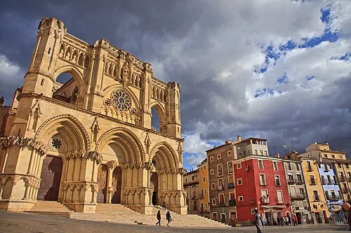 Cuenca Cathedral Attraction, Cuenca9.1 km W
-
Parque de Los Principes Natural site, Cuenca8.8 km W
-
Muralla Museum, Cuenca9 km W
-
Museo de Arte abstracto español Museum, Cuenca9.1 km W
-
Teatro Auditorio de Cuenca Attraction, Cuenca9.1 km W
-
Museo arqueológico de Cuenca Museum, Cuenca9.1 km W
-
Museo Diocesano de Cuenca Museum, Cuenca9.1 km W
-
Museo Fundación Antonio Saura Museum, Cuenca9.2 km W
Other cities and towns in Province of Cuenca
-
 Villar de Olalla Municipality, Province of Cuenca20 km W
-
 Villalba de la Sierra Municipality, Province of Cuenca19 km N
-
 Fuentes Municipality, Province of Cuenca14 km S
-
Arcas del Villar Municipality, Province of Cuenca14 km SW
-
 Valdemoro-Sierra Municipality, Province of Cuenca22 km E
-
Chillarón de Cuenca Municipality, Province of Cuenca18 km W
Sources & licences
Data last updated: · 2 independent sources