- Elevation
- 1,676 m
- above sea level
- Local time
- UTC+01:00
- Europe/Madrid · UTC+01:00
- Airports
- ILD Lleida-Alguaire Airport40 km
- LEU Pirineus - la Seu d'Urgel Airport63 km
About Sant Alís
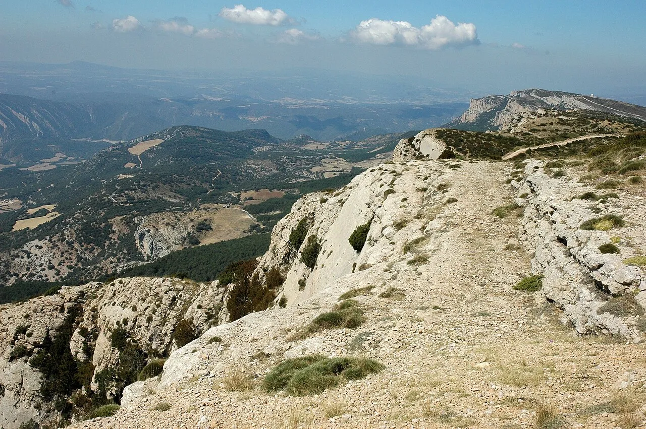
Sant Alís is a mountain. Location: Sant Esteve de la Sarga, Lleida. Elevation: 1,676 m.
Sant Alís is the highest mountain of Montsec d'Ares, the central part of the Serra del Montsec in Catalonia, Spain. It has an elevation of 1,675 metres above sea level.
Source: Wikipedia · CC BY-SA 4.0
At a glance
- Topographic prominence
- 733 m
Source: Wikidata
Photos of Sant Alís
-

Simonjoan · CC BY-SA 4.0 -

Simonjoan · CC BY-SA 4.0 -

Simonjoan · CC BY-SA 4.0


Climate of Sant Alís
Best months for sightseeingBest months for sightseeing: July–August.
This month · November
A cold month
Day 7° · Night -2° · Rain 74 mm
- Hottest month
- August (day 23°)
- Coldest month
- January (night -7°)
- Wettest month
- May (81 mm)
- Driest month
- July (40 mm)
Bars: average monthly low and high temperature. Below: precipitation. Monthly averages for 1970–2000 at about 18 km resolution, adjusted for elevation. Highlighted months are mild and relatively dry. Source: WorldClim 2.1 (CC BY 4.0).
Show values as a table
| Month | Jan | Feb | Mar | Apr | May | Jun | Jul | Aug | Sep | Oct | Nov | Dec |
|---|---|---|---|---|---|---|---|---|---|---|---|---|
| Average high (°C) | 1° | 4° | 7° | 9° | 13° | 18° | 23° | 23° | 19° | 12° | 7° | 3° |
| Average low (°C) | -7° | -5° | -4° | -2° | 1° | 5° | 8° | 9° | 6° | 2° | -2° | -5° |
| Precipitation (mm) | 49 | 44 | 49 | 60 | 81 | 74 | 40 | 59 | 70 | 70 | 74 | 60 |
How to get to Sant Alís
The nearest airport is Lleida-Alguaire Airport (ILD), 40 km to the southwest as the crow flies. For international flights: Reus Airport (REU) (105 km). The nearest large city is Lleida, 49 km to the south.
Airports
- Lleida-Alguaire Airport (ILD) Lleida 40 kmsouthwest
- Pirineus - la Seu d'Urgel Airport (LEU) La Seu d'Urgell Pyrenees and Andorra 63 kmnortheast
- Reus Airport (REU) Reus 105 kmsouth
Nearby large cities
- Lleida Population: 140.8K 49 kmsouth
- Reus Population: 103.5K 102 kmsouth
- Tarragona Population: 141.5K 110 kmsouth
- Terrassa Population: 218.5K 116 kmsoutheast
- Sabadell Population: 211.7K 125 kmsoutheast
Straight-line distances; road distances are longer. Airport data: OurAirports.
Day trips from Sant Alís
Within 100 km: 143 historic and cultural sites, 1,168 natural sites, 226 lakes, rivers and coasts.
0–25 km69 places
- Pantà de Sant Antoni Lake 24 kmNE
- Pantà de Terradets Lake 11 kmE
- Pantà de Sant Llorenç de Montgai Lake 21 kmS
- Pantà de Canelles Lake 12 kmSW
25–60 km256 places
- Esglesia de Sant Esteve de Ginast Attraction 51 kmN
- Estany d'Ivars i Vila-san Lake 42 kmS
- Lago Saburó Lake 58 kmN
- Pantà d'Oliana Lake 45 kmE
60–100 km1,212 places
- Artigue River 89 kmN
- Lago de Urdiceto Lake 80 kmNW
- Pantà d'Utxesa Lake 63 kmS
- Estany de Travessani Lake 64 kmN
Straight-line distances.
Nearest towns and villages
Nearby attractions & nature
Everything nearby-
Cap del Ras Mountain, Sant Esteve de la Sarga0.6 km W
-
el Montsec d'Ares Mountain, Àger0.7 km S
-
la Corona Mountain, Sant Esteve de la Sarga4.2 km W
-
la Tualdeta Mountain, Sant Esteve de la Sarga4.9 km W
-
Tossal de l'Osca Mountain, Àger5.4 km E
-
Congost del Seguer Natural site, Àger8.3 km NW
-
Congost de Mont-rebei Natural site, Sant Esteve de la Sarga8.3 km NW
-
la Torreta Mountain, Camarasa11 km E
Sources & licences
Data last updated: · 2 independent sources