- Elevation
- 18 m
- above sea level
- Local time
- UTC+01:00
- Europe/Madrid · UTC+01:00
- Airports
- REU Reus Airport59 km
- ILD Lleida-Alguaire Airport85 km
About Río Canaletas
Río Canaletas is a river. Location: Benifallet, Tarragona. The best months to visit are April–May, October. The nearest airport is Reus Airport (59 km). Nearby sights include Mola Rasa and Roca de la Barca.
Climate of Río Canaletas
Best months for sightseeingBest months for sightseeing: April–May, October.
This month · November
Outside the best season
Day 18° · Night 9° · Rain 64 mm
Better nearby cities in November
- Alicante · 303 km south20°
- Elche · 318 km south20°
- Orihuela · 343 km south20°
- Hottest month
- July (day 32°)
- Coldest month
- January (night 5°)
- Wettest month
- October (74 mm)
- Driest month
- July (14 mm)
Bars: average monthly low and high temperature. Below: precipitation. Monthly averages for 1970–2000 at about 18 km resolution, adjusted for elevation. Highlighted months are mild and relatively dry. Source: WorldClim 2.1 (CC BY 4.0).
Show values as a table
| Month | Jan | Feb | Mar | Apr | May | Jun | Jul | Aug | Sep | Oct | Nov | Dec |
|---|---|---|---|---|---|---|---|---|---|---|---|---|
| Average high (°C) | 14° | 16° | 18° | 20° | 24° | 28° | 32° | 32° | 28° | 23° | 18° | 15° |
| Average low (°C) | 5° | 6° | 7° | 10° | 13° | 17° | 19° | 20° | 17° | 13° | 9° | 6° |
| Precipitation (mm) | 42 | 28 | 40 | 48 | 60 | 41 | 14 | 31 | 64 | 74 | 64 | 57 |
How to get to Río Canaletas
The nearest airport is Reus Airport (REU), 59 km to the east as the crow flies. The nearest large city is Reus, 55 km to the northeast.
Airports
- Reus Airport (REU) Reus 59 kmeast
- Lleida-Alguaire Airport (ILD) Lleida 85 kmnorth
- Castellón-Costa Azahar Airport (CDT) Castellón de la Plana 91 kmsouthwest
Nearby large cities
- Reus Population: 103.5K 55 kmnortheast
- Tarragona Population: 141.5K 64 kmeast
- Lleida Population: 140.8K 73 kmnorth
- Castellon Population: 183.7K 118 kmsouthwest
- Zaragoza Population: 687K 139 kmnorthwest
Straight-line distances; road distances are longer. Airport data: OurAirports.
Day trips from Río Canaletas
Within 100 km: 169 historic and cultural sites, 240 natural sites, 176 lakes, rivers and coasts.
0–25 km86 places
- Platja Avellanes Beach 24 kmSE
- Playa L'Ampolla Beach 24 kmSE
- Platja Cap Roig Beach 24 kmSE
- Platja Perelló Beach 25 kmSE
25–60 km242 places
- Playa del Río Beach 55 kmS
- Playa del Rincón Beach 58 kmE
- Playa de Rifá Beach 41 kmE
- Platja del Marjal Beach 46 kmS
60–100 km257 places
- Playa Roda Beach 81 kmS
- Playa del Moro Beach 83 kmS
- Playa del Cargador Beach 82 kmS
- Playa Barà Beach 84 kmE
Straight-line distances.
Nearest towns and villages
-
Benifallet Village, Benifallet1.6 km NE
-
el Pinell de Brai Municipality, Tarragona6.1 km N
-
Tivenys Village, Tivenys6 km S
-
Tivenys Municipality, Tarragona7.3 km SE
-
Xerta Municipality Municipality, Tarragona7.6 km SW
-
Rasquera Municipality Municipality, Tarragona8.9 km E
Nearby attractions & nature
Everything nearby-
Mola Rasa Mountain, Paüls Municipality7.3 km W
-
Roca de la Barca Mountain, Rasquera Municipality6.3 km E
-
La Creu de Santos Mountain, Benifallet6.9 km E
-
Mola de la Llacuna Mountain, Rasquera Municipality6.6 km E
-
La Tosa Mountain, Prat de Comte6.8 km W
-
l'Escaleta Mountain, Rasquera Municipality7 km E
-
Punta Alta Mountain, el Pinell de Brai7.7 km NW
-
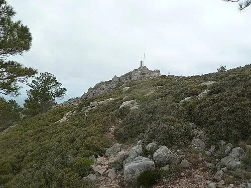 la Coscollosa Mountain, Alfara de Carles Municipality10 km SW
Sources & licences
Data last updated: