Arroyo Rubiales
Located in Jerez de los Caballeros, Badajoz Coordinates: 38°21′40″ N 6°42′18″ W
- Elevation
- 297 m
- above sea level
- Local time
- UTC+01:00
- Europe/Madrid · UTC+01:00
- Airports
- BJZ Badajoz Airport60 km
- SVQ Seville Airport127 km
About Arroyo Rubiales
Arroyo Rubiales is a river. Location: Jerez de los Caballeros, Badajoz. The best months to visit are May, October. The nearest airport is Badajoz Airport (60 km). Nearby sights include Arroyo de San Lázaro and Arroyo Brovales.
Climate of Arroyo Rubiales
Best months for sightseeingBest months for sightseeing: May, October.
This month · November
Outside the best season
Day 18° · Night 8° · Rain 87 mm
Better nearby cities in November
- Seville · 126 km southeast20°
- Dos Hermanas · 138 km southeast20°
- Málaga · 272 km southeast20°
- Hottest month
- July (day 34°)
- Coldest month
- January (night 5°)
- Wettest month
- December (102 mm)
- Driest month
- July (6 mm)
Bars: average monthly low and high temperature. Below: precipitation. Monthly averages for 1970–2000 at about 18 km resolution, adjusted for elevation. Highlighted months are mild and relatively dry. Source: WorldClim 2.1 (CC BY 4.0).
Show values as a table
| Month | Jan | Feb | Mar | Apr | May | Jun | Jul | Aug | Sep | Oct | Nov | Dec |
|---|---|---|---|---|---|---|---|---|---|---|---|---|
| Average high (°C) | 14° | 15° | 18° | 20° | 23° | 29° | 34° | 33° | 29° | 23° | 18° | 14° |
| Average low (°C) | 5° | 6° | 7° | 9° | 11° | 15° | 18° | 17° | 16° | 12° | 8° | 6° |
| Precipitation (mm) | 86 | 67 | 47 | 66 | 50 | 24 | 6 | 6 | 27 | 71 | 87 | 102 |
How to get to Arroyo Rubiales
The nearest airport is Badajoz Airport (BJZ), 60 km to the north as the crow flies. For international flights: Seville Airport (SVQ) (127 km). The nearest large city is Badajoz, 62 km to the north.
Airports
- Badajoz Airport (BJZ) Badajoz 60 kmnorth
- Seville Airport (SVQ) Seville 127 kmsoutheast
- Córdoba Airport (ODB) Córdoba 173 kmeast
Nearby large cities
- Badajoz Population: 150.5K 62 kmnorth
- Huelva Population: 144.3K 123 kmsouth
- Seville Population: 686.7K 126 kmsoutheast
- Dos Hermanas Population: 122.9K 138 kmsoutheast
- Córdoba Population: 325.7K 177 kmeast
Straight-line distances; road distances are longer. Airport data: OurAirports.
Day trips from Arroyo Rubiales
Within 100 km: 87 historic and cultural sites, 41 natural sites, 244 lakes, rivers and coasts.
0–25 km30 places
- Pantano de la Albuera Lake 9 kmSW
- Arroyo Vaquero River 24 kmNW
- Arroyo de Tamujoso River 20 kmSW
- Arroyo de San Lázaro River 7 kmSE
25–60 km122 places
- Laguna Grande Lake 36 kmN
- Embalse de Alange Lake 58 kmNE
- Sierra de Tudia Mountain 49 kmSE
- Cerro de Tentudia Mountain 47 kmSE
60–100 km220 places
- Pantano de Proserpina Lake 74 kmNE
- Pantano del Pintado Lake 77 kmSE
- Pantano de la Peña del Águila Lake 94 kmN
- Pantano de la Minilla Lake 90 kmSE
Straight-line distances.
Nearest towns and villages
-
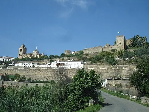 Jerez de los Caballeros Town, Jerez de los Caballeros7.4 km SW
-
 Valle de Santa Ana Municipality, Badajoz6.8 km W
-
El Guijo Village, Jerez de los Caballeros3.4 km E
-
 Burguillos del Cerro Municipality, Badajoz9.8 km E
-
 Valle de Matamoros Municipality, Badajoz8.5 km W
-
Valle de Santa Ana Village, Valle de Santa Ana7.3 km W
Nearby attractions & nature
Everything nearby-
Arroyo de San Lázaro River, Jerez de los Caballeros6.6 km SE
-
Arroyo Brovales River, Jerez de los Caballeros6.7 km S
-
Arroyo de la Cañada River, Jerez de los Caballeros7 km E
-
Arroyo Charco de la Cañada River, Jerez de los Caballeros7.1 km N
-
Arroyo Grande River, Jerez de los Caballeros7.2 km NW
-
Arroyo de La Parrilla River, Jerez de los Caballeros8.7 km SE
-
Arroyo Prado de la Higuera River, Jerez de los Caballeros8.8 km N
-
Pantano de la Albuera Lake, Jerez de los Caballeros9.4 km SW
Sources & licences
Data last updated: