Villanueva del Fresno
Located in Badajoz, Extremadura Coordinates: 38°23′15″ N 7°09′56″ W

- Population
- 3,617
- 3.6K
- Elevation
- 273 m
- above sea level
- Local time
- UTC+01:00
- Europe/Madrid · UTC+01:00
- Places inside
- 4
- listed under Villanueva del Fresno
- Airports
- BJZ Badajoz Airport63 km
- SVQ Seville Airport155 km
About Villanueva del Fresno
Villanueva del Fresno is a municipality. Location: Badajoz, Extremadura. Population: 3,617. Elevation: 273 m.
Villanueva del Fresno is a town in Badajoz Province in Extremadura, Spain. Villanueva del Fresno is the southernmost town of the district of Olivenza and also one of the closest to the Portuguese border, with which it has extensive commercial contacts.
Source: Wikipedia · CC BY-SA 4.0
Photos of Villanueva del Fresno
-

Hovallef · CC BY 4.0 -

Hovallef · CC BY 4.0 -

Adolfobrigido · CC BY-SA 4.0 -

Cardoazul · CC BY-SA 4.0


Places bordering Villanueva del Fresno
- Alconchel
- Higuera de Vargas
- Oliva de la Frontera
- Valencia del Mombuey
- Mourão Municipality
Population of Villanueva del Fresno over time
| 2014 | 3,538 | |
|---|---|---|
| 2015 | 3,489 | |
| 2016 | 3,464 | |
| 2017 | 3,411 | |
| 2018 | 3,401 | |
| 2019 | 3,397 | |
| 2020 | 3,364 | |
| 2021 | 3,335 | |
| 2022 | 3,316 | |
| 2023 | 3,272 | |
| 2024 | 3,274 | |
| 2025 | 3,247 |
Censuses and official estimates; source: Wikidata.
Climate of Villanueva del Fresno
Best months for sightseeingBest months for sightseeing: May, October.
This month · November
Outside the best season
Day 18° · Night 8° · Rain 76 mm
Better nearby cities in November
- Seville · 153 km southeast20°
- Dos Hermanas · 164 km southeast20°
- Málaga · 305 km southeast20°
- Hottest month
- July (day 32°)
- Coldest month
- January (night 4°)
- Wettest month
- December (89 mm)
- Driest month
- July (4 mm)
Bars: average monthly low and high temperature. Below: precipitation. Monthly averages for 1970–2000 at about 18 km resolution, adjusted for elevation. Highlighted months are mild and relatively dry. Source: WorldClim 2.1 (CC BY 4.0).
Show values as a table
| Month | Jan | Feb | Mar | Apr | May | Jun | Jul | Aug | Sep | Oct | Nov | Dec |
|---|---|---|---|---|---|---|---|---|---|---|---|---|
| Average high (°C) | 14° | 15° | 18° | 20° | 23° | 28° | 32° | 32° | 29° | 23° | 18° | 14° |
| Average low (°C) | 4° | 5° | 6° | 8° | 10° | 13° | 16° | 16° | 14° | 11° | 8° | 5° |
| Precipitation (mm) | 75 | 59 | 43 | 59 | 45 | 21 | 4 | 5 | 26 | 63 | 76 | 89 |
How to get to Villanueva del Fresno
The nearest airport is Badajoz Airport (BJZ), 63 km to the northeast as the crow flies. For international flights: Seville Airport (SVQ) (155 km). The nearest large city is Badajoz, 57 km to the north.
Airports
- Badajoz Airport (BJZ) Badajoz 63 kmnortheast
- Seville Airport (SVQ) Seville 155 kmsoutheast
- Faro - Gago Coutinho International Airport (FAO) Faro 168 kmsouthwest
Nearby large cities
- Badajoz Population: 150.5K 57 kmnorth
- Huelva Population: 144.3K 126 kmsouth
- Setúbal Population: 118.2K 151 kmwest
- Seville Population: 686.7K 153 kmsoutheast
- Dos Hermanas Population: 122.9K 164 kmsoutheast
Straight-line distances; road distances are longer. Airport data: OurAirports.
Day trips from Villanueva del Fresno
Within 100 km: 89 historic and cultural sites, 62 natural sites, 182 lakes, rivers and coasts.
0–25 km17 places
- Sierra Morena Mountain 17 kmNE
- Ribeiro dos Saus River 12 kmS
- Arroyo Vaquero River 23 kmNE
- Arroyo del Trazo River 12 kmNW
25–60 km100 places
- Laguna Grande Lake 49 kmNE
- Pantano de la Albuera Lake 33 kmE
- Las Peñas Mountain 51 kmS
- El Mijo Mountain 51 kmS
60–100 km216 places
- Pantano de Proserpina Lake 95 kmNE
- Pantano de la Peña del Águila Lake 93 kmN
- Embalse de Alange Lake 89 kmNE
- Alpotreque Mountain 97 kmN
Straight-line distances.
Places in Villanueva del Fresno
4 placesBar: population relative to the most populous place in this list.
Lakes, rivers & coasts3
- Arroyo del Higuerón · River
- Arroyo Friegamuñoz · River
- Río Confrentes · River
Nearby attractions & nature
Everything nearby-
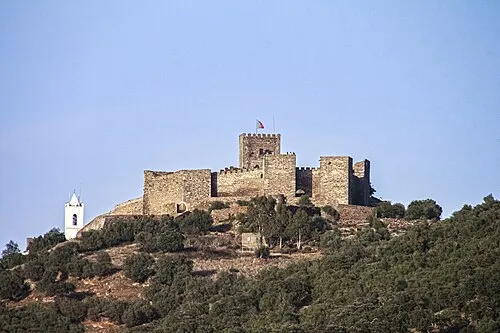 Castelo de Monsaraz Historic site, Monsaraz20 km W
-
Outeiro da Sentinela Mountain, Capelins (Santo António)21 km NW
-
Sierra Morena Mountain, Alconchel17 km NE
-
Arroyo del Trazo River, Alconchel12 km NW
-
Arroyo de Blancos River, Zahínos15 km E
-
Arroyo del Pajarito River, Alconchel14 km NE
-
Ribeiro dos Saus River, Spain12 km S
-
Arroyo de Bujardo River, Higuera de Vargas17 km E
Other cities and towns in Badajoz
-
 Cheles Municipality, Badajoz20 km NW
-
 Barcarrota Municipality, Badajoz28 km NE
-
 Oliva de la Frontera Municipality, Badajoz22 km SE
-
 Valle de Santa Ana Municipality, Badajoz34 km E
-
Táliga Municipality, Badajoz21 km NE
-
 Valle de Matamoros Municipality, Badajoz32 km E
Sources & licences
Data last updated: · 2 independent sources