Igrexa de Santa María A Real do Cebreiro
Located in Pedrafita do Cebreiro, Lugo Coordinates: 42°42′29″ N 7°02′35″ W
- Local time
- UTC+01:00
- Europe/Madrid · UTC+01:00
- Elevation
- 1,296 m
- above sea level
- Airports
- BGC Bragança Airport98 km
- SCQ Santiago-Rosalía de Castro Airport114 km
About Igrexa de Santa María A Real do Cebreiro
Igrexa de Santa María A Real do Cebreiro is a tourist attraction. Location: Pedrafita do Cebreiro, Lugo. The best months to visit are July–August. The nearest airport is Bragança Airport (98 km). Nearby sights include Serra do Courel and Formigueiros.
Climate of Igrexa de Santa María A Real do Cebreiro
Best months for sightseeingBest months for sightseeing: July–August.
This month · November
A wet month
Day 8° · Night 1° · Rain 165 mm
- Hottest month
- August (day 22°)
- Coldest month
- January (night -2°)
- Wettest month
- December (176 mm)
- Driest month
- July (40 mm)
Bars: average monthly low and high temperature. Below: precipitation. Monthly averages for 1970–2000 at about 18 km resolution, adjusted for elevation. Highlighted months are mild and relatively dry. Source: WorldClim 2.1 (CC BY 4.0).
Show values as a table
| Month | Jan | Feb | Mar | Apr | May | Jun | Jul | Aug | Sep | Oct | Nov | Dec |
|---|---|---|---|---|---|---|---|---|---|---|---|---|
| Average high (°C) | 5° | 6° | 9° | 11° | 14° | 18° | 22° | 22° | 19° | 13° | 8° | 6° |
| Average low (°C) | -2° | -2° | -1° | 1° | 4° | 7° | 9° | 9° | 7° | 4° | 1° | -1° |
| Precipitation (mm) | 163 | 134 | 110 | 115 | 108 | 64 | 40 | 43 | 83 | 151 | 165 | 176 |
How to get to Igrexa de Santa María A Real do Cebreiro
The nearest airport is Bragança Airport (BGC), 98 km to the south as the crow flies. For international flights: Santiago-Rosalía de Castro Airport (SCQ) (114 km). The nearest large city is Ourense, 79 km to the southwest.
Airports
- Bragança Airport (BGC) Bragança 98 kmsouth
- Santiago-Rosalía de Castro Airport (SCQ) Santiago de Compostela 114 kmwest
- León Airport (LEN) La Virgen del Camino 115 kmeast
Nearby large cities
- Ourense Population: 105.2K 79 kmsouthwest
- León Population: 124.8K 121 kmeast
- Oviedo Population: 220K 122 kmnortheast
- A Coruña Population: 250.4K 133 kmnorthwest
- Gijón Population: 271.8K 145 kmnortheast
Straight-line distances; road distances are longer. Airport data: OurAirports.
Day trips from Igrexa de Santa María A Real do Cebreiro
Within 100 km: 90 historic and cultural sites, 132 natural sites, 287 lakes, rivers and coasts.
0–25 km16 places
- Pía Paxaro Mountain 16 kmSW
- Serra dos Ancares Mountain 17 kmNE
- Alto de Cuíña Mountain 23 kmNE
- Mustallar Mountain 21 kmNE
25–60 km156 places
- Embalse de Belesar Lake 57 kmW
- Montes de San Paio Mountain 56 kmW
- Serra de Queixa Mountain 55 kmSW
- Moncalvo Mountain 60 kmS
60–100 km337 places
- Playa de Represas Beach 96 kmN
- Praia de Paixás Beach 99 kmN
- Praia de Lobás Beach 98 kmN
- Playa Permenande Beach 97 kmN
Straight-line distances.
Nearby attractions & nature
Everything nearby-
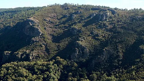 Serra do Courel Mountain, Folgoso do Courel17 km SW
-
Formigueiros Mountain, Folgoso do Courel12 km S
-
Pena Soá Mountain, Samos15 km W
-
Campín de Murelos Mountain, Quiroga15 km SW
-
A Escrita Mountain, Folgoso do Courel15 km SW
-
Serra do Oribio Mountain, Samos16 km W
-
Pía Paxaro Mountain, Folgoso do Courel16 km SW
-
Alto de Torrentes Mountain, Samos16 km W
Nearest towns and villages
-
O Cebreiro Village, Pedrafita do Cebreiro0.1 km N
-
Acibo Village, Pedrafita do Cebreiro1 km SW
-
Fontevedra Village, Pedrafita do Cebreiro1.2 km NE
-
Barjamayor Village, Pedrafita do Cebreiro1.6 km NW
Sources & licences
Data last updated: