Barco de Valdeorras, O
Located in Ourense, Galicia Coordinates: 42°25′58″ N 6°58′07″ W
- Population
- 14,052
- 14.1K
- Elevation
- 385 m
- above sea level
- Local time
- UTC+01:00
- Europe/Madrid · UTC+01:00
- Places inside
- 34
- listed under Barco de Valdeorras, O
About Barco de Valdeorras, O
Barco de Valdeorras, O is a municipality. Location: Ourense, Galicia. Population: 14,052. Elevation: 385 m.
In comparison
- No. 4 of 92 places in Ourense by population
- Nearest larger town: Ponferrada, 33 km NE
- 6 sights and natural places within 10 km Arroyo Balado, Río Fuloma
- Listed here: Village: 28, River: 5, Town: 1
Places in Barco de Valdeorras, O
34 places- 13.5K
-
Coedo Village34
-
Alixo Village
-
Ambasaugas Village
-
A Pobla Village
-
A Proba Village
-
Arroyo Balado River
-
Arroyo de Candis River
-
Cesures Village
-
Entoma Village
-
Fervenza Village
-
Forcadela Village
-
Millarouso Village
-
O Castro Village
-
Otarelo Village
-
Pacios Village
-
Raxoá Village
-
Regato da Fervenza River
-
Reporicelo Village
-
Río Casoio River
-
Río Fuloma River
-
San Martín Village
-
Santa Mariña Village
-
Santigoso Village
-
Santurxo Village
-
Soulecín Village
-
Termiñana Village
-
Vales Village
-
Vegadecabo Village
-
Veigamuiños Village
-
Vilanova Village
-
Vilariño Village
-
Villoría Village
-
Xagoaza Village
Nearby attractions & nature
Everything nearby-
Río Leira River, Vilamartín de Valdeorras7.6 km W
-
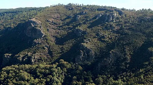 Serra do Courel Mountain, Folgoso do Courel23 km NW
-
Fonte Forraxes Natural site, A Veiga12 km S
-
Pena Trevinca Mountain, A Veiga24 km SE
-
Río Cabrera River, Puente de Domingo Flórez13 km E
-
Arroyo de Pincheira River, Quiroga15 km W
-
Río Valdecaballos River, A Veiga15 km S
-
Paxaro Mountain, Folgoso do Courel22 km NW
Sources & licences
Data last updated: