- Elevation
- 130 m
- above sea level
- Local time
- UTC+01:00
- Europe/Madrid · UTC+01:00
- Airports
- VGO Vigo Airport25 km
- SCQ Santiago-Rosalía de Castro Airport62 km
About Buezas
Buezas is a village. Location: Sanxenxo, Pontevedra. Elevation: 130 m. The best months to visit are June–August. The nearest airport is Vigo Airport (25 km). Nearby sights include Panadeira and Lavapanos.
Climate of Buezas
Best months for sightseeingBest months for sightseeing: June–August.
This month · November
A wet month
Day 14° · Night 9° · Rain 188 mm
- Hottest month
- August (day 23°)
- Coldest month
- January (night 7°)
- Wettest month
- December (221 mm)
- Driest month
- July (35 mm)
Bars: average monthly low and high temperature. Below: precipitation. Monthly averages for 1970–2000 at about 18 km resolution, adjusted for elevation. Highlighted months are mild and relatively dry. Source: WorldClim 2.1 (CC BY 4.0).
Show values as a table
| Month | Jan | Feb | Mar | Apr | May | Jun | Jul | Aug | Sep | Oct | Nov | Dec |
|---|---|---|---|---|---|---|---|---|---|---|---|---|
| Average high (°C) | 12° | 13° | 15° | 16° | 18° | 21° | 23° | 23° | 21° | 18° | 14° | 12° |
| Average low (°C) | 7° | 7° | 8° | 9° | 11° | 14° | 15° | 16° | 14° | 12° | 9° | 7° |
| Precipitation (mm) | 220 | 197 | 146 | 126 | 120 | 70 | 35 | 38 | 101 | 173 | 188 | 221 |
How to get to Buezas
The nearest airport is Vigo Airport (VGO), 25 km to the southeast as the crow flies. For international flights: Santiago-Rosalía de Castro Airport (SCQ) (62 km). The nearest large city is Vigo, 21 km to the south.
Airports
- Vigo Airport (VGO) Vigo 25 kmsoutheast
- Santiago-Rosalía de Castro Airport (SCQ) Santiago de Compostela 62 kmnortheast
- A Coruña Airport (LCG) Culleredo 104 kmnorth
Nearby large cities
- Vigo Population: 293.6K 21 kmsouth
- Ourense Population: 105.2K 77 kmeast
- Braga Population: 193.3K 101 kmsouth
- A Coruña Population: 250.4K 111 kmnorth
- Porto Population: 252.7K 142 kmsouth
Straight-line distances; road distances are longer. Airport data: OurAirports.
Nearby attractions & nature
Everything nearby-
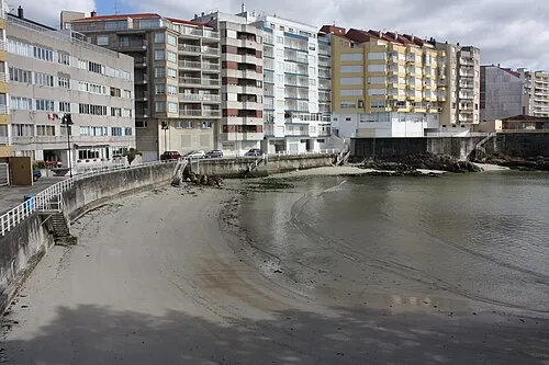 Panadeira Beach, Sanxenxo1.8 km S
-
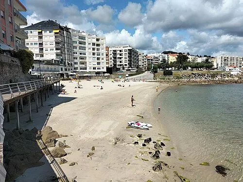 Lavapanos Beach, Sanxenxo1.9 km S
-
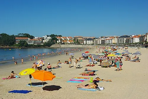 Playa del Silgar Beach, Pontevedra2.1 km SW
-
Auditorio Emilia Pardo Bazán Attraction, Sanxenxo1.5 km S
-
Nuevo Templo de Sanxenxo Attraction, Sanxenxo1.7 km S
-
Areas Gordas Beach, Sanxenxo2.9 km SW
Sources & licences
Data last updated: