Parque municipal Julio Herrero
Located in Torrelodones, Madrid Coordinates: 40°34′36″ N 3°55′31″ W
- Elevation
- 861 m
- above sea level
- Local time
- UTC+01:00
- Europe/Madrid · UTC+01:00
- Airports
- MAD Adolfo Suárez Madrid–Barajas Airport31 km
- SLM Salamanca Airport139 km
About Parque municipal Julio Herrero
Parque municipal Julio Herrero is a natural site. Location: Torrelodones, Madrid. The best months to visit are May–June, September. The nearest airport is Adolfo Suárez Madrid–Barajas Airport (31 km). Nearby sights include Estanque del Parque Julio Herrero and Galería Fomentarte.
Climate of Parque municipal Julio Herrero
Best months for sightseeingBest months for sightseeing: May–June, September.
This month · November
Outside the best season
Day 13° · Night 4° · Rain 49 mm
Better nearby cities in November
- Murcia · 375 km southeast20°
- Orihuela · 377 km southeast20°
- Elche · 378 km southeast20°
- Hottest month
- July (day 30°)
- Coldest month
- January (night 1°)
- Wettest month
- May (51 mm)
- Driest month
- August (14 mm)
Bars: average monthly low and high temperature. Below: precipitation. Monthly averages for 1970–2000 at about 18 km resolution, adjusted for elevation. Highlighted months are mild and relatively dry. Source: WorldClim 2.1 (CC BY 4.0).
Show values as a table
| Month | Jan | Feb | Mar | Apr | May | Jun | Jul | Aug | Sep | Oct | Nov | Dec |
|---|---|---|---|---|---|---|---|---|---|---|---|---|
| Average high (°C) | 9° | 11° | 14° | 16° | 20° | 26° | 30° | 30° | 25° | 18° | 13° | 9° |
| Average low (°C) | 1° | 1° | 3° | 5° | 8° | 13° | 16° | 16° | 12° | 8° | 4° | 2° |
| Precipitation (mm) | 37 | 31 | 25 | 43 | 51 | 30 | 16 | 14 | 28 | 46 | 49 | 48 |
How to get to Parque municipal Julio Herrero
The nearest airport is Adolfo Suárez Madrid–Barajas Airport (MAD), 31 km to the east as the crow flies. The nearest large city is Alcobendas, 24 km to the east.
Airports
- Adolfo Suárez Madrid–Barajas Airport (MAD) Madrid 31 kmeast
- Salamanca Airport (SLM) Salamanca 139 kmwest
- Valladolid Airport (VLL) Valladolid 148 kmnorthwest
Nearby large cities
- Alcobendas Population: 116K 24 kmeast
- Chamartin Population: 140K 25 kmsoutheast
- Madrid Population: 3.3M 26 kmsoutheast
- Alcorcón Population: 172.4K 27 kmsouth
- Ciudad Lineal Population: 228.2K 27 kmsoutheast
Straight-line distances; road distances are longer. Airport data: OurAirports.
Day trips from Parque municipal Julio Herrero
Within 100 km: 481 historic and cultural sites, 266 natural sites, 360 lakes, rivers and coasts.
0–25 km211 places
- Embalse de Santillana Lake 18 kmNE
- La Jarosa Lake 20 kmNW
- Embalse Tobar Lake 23 kmW
- Embalse de Valmayor Lake 12 kmW
25–60 km549 places
- San Millán Attraction 44 kmN
- Embalse del Burguillo Lake 58 kmW
- Pantano de San Juan Lake 41 kmSW
- Pantano de San Juan Lake 40 kmSW
60–100 km347 places
- Laguna de Taeña Lake 61 kmW
- Cerro de Layos Mountain 94 kmS
- Somosierra Mountain 69 kmNE
- Risco del Sol Mountain 80 kmW
Straight-line distances.
Nearest towns and villages
-
Torrelodones Town, Torrelodones0.1 km W
-
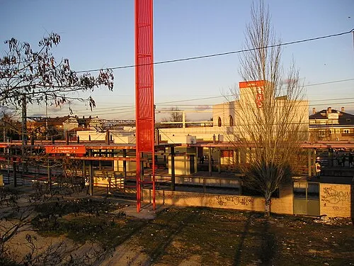 Las Matas Town, Las Rozas de Madrid3.5 km SE
-
Galapagar Municipality, Madrid4.7 km SW
-
Las Rozas de Madrid Municipality, Madrid5.9 km S
-
Hoyo de Manzanares Town, Hoyo de Manzanares5.3 km N
-
Hoyo de Manzanares Municipality, Madrid5.3 km N
Nearby attractions & nature
Everything nearby-
Estanque del Parque Julio Herrero Landmark, Torrelodones<0.1 km SE
-
Galería Fomentarte Museum, Torrelodones0.1 km N
-
Fuente del Caño Landmark, Torrelodones0.4 km W
-
Parroquia de la Asunción de Nuestra Señora de Torrelodones Attraction, Torrelodones0.5 km W
-
Club de Campo Landmark, Torrelodones1.6 km W
-
Casa de la Cultura de Torrelodone Attraction, Torrelodones2.7 km W
-
Sierra del Hoyo Mountain, Hoyo de Manzanares6.9 km N
-
Parque del Sol Natural site, Villanueva del Pardillo10 km S
Sources & licences
Data last updated: