- Local time
- UTC+01:00
- Europe/Madrid · UTC+01:00
- Elevation
- 545 m
- above sea level
- Airports
- RMU Region of Murcia International Airport67 km
- ALC Alicante-Elche Miguel Hernández Airport111 km
About Parroquia San Antonio de Pádua
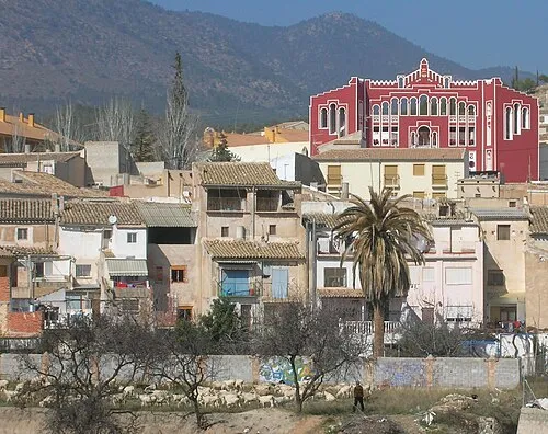
Parroquia San Antonio de Pádua is a tourist attraction. Location: Cehegín, Murcia. The best months to visit are April–May, October. The nearest airport is Region of Murcia International Airport (67 km). Nearby sights include Cloudart Obra gráfica and Convento de San Esteban.
Climate of Parroquia San Antonio de Pádua
Best months for sightseeingBest months for sightseeing: April–May, October.
This month · November
Outside the best season
Day 17° · Night 5° · Rain 38 mm
Better nearby cities in November
- Murcia · 60 km east20°
- Orihuela · 75 km east20°
- Cartagena · 90 km southeast21°
- Hottest month
- July (day 34°)
- Coldest month
- January (night 2°)
- Wettest month
- October (44 mm)
- Driest month
- July (7 mm)
Bars: average monthly low and high temperature. Below: precipitation. Monthly averages for 1970–2000 at about 18 km resolution, adjusted for elevation. Highlighted months are mild and relatively dry. Source: WorldClim 2.1 (CC BY 4.0).
Show values as a table
| Month | Jan | Feb | Mar | Apr | May | Jun | Jul | Aug | Sep | Oct | Nov | Dec |
|---|---|---|---|---|---|---|---|---|---|---|---|---|
| Average high (°C) | 12° | 14° | 17° | 19° | 24° | 29° | 34° | 33° | 29° | 22° | 17° | 13° |
| Average low (°C) | 2° | 3° | 4° | 6° | 10° | 14° | 17° | 17° | 14° | 10° | 5° | 3° |
| Precipitation (mm) | 31 | 32 | 32 | 39 | 39 | 23 | 7 | 8 | 24 | 44 | 38 | 34 |
How to get to Parroquia San Antonio de Pádua
The nearest airport is Region of Murcia International Airport (RMU), 67 km to the southeast as the crow flies. The nearest large city is Murcia, 60 km to the east.
Airports
- Region of Murcia International Airport (RMU) Corvera 67 kmsoutheast
- Alicante-Elche Miguel Hernández Airport (ALC) Alicante 111 kmeast
- Almería Airport (LEI) Almería 147 kmsouth
Nearby large cities
- Murcia Population: 472K 60 kmeast
- Orihuela Population: 101.3K 75 kmeast
- Cartagena Population: 213.9K 90 kmsoutheast
- Elche Population: 234.8K 98 kmeast
- Albacete Population: 173K 100 kmnorth
Straight-line distances; road distances are longer. Airport data: OurAirports.
Day trips from Parroquia San Antonio de Pádua
Within 100 km: 329 historic and cultural sites, 249 natural sites, 194 lakes, rivers and coasts.
0–25 km33 places
- Pantano de Quipar Lake 22 kmNE
- Cerro de Peña María Mountain 25 kmSW
- Cambrones Mountain 12 kmNE
- Buitre Mountain 12 kmNW
25–60 km201 places
- Pantano de Valdeinfierno Lake 35 kmSW
- Pantano de Talave Lake 47 kmN
- Pantano de Puentes Lake 39 kmS
- Pantano de La Cierva Lake 27 kmE
60–100 km538 places
- Isla Plana Island 78 kmSE
- Playa de la Hita Beach 93 kmE
- Playa de Fatares Beach 88 kmSE
- Playa de La Chapineta Beach 80 kmSE
Straight-line distances.
Nearby attractions & nature
Everything nearby-
Cloudart Obra gráfica Museum, Cehegín0.3 km NW
-
Convento de San Esteban Attraction, Cehegín0.3 km SE
-
Plaza de Toros Attraction, Cehegín0.4 km SW
-
Arco Romano Cehegín Landmark, Cehegín0.5 km W
-
Museo Arqueológico Museum, Cehegín0.8 km NW
-
Parroquia Santa María Magdalena Attraction, Cehegín0.9 km N
-
Juan Pablo II Park Natural site, Cehegín0.4 km W
-
Ruinas de Begastri Historic site, Cehegín2.3 km E
Nearest towns and villages
-
Cehegín Town, Cehegín0.2 km NW
-
Las Maravillas Village, Cehegín1.5 km SE
-
 Caravaca Town, Caravaca de la Cruz6.1 km W
-
Campillo y Suertes Village, Cehegín2.7 km S
Sources & licences
Data last updated: