Häradsbygden
Located in Leksand Municipality, Dalarna County Coordinates: 60°42′00″ N 15°02′00″ E
- Population
- 696
- 696
- Elevation
- 195 m
- above sea level
- Local time
- UTC+01:00
- Europe/Stockholm · UTC+01:00
- Airports
- MXX Mora Airport40 km
- BLE Dala Airport41 km
About Häradsbygden
Häradsbygden is a village. Location: Leksand Municipality, Dalarna County. Population: 696. Elevation: 195 m.
Häradsbygden is a locality situated in Leksand Municipality, Dalarna County, Sweden with 643 inhabitants in 2010.
Source: Wikipedia · CC BY-SA 4.0
At a glance
- Area
- 2 km²
Source: Wikidata
Population of Häradsbygden over time
| 2010 | 643 | |
|---|---|---|
| 2015 | 696 | |
| 2016 | 687 | |
| 2017 | 693 | |
| 2018 | 708 | |
| 2019 | 698 | |
| 2020 | 694 | |
| 2023 | 713 |
Censuses and official estimates; source: Wikidata.
Climate of Häradsbygden
Best months for sightseeingBest months for sightseeing: June–August.
This month · November
A cold month
Day 2° · Night -3° · Rain 59 mm
- Hottest month
- July (day 21°)
- Coldest month
- February (night -10°)
- Wettest month
- July (84 mm)
- Driest month
- February (29 mm)
Bars: average monthly low and high temperature. Below: precipitation. Monthly averages for 1970–2000 at about 18 km resolution, adjusted for elevation. Highlighted months are mild and relatively dry. Source: WorldClim 2.1 (CC BY 4.0).
Show values as a table
| Month | Jan | Feb | Mar | Apr | May | Jun | Jul | Aug | Sep | Oct | Nov | Dec |
|---|---|---|---|---|---|---|---|---|---|---|---|---|
| Average high (°C) | -2° | -2° | 3° | 8° | 16° | 20° | 21° | 19° | 14° | 8° | 2° | -1° |
| Average low (°C) | -9° | -10° | -6° | -2° | 4° | 8° | 11° | 9° | 5° | 2° | -3° | -7° |
| Precipitation (mm) | 40 | 29 | 34 | 47 | 47 | 69 | 84 | 74 | 68 | 57 | 59 | 43 |
How to get to Häradsbygden
The nearest airport is Mora Airport (MXX), 40 km to the northwest as the crow flies. The nearest large city is Västerås, 147 km to the southeast.
Airports
- Mora Airport (MXX) Mora 40 kmnorthwest
- Dala Airport (BLE) Borlange 41 kmsoutheast
- Torsby Airport (TYF) Torsby 128 kmsouthwest
Nearby large cities
- Västerås Population: 127.8K 147 kmsoutheast
- Örebro Population: 156K 159 kmsouth
- Sollentuna Population: 139.6K 216 kmsoutheast
- Stockholm Population: 1.5M 228 kmsoutheast
- Oslo Population: 1.1M 253 kmwest
Straight-line distances; road distances are longer. Airport data: OurAirports.
Day trips from Häradsbygden
Within 100 km: 22 natural sites, 54 lakes, rivers and coasts.
0–25 km3 places
- Digernäset Natural site 16 kmNW
- Prästön Island 7 kmE
- Käringberget Mountain 5 kmNW
25–60 km38 places
- Fiskstuholme Island 58 kmNE
- Olsnäset Island 52 kmS
- Lövön Island 54 kmS
- Hellmansö Island 38 kmSE
60–100 km35 places
- Digerberget Mountain 100 kmW
- Bockholmen Island 97 kmN
- Trondhatten Mountain 99 kmN
- Telneråsen Mountain 69 kmN
Straight-line distances.
Nearby attractions & nature
Everything nearby-
Käringberget Mountain, Leksand Municipality5.4 km NW
-
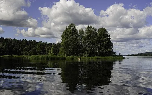 Prästön Island, Dalarna County6.6 km E
-
Digernäset Natural site, Dalarna County16 km NW
Sources & licences
Data last updated: · 2 independent sources