- Elevation
- 54 m
- above sea level
- Local time
- UTC+01:00
- Europe/Stockholm · UTC+01:00
- Airports
- BLE Dala Airport85 km
- VST Stockholm Västerås Airport117 km
About Valbo socken
Valbo socken is a village. Location: Valbo, Gävle Municipality. Elevation: 54 m. The best months to visit are June–August. The nearest airport is Dala Airport (85 km). Nearby sights include Strömvallen and Lesandsön.
Climate of Valbo socken
Best months for sightseeingBest months for sightseeing: June–August.
This month · November
A cold month
Day 3° · Night -2° · Rain 57 mm
- Hottest month
- July (day 22°)
- Coldest month
- February (night -8°)
- Wettest month
- July (76 mm)
- Driest month
- February (30 mm)
Bars: average monthly low and high temperature. Below: precipitation. Monthly averages for 1970–2000 at about 18 km resolution, adjusted for elevation. Highlighted months are mild and relatively dry. Source: WorldClim 2.1 (CC BY 4.0).
Show values as a table
| Month | Jan | Feb | Mar | Apr | May | Jun | Jul | Aug | Sep | Oct | Nov | Dec |
|---|---|---|---|---|---|---|---|---|---|---|---|---|
| Average high (°C) | -1° | 0° | 3° | 8° | 15° | 19° | 22° | 20° | 15° | 9° | 3° | 0° |
| Average low (°C) | -7° | -8° | -5° | -1° | 4° | 8° | 11° | 10° | 6° | 2° | -2° | -6° |
| Precipitation (mm) | 44 | 30 | 33 | 42 | 38 | 55 | 76 | 75 | 64 | 54 | 57 | 50 |
How to get to Valbo socken
The nearest airport is Dala Airport (BLE), 85 km to the west as the crow flies. For international flights: Stockholm Västerås Airport (VST) (117 km). The nearest large city is Västerås, 115 km to the south.
Airports
- Dala Airport (BLE) Borlange 85 kmwest
- Stockholm Västerås Airport (VST) Stockholm / Västerås 117 kmsouth
- Stockholm-Arlanda Airport (ARN) Stockholm 120 kmsoutheast
Nearby large cities
- Västerås Population: 127.8K 115 kmsouth
- Sollentuna Population: 139.6K 143 kmsouth
- Stockholm Population: 1.5M 156 kmsoutheast
- Örebro Population: 156K 181 kmsouthwest
- Oslo Population: 1.1M 355 kmwest
Straight-line distances; road distances are longer. Airport data: OurAirports.
Day trips from Valbo socken
Within 100 km: 3 historic and cultural sites, 30 natural sites, 148 lakes, rivers and coasts.
0–25 km10 places
- Gässön Island 24 kmSE
- Lesandsön Island 8 kmW
- Orarna Island 18 kmNE
- Malmön Island 14 kmW
25–60 km50 places
- Oppalagrund Island 28 kmNE
- Fårholmen Natural site 36 kmN
- Pelargrundet Island 59 kmE
- Kniven Island 38 kmE
60–100 km121 places
- Fiskstuholme Island 94 kmNW
- Norrön Island 94 kmE
- Krukskäret Island 92 kmE
- Fetskäret Island 90 kmSE
Straight-line distances.
Nearby attractions & nature
Everything nearby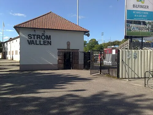
Sources & licences
Data last updated: