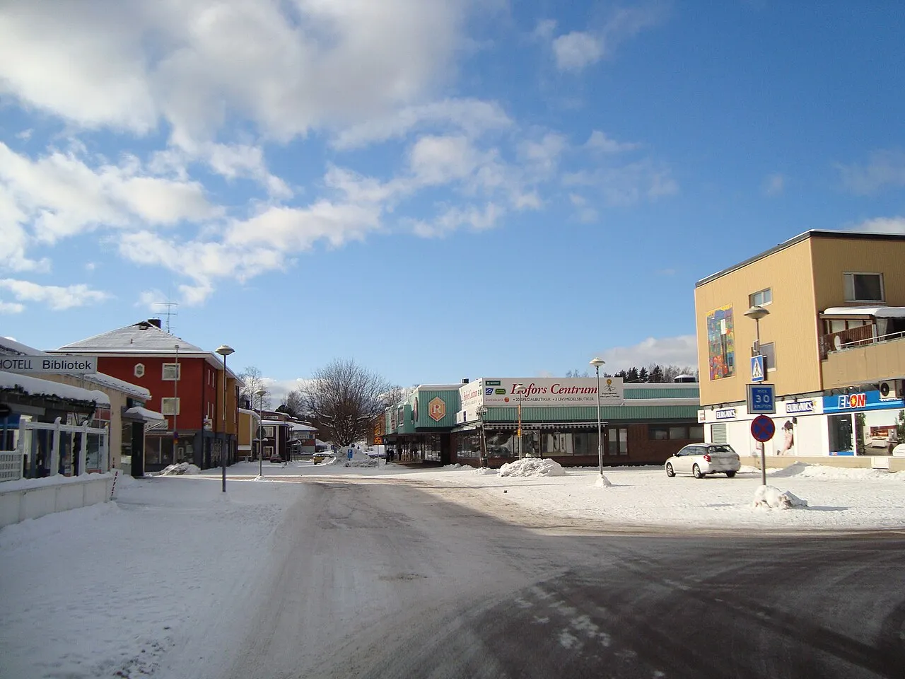
- Population
- 6,090
- 6.1K
- Elevation
- 114 m
- above sea level
- Local time
- UTC+01:00
- Europe/Stockholm · UTC+01:00
- Airports
- BLE Dala Airport45 km
- MXX Mora Airport107 km
About Hofors
Hofors is a city. Location: Hofors Municipality, Gävleborg County. Population: 6,090. Elevation: 114 m.
Hofors (Swedish pronunciation: [ˈhûːfɔʂ]) is a locality and the seat of Hofors Municipality, Gävleborg County, Sweden with 6,681 inhabitants in 2010.
Source: Wikipedia · CC BY-SA 4.0
At a glance
- Area
- 6.4 km²
Source: Wikidata
Photos of Hofors
-

AleWi · CC BY-SA 4.0 -

Johanmichaelson · CC BY-SA 4.0 -

Calle Eklund/ V-wolf · CC BY-SA 3.0 -

Olof Lagerkvist · CC BY 3.0 -

Olof Lagerkvist · CC BY 3.0


Travel notes for Hofors
From Wikivoyage
Hofors is a town, and a municipality, Hofors kommun, in Gävleborg County, in the western Gästrikland province.
Get in+
Hofors is along European route E16 route between Oslo and Gävle. Travelling by car from Gävle takes about 45 minutes. Bus 141 from Gävle via Sandviken stops in Hofors.
Regional trains run hourly from Gävle to Sandviken, Storvik, Hofors (40 min), Falun and Borlänge. Some continue to Kopparberg and Örebro.
Other trains towards Örebro via Avesta only call at Torsåker.
1 Hofors railway station (Hofors järnvägsstation). The railway station in Hofors inconveniently located about 3½ kilometres north of the town centre, however there is usually a connecting bus. (updated Aug 2020)
2 Torsåker railway station (Torsåker järnvägsstation). (updated Aug 2020)
Source: Wikivoyage · CC BY-SA 4.0 · abridged
Population of Hofors over time
| 2010 | 6,681 | |
|---|---|---|
| 2015 | 6,090 | |
| 2016 | 6,156 | |
| 2017 | 6,282 | |
| 2018 | 6,230 | |
| 2019 | 6,201 | |
| 2020 | 6,200 | |
| 2023 | 6,037 |
Censuses and official estimates; source: Wikidata.
Climate of Hofors
Best months for sightseeingBest months for sightseeing: June–August.
This month · November
A cold month
Day 3° · Night -3° · Rain 63 mm
- Hottest month
- July (day 22°)
- Coldest month
- February (night -9°)
- Wettest month
- July (81 mm)
- Driest month
- February (30 mm)
Bars: average monthly low and high temperature. Below: precipitation. Monthly averages for 1970–2000 at about 18 km resolution, adjusted for elevation. Highlighted months are mild and relatively dry. Source: WorldClim 2.1 (CC BY 4.0).
Show values as a table
| Month | Jan | Feb | Mar | Apr | May | Jun | Jul | Aug | Sep | Oct | Nov | Dec |
|---|---|---|---|---|---|---|---|---|---|---|---|---|
| Average high (°C) | -2° | -1° | 3° | 8° | 16° | 20° | 22° | 20° | 14° | 8° | 3° | 0° |
| Average low (°C) | -8° | -9° | -5° | -2° | 4° | 8° | 11° | 9° | 5° | 2° | -3° | -7° |
| Precipitation (mm) | 44 | 30 | 37 | 46 | 41 | 62 | 81 | 79 | 71 | 61 | 63 | 49 |
How to get to Hofors
The nearest airport is Dala Airport (BLE), 45 km to the west as the crow flies. For international flights: Stockholm Västerås Airport (VST) (108 km). The nearest large city is Västerås, 105 km to the south.
Airports
- Dala Airport (BLE) Borlange 45 kmwest
- Mora Airport (MXX) Mora 107 kmnorthwest
- Stockholm Västerås Airport (VST) Stockholm / Västerås 108 kmsouth
Nearby large cities
- Västerås Population: 127.8K 105 kmsouth
- Örebro Population: 156K 154 kmsouthwest
- Sollentuna Population: 139.6K 155 kmsoutheast
- Stockholm Population: 1.5M 168 kmsoutheast
- Oslo Population: 1.1M 315 kmwest
Straight-line distances; road distances are longer. Airport data: OurAirports.
Day trips from Hofors
Within 100 km: 1 historic or cultural site, 18 natural sites, 90 lakes, rivers and coasts.
0–25 km1 place
- Rankholmen Island 22 kmSW
25–60 km32 places
- Hellmansö Island 34 kmW
- Granön Island 36 kmW
- Elseholm Island 52 kmSW
- Kalkberget Mountain 52 kmW
60–100 km76 places
- Söderåsen Mountain 65 kmN
- Ramön Island 68 kmS
- Lisselön Island 68 kmSW
- Kalvön Island 68 kmS
Straight-line distances.
Sources & licences
Data last updated: · 2 independent sources