- Elevation
- 346 m
- above sea level
- Local time
- UTC+01:00
- Europe/Stockholm · UTC+01:00
- Airports
- OSD Åre Östersund Airport19 km
- TRD Trondheim Airport, Værnes168 km
About Kingsta
Kingsta is a village. Location: Krokoms Kommun, Jämtland County. Elevation: 346 m. The best months to visit are June–August. The nearest airport is Åre Östersund Airport (19 km). Nearby sights include Jämtkraft Arena and Hästön.
Climate of Kingsta
Best months for sightseeingBest months for sightseeing: June–August.
This month · November
A cold month
Day 1° · Night -5° · Rain 41 mm
- Hottest month
- July (day 18°)
- Coldest month
- January (night -11°)
- Wettest month
- July (82 mm)
- Driest month
- February (25 mm)
Bars: average monthly low and high temperature. Below: precipitation. Monthly averages for 1970–2000 at about 18 km resolution, adjusted for elevation. Highlighted months are mild and relatively dry. Source: WorldClim 2.1 (CC BY 4.0).
Show values as a table
| Month | Jan | Feb | Mar | Apr | May | Jun | Jul | Aug | Sep | Oct | Nov | Dec |
|---|---|---|---|---|---|---|---|---|---|---|---|---|
| Average high (°C) | -4° | -3° | 1° | 5° | 12° | 16° | 18° | 16° | 11° | 6° | 1° | -2° |
| Average low (°C) | -11° | -10° | -7° | -3° | 2° | 7° | 9° | 8° | 5° | 1° | -5° | -9° |
| Precipitation (mm) | 32 | 25 | 27 | 30 | 36 | 62 | 82 | 63 | 59 | 47 | 41 | 36 |
How to get to Kingsta
The nearest airport is Åre Östersund Airport (OSD), 19 km to the southeast as the crow flies. For international flights: Trondheim Airport, Værnes (TRD) (168 km). The nearest large city is Trondheim, 195 km to the west.
Airports
- Åre Östersund Airport (OSD) Östersund 19 kmsoutheast
- Trondheim Airport, Værnes (TRD) Trondheim 168 kmwest
- Røros Airport (RRS) Røros 171 kmsouthwest
Nearby large cities
- Trondheim Population: 216.5K 195 kmwest
- Umeå Population: 130.2K 302 kmeast
Straight-line distances; road distances are longer. Airport data: OurAirports.
Day trips from Kingsta
Within 100 km: 1 historic or cultural site, 91 natural sites, 7 lakes, rivers and coasts.
0–25 km2 places
- Hästön Island 22 kmW
- Jämtkraft Arena Landmark 24 kmSE
25–60 km11 places
- Totthummeln Mountain 60 kmW
- Stora Anahögen Mountain 60 kmSW
- Stalon Mountain 58 kmSW
- Sällsjöfjäll Mountain 33 kmSW
60–100 km86 places
- Digerön Island 87 kmNE
- Lillön Island 82 kmNE
- Järpön Island 85 kmW
- Grönön Island 83 kmNE
Straight-line distances.
Nearby attractions & nature
Everything nearby-
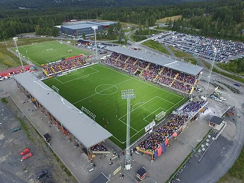 Jämtkraft Arena Landmark, Östersund socken24 km SE
-
Hästön Island, Jämtland County22 km W
Sources & licences
Data last updated: · 2 independent sources