- Elevation
- 13 m
- above sea level
- Local time
- UTC+01:00
- Europe/Stockholm · UTC+01:00
- Airports
- KLR Kalmar Airport81 km
- VBY Visby Airport89 km
About Böda socken
Böda socken is a village. Location: Böda, Borgholm Municipality. Elevation: 13 m. The best months to visit are June–August. The nearest airport is Kalmar Airport (81 km). Nearby sights include Björnnabben and Lilla Grundet.
Climate of Böda socken
Best months for sightseeingBest months for sightseeing: June–August.
This month · November
A cold month
Day 7° · Night 2° · Rain 49 mm
- Hottest month
- July (day 21°)
- Coldest month
- February (night -3°)
- Wettest month
- September (51 mm)
- Driest month
- February (25 mm)
Bars: average monthly low and high temperature. Below: precipitation. Monthly averages for 1970–2000 at about 18 km resolution, adjusted for elevation. Highlighted months are mild and relatively dry. Source: WorldClim 2.1 (CC BY 4.0).
Show values as a table
| Month | Jan | Feb | Mar | Apr | May | Jun | Jul | Aug | Sep | Oct | Nov | Dec |
|---|---|---|---|---|---|---|---|---|---|---|---|---|
| Average high (°C) | 2° | 2° | 4° | 8° | 14° | 19° | 21° | 21° | 16° | 12° | 7° | 4° |
| Average low (°C) | -2° | -3° | -2° | 1° | 5° | 10° | 13° | 13° | 9° | 6° | 2° | -1° |
| Precipitation (mm) | 31 | 25 | 27 | 28 | 31 | 43 | 47 | 48 | 51 | 41 | 49 | 42 |
How to get to Böda socken
The nearest airport is Kalmar Airport (KLR), 81 km to the southwest as the crow flies. For international flights: Visby Airport (VBY) (89 km). The nearest large city is Jönköping, 181 km to the west.
Airports
- Kalmar Airport (KLR) Kalmar 81 kmsouthwest
- Visby Airport (VBY) Visby 89 kmnortheast
- Växjö Kronoberg Airport (VXO) Växjö 146 kmwest
Nearby large cities
- Jönköping Population: 112.8K 181 kmwest
- Stockholm Population: 1.5M 235 kmnorth
- Sollentuna Population: 139.6K 244 kmnorth
- Örebro Population: 156K 246 kmnorthwest
- Västerås Population: 127.8K 261 kmnorth
Straight-line distances; road distances are longer. Airport data: OurAirports.
Day trips from Böda socken
Within 100 km: 2 historic and cultural sites, 48 natural sites, 225 lakes, rivers and coasts.
0–25 km3 places
- Lilla Grundet Island 9 kmNE
- Blå Jungfrun Island 16 kmW
- Björnnabben Natural site 9 kmN
25–60 km150 places
- Lindö Island 30 kmW
- Kuggen Island 28 kmNW
- Paslan Island 54 kmSW
- Nötgårdsö Island 37 kmNW
60–100 km122 places
- Gotland Island 94 kmE
- Öland Island 65 kmSW
- Brandholmen Island 94 kmN
- Norra Kalvholmen Island 76 kmSW
Straight-line distances.
Nearby attractions & nature
Everything nearby-
Björnnabben Natural site, Kalmar County8.7 km N
-
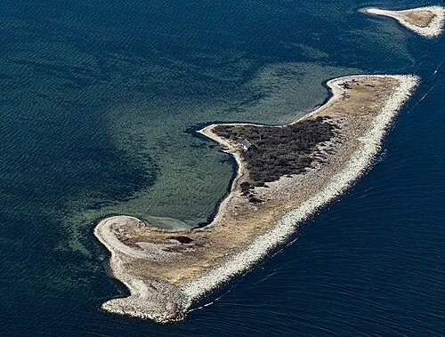 Lilla Grundet Island, Kalmar County9.4 km NE
-
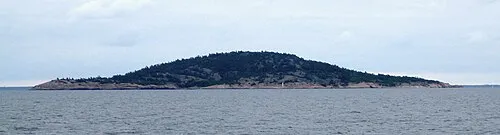 Blå Jungfrun Island, Kalmar County16 km W
Sources & licences
Data last updated: