- Local time
- UTC+01:00
- Europe/Stockholm · UTC+01:00
- Airports
- KLR Kalmar Airport11 km
- RNB Ronneby Airport79 km
About Ytterskär
Ytterskär is an island. Location: Vickleby socken, Resmo-Vickleby. The best months to visit are June–August. The nearest airport is Kalmar Airport (11 km). Nearby sights include Eriksörestrand and Barlastholmen.
Climate of Ytterskär
Best months for sightseeingBest months for sightseeing: June–August.
This month · November
A cold month
Day 6° · Night 1° · Rain 51 mm
- Hottest month
- July (day 22°)
- Coldest month
- February (night -4°)
- Wettest month
- September (54 mm)
- Driest month
- April (29 mm)
Bars: average monthly low and high temperature. Below: precipitation. Monthly averages for 1970–2000 at about 18 km resolution, adjusted for elevation. Highlighted months are mild and relatively dry. Source: WorldClim 2.1 (CC BY 4.0).
Show values as a table
| Month | Jan | Feb | Mar | Apr | May | Jun | Jul | Aug | Sep | Oct | Nov | Dec |
|---|---|---|---|---|---|---|---|---|---|---|---|---|
| Average high (°C) | 1° | 2° | 4° | 9° | 15° | 20° | 22° | 21° | 16° | 11° | 6° | 3° |
| Average low (°C) | -3° | -4° | -2° | 1° | 5° | 10° | 12° | 12° | 8° | 5° | 1° | -1° |
| Precipitation (mm) | 35 | 34 | 31 | 29 | 35 | 44 | 52 | 48 | 54 | 42 | 51 | 45 |
How to get to Ytterskär
The nearest airport is Kalmar Airport (KLR), 11 km to the northwest as the crow flies. The nearest large city is Jönköping, 188 km to the northwest.
Airports
- Kalmar Airport (KLR) Kalmar 11 kmnorthwest
- Ronneby Airport (RNB) Ronneby 79 kmsouthwest
- Växjö Kronoberg Airport (VXO) Växjö 108 kmwest
Nearby large cities
- Jönköping Population: 112.8K 188 kmnorthwest
- Helsingborg Population: 104.2K 237 kmwest
- Malmö Population: 362.1K 238 kmsouthwest
- Copenhagen Population: 1.2M 259 kmwest
- Gothenburg Population: 608.5K 295 kmnorthwest
Straight-line distances; road distances are longer. Airport data: OurAirports.
Day trips from Ytterskär
Within 100 km: 3 historic and cultural sites, 30 natural sites, 199 lakes, rivers and coasts.
0–25 km37 places
- Öland Island 22 kmNE
- Buskakibbö Island 19 kmSW
- Enudden Natural site 16 kmSW
- Nordmansskär Island 12 kmNE
25–60 km63 places
- Kungsholmen Island 57 kmN
- Yttre Gundleholmen Island 53 kmN
- Lökeholm Island 55 kmN
- Pinneholmen Island 57 kmN
60–100 km132 places
- Lilla Almö Island 100 kmW
- Norrön Island 96 kmNW
- Kättelsö Island 81 kmN
- Hulta Fågelö Island 63 kmN
Straight-line distances.
Nearest towns and villages
-
 Karlevi Village, Mörbylånga Municipality4.7 km E
-
Vickleby Village, Mörbylånga Municipality4.9 km SE
-
Kalmar City, Kalmar Municipality7 km N
-
Kalmar domkyrkoförs. Municipality, Kalmar Municipality7.2 km N
-
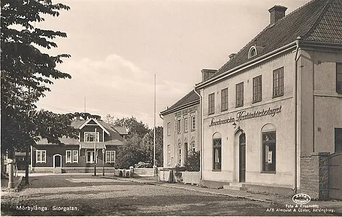 Mörbylånga City, Mörbylånga Municipality8.5 km S
-
Kalmar S:t Johannes Municipality, Kalmar Municipality7.9 km NW
Nearby attractions & nature
Everything nearby-
Eriksörestrand Beach, Kalmar County3.1 km NE
-
Barlastholmen Island, Kalmar County5.6 km N
-
Kallingen Island, Kalmar County6.8 km W
-
Ramsö Island, Kalmar County8.5 km NW
-
Aspö Natural site, Kalmar County8.5 km NW
-
Hästaskär Island, Kalmar County8.6 km W
-
Ljungby Island, Kalmar County8.6 km W
-
Ljungby Hästaskär Island, Kalmar County8.6 km W
Sources & licences
Data last updated: · 2 independent sources