- Population
- 15,785
- 15.8K
- Elevation
- 142 m
- above sea level
- Local time
- UTC+01:00
- Europe/Stockholm · UTC+01:00
- Airports
- VXO Växjö Kronoberg Airport49 km
- HAD Halmstad Airport70 km
About Ljungby
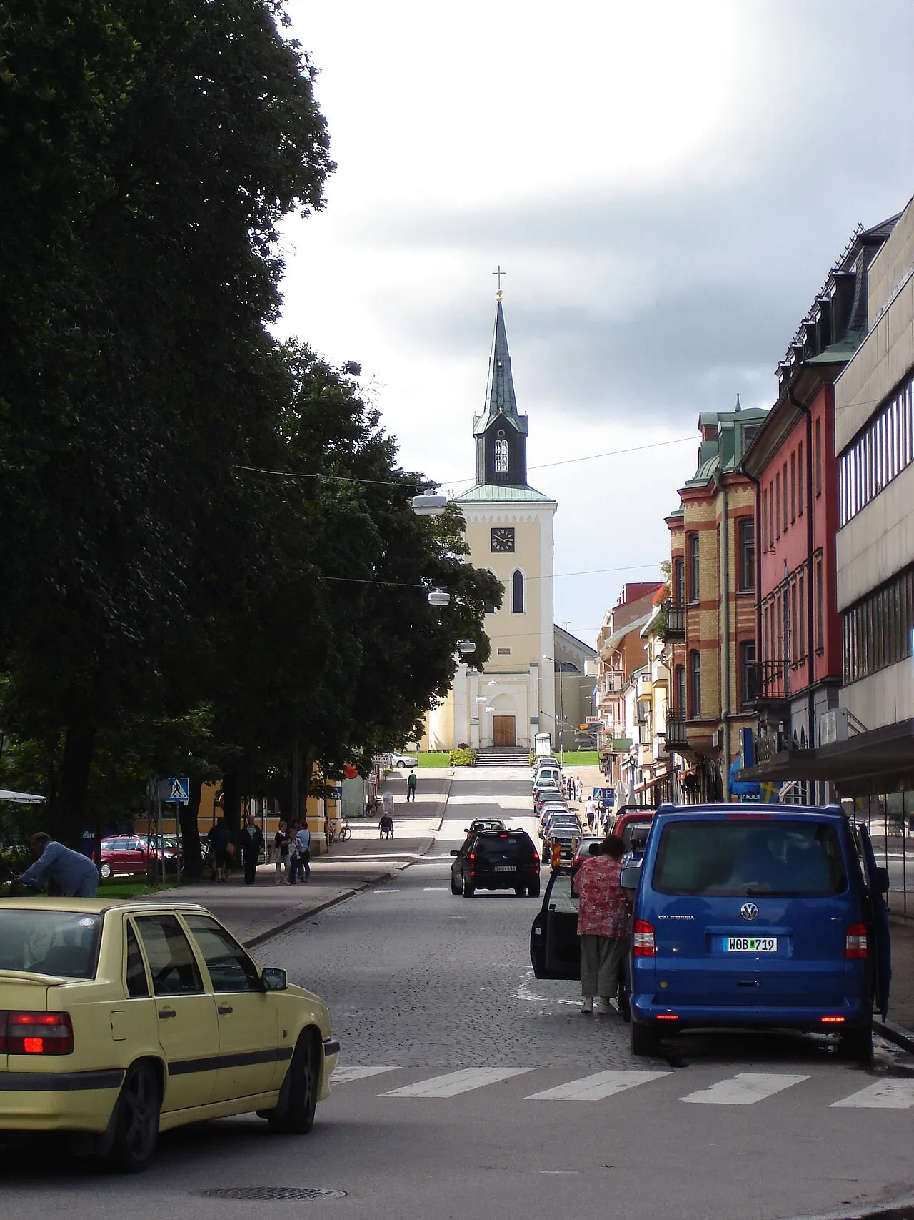
Ljungby is a city. Location: Ljungby Municipality, Kronoberg County. Population: 15,785. Elevation: 142 m.
Ljungby (Swedish: [ˈjɵ̂ŋːbʏ] ) is the central locality of Ljungby Municipality, Kronoberg County, Sweden, with 15,785 inhabitants in 2015. Ljungby was instituted in 1829 as a köping, or market town, and did not become a municipality of its own when the first local government acts took effect in 1863, but retained part of the surrounding rural municipality of the same name. In 1936 Ljungby got the title stad, Swedish for Town or City. Since 1971 Ljungby is the seat of Ljungby Municipality.
Source: Wikipedia · CC BY-SA 4.0
Photos of Ljungby
-

Christoffer Rydström · CC BY-SA 4.0 -

Christoffer Rydström · CC BY-SA 4.0 -

Christoffre · CC BY-SA 3.0


Travel notes for Ljungby
From Wikivoyage
Ljungby is a town in southern Sweden that lies by the river Lagan. It is in the historical region Finnveden, one of the "small countries" which make up today's Småland. After a fire destroyed much of the town centre in 1953, the centre was rebuilt with buildings and a piazza in the modern International Style.
Understand+
Ljungby was first mentioned in 1301 as "iuxta Liongby", but it did not grew into a town until the mid-1800s. It is the second largest city in Kronoberg County, after Växjö. As of 2017 the town has about 16 000 inhabitants, with a total of 28 400 in the municipality.
Tourist office:
1 Ljungby Tourist Center (Ljungby Turistbyrå), Stora torget 6, ☏ +46 372-78 92 20, turistbyran@ljungby.se. Mon-Tue 10:00—13:00 and 14:00—16:30; Wed closed; Thu 10:00—13:00 and 14:00—18:00; Fri 12:00—16:30.
Get in+
By car:
Several car routes intersect at Ljungby. The E4 highway connects to Helsingborg and Stockholm in the south, continuing north to Tornio. Route 25 connects to Halmstad in west and Växjö, continuing to Kalmar, in east. An alternative to the E4 is the scenic route Riksettan that pass through Ljungby.
By bus:
1 Ljungby bus terminal. Operated by Länstrafiken Kronoberg and Flixbus (updated Sep 2018)
By bicycle:
Banvallsleden. A 250-km long-distance cycling route that pass through central Ljungby and connects with Halmstad in the west and Karlshamn in the southeast. (updated Sep 2018)
Sverigeleden (29). This route connects Gothenburg with Blädinge and pass through Lagan about 10 km north of Ljungby. Lagan and Ljungby are connected with a bicycle path that takes you straight from Sverigeleden to central Ljungby. (updated Sep 2018)
By train:
2 Alvesta Station is in Alvesta, about 40 minutes east of Ljungby, and can be reached by bus or car. There are direct trains from Copenhagen and Kastrup airport in Denmark. Furthermore, there are trains from Malmö, Gothenburg and Stockholm.
3 Halmstad Central Station is in Halmstad, about an hour west of Ljungby and can be reached by bus or car. There are good connections with both Malmö/Copenhagen in the south and Göteborg/Oslo/Stockholm in the northern direction.
By plane:
4 Växjö Småland Airport (VXO IATA) (outside Växjö, about 40 minutes by car). Airport buses connect the airport with Växjö. Operated by SAS, Fly Smaland and Ryanair and has flights from Stockholm, Kalmar, Visby, Weeze, Berlin and Kaunas in Lithuania.
5 Feringe airfield (ICAO: ESMG). Private airfield 15 km outside Ljungby, without regular passenger traffic. (updated Sep 2018)
The nearest major international airports are Copenhagen Airport, Malmö Airport, Göteborg Airport and Stockholm Arlanda Airport.
Source: Wikivoyage · CC BY-SA 4.0 · abridged
Population of Ljungby over time
| 1960 | 8,750 | |
|---|---|---|
| 1965 | 10,727 | |
| 1970 | 12,596 | |
| 2015 | 15,785 | |
| 2016 | 15,868 | |
| 2017 | 16,037 | |
| 2018 | 16,181 | |
| 2019 | 16,094 | |
| 2020 | 16,098 | |
| 2023 | 16,076 |
Censuses and official estimates; source: Wikidata.
Climate of Ljungby
Best months for sightseeingBest months for sightseeing: June–August.
This month · November
A cold month
Day 5° · Night 0° · Rain 76 mm
- Hottest month
- July (day 21°)
- Coldest month
- February (night -5°)
- Wettest month
- September (84 mm)
- Driest month
- April (44 mm)
Bars: average monthly low and high temperature. Below: precipitation. Monthly averages for 1970–2000 at about 18 km resolution, adjusted for elevation. Highlighted months are mild and relatively dry. Source: WorldClim 2.1 (CC BY 4.0).
Show values as a table
| Month | Jan | Feb | Mar | Apr | May | Jun | Jul | Aug | Sep | Oct | Nov | Dec |
|---|---|---|---|---|---|---|---|---|---|---|---|---|
| Average high (°C) | 0° | 1° | 4° | 10° | 17° | 20° | 21° | 20° | 15° | 10° | 5° | 2° |
| Average low (°C) | -5° | -5° | -3° | 0° | 5° | 8° | 11° | 10° | 7° | 3° | 0° | -3° |
| Precipitation (mm) | 66 | 45 | 53 | 44 | 51 | 69 | 79 | 72 | 84 | 74 | 76 | 75 |
How to get to Ljungby
The nearest airport is Växjö Kronoberg Airport (VXO), 49 km to the east as the crow flies. The nearest large city is Jönköping, 106 km to the north.
Airports
- Växjö Kronoberg Airport (VXO) Växjö 49 kmeast
- Halmstad Airport (HAD) Halmstad 70 kmwest
- Ängelholm-Helsingborg Airport (AGH) Ängelholm 90 kmsouthwest
Nearby large cities
- Jönköping Population: 112.8K 106 kmnorth
- Helsingborg Population: 104.2K 117 kmsouthwest
- Malmö Population: 362.1K 149 kmsouthwest
- Gothenburg Population: 608.5K 154 kmnorthwest
- Copenhagen Population: 1.2M 154 kmsouthwest
Straight-line distances; road distances are longer. Airport data: OurAirports.
Day trips from Ljungby
Within 100 km: 1 historic or cultural site, 19 natural sites, 51 lakes, rivers and coasts.
0–25 km8 places
- Danö Island 24 kmN
- Lång Island 25 kmSE
- Lövö Island 18 kmNW
- Linnerö Island 14 kmW
25–60 km16 places
- Harö Island 57 kmSE
- Risö Island 57 kmSE
- Ramsö Island 55 kmE
- Lindö Island 58 kmNE
60–100 km47 places
- Enskär Island 96 kmSE
- Enön Island 84 kmS
- Långarevet Natural site 90 kmW
- Agerörsmalen Natural site 94 kmW
Straight-line distances.
Nearby attractions & nature
Everything nearby-
Lagadalen Natural site, Kronoberg County9.9 km S
-
Linnerö Island, Kronoberg County14 km W
-
Askenäset Natural site, Sweden22 km N
-
Danö Island, Jönköping County24 km N
-
Björkö Island, Kronoberg County18 km W
-
Lövö Island, Kronoberg County18 km NW
-
Lång Island, Kronoberg County25 km SE
-
Färjansö Island, Sweden25 km N
Sources & licences
Data last updated: · 2 independent sources