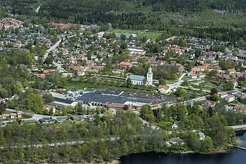
Älmeboda
Located in Tingsryd Municipality, Kronoberg County Coordinates: 56°33′21″ N 15°15′46″ E
- Population
- 919
- 919
- Elevation
- 166 m
- above sea level
- Local time
- UTC+01:00
- Europe/Stockholm · UTC+01:00
- Places inside
- 1
- listed under Älmeboda
- Airports
- RNB Ronneby Airport32 km
- VXO Växjö Kronoberg Airport53 km
About Älmeboda
Älmeboda is a municipality. Location: Tingsryd Municipality, Kronoberg County. Population: 919. Elevation: 166 m. The best months to visit are June–August. The nearest airport is Ronneby Airport (32 km).
Climate of Älmeboda
Best months for sightseeingBest months for sightseeing: June–August.
This month · November
A cold month
Day 5° · Night 0° · Rain 67 mm
- Hottest month
- July (day 21°)
- Coldest month
- February (night -5°)
- Wettest month
- July (70 mm)
- Driest month
- February (41 mm)
Bars: average monthly low and high temperature. Below: precipitation. Monthly averages for 1970–2000 at about 18 km resolution, adjusted for elevation. Highlighted months are mild and relatively dry. Source: WorldClim 2.1 (CC BY 4.0).
Show values as a table
| Month | Jan | Feb | Mar | Apr | May | Jun | Jul | Aug | Sep | Oct | Nov | Dec |
|---|---|---|---|---|---|---|---|---|---|---|---|---|
| Average high (°C) | 1° | 1° | 4° | 10° | 16° | 19° | 21° | 20° | 15° | 10° | 5° | 2° |
| Average low (°C) | -4° | -5° | -3° | 0° | 4° | 8° | 10° | 10° | 7° | 3° | 0° | -3° |
| Precipitation (mm) | 52 | 41 | 47 | 41 | 48 | 60 | 70 | 58 | 68 | 63 | 67 | 64 |
How to get to Älmeboda
The nearest airport is Ronneby Airport (RNB), 32 km to the south as the crow flies. The nearest large city is Jönköping, 152 km to the northwest.
Airports
- Ronneby Airport (RNB) Ronneby 32 kmsouth
- Växjö Kronoberg Airport (VXO) Växjö 53 kmnorthwest
- Kalmar Airport (KLR) Kalmar 65 kmeast
Nearby large cities
- Jönköping Population: 112.8K 152 kmnorthwest
- Helsingborg Population: 104.2K 169 kmwest
- Malmö Population: 362.1K 176 kmsouthwest
- Copenhagen Population: 1.2M 194 kmsouthwest
- Gothenburg Population: 608.5K 237 kmnorthwest
Straight-line distances; road distances are longer. Airport data: OurAirports.
Day trips from Älmeboda
Within 100 km: 3 historic and cultural sites, 35 natural sites, 208 lakes, rivers and coasts.
0–25 km1 place
- Hyllesbolsö Island 21 kmW
25–60 km120 places
- Tjurkö Island 54 kmSE
- Korsör Island 57 kmE
- Ramsholmen Island 52 kmSE
- Enskär Island 50 kmSW
60–100 km125 places
- Öland Island 87 kmE
- Nordmannen Island 76 kmE
- Hästören Island 72 kmE
- Ljungby Island 61 kmE
Straight-line distances.
Places in Älmeboda
1 placeCities & villages1
- Älmeboda socken · Village
Other cities and towns in Tingsryd Municipality
-
Tingsås Municipality, Tingsryd Municipality17 km W
-
Väckelsång Municipality, Tingsryd Municipality21 km W
-
 Tingsryd City, Tingsryd Municipality18 km W
-
Urshult Municipality, Tingsryd Municipality28 km W
-
Almundsryd Municipality, Tingsryd Municipality36 km W
Sources & licences
Data last updated: