Salvotjåkko
Located in Gällivare Municipality, Norrbotten County Coordinates: 67°26′00″ N 19°55′00″ E
- Elevation
- 648 m
- above sea level
- Local time
- UTC+01:00
- Europe/Stockholm · UTC+01:00
- Airports
- KRN Kiruna Airport47 km
- GEV Gällivare Airport51 km
About Salvotjåkko
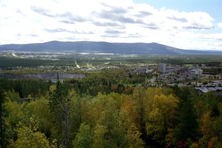
Salvotjåkko is a mountain. Location: Gällivare Municipality, Norrbotten County. Elevation: 648 m. The best months to visit are July. The nearest airport is Kiruna Airport (47 km). Nearby sights include Pannetjåkko and Tuolpatjåkko.
Climate of Salvotjåkko
Best months for sightseeingBest months for sightseeing: July.
This month · November
A cold month
Day -5° · Night -14° · Rain 40 mm
- Hottest month
- July (day 17°)
- Coldest month
- January (night -20°)
- Wettest month
- July (96 mm)
- Driest month
- February (26 mm)
Bars: average monthly low and high temperature. Below: precipitation. Monthly averages for 1970–2000 at about 18 km resolution, adjusted for elevation. Highlighted months are mild and relatively dry. Source: WorldClim 2.1 (CC BY 4.0).
Show values as a table
| Month | Jan | Feb | Mar | Apr | May | Jun | Jul | Aug | Sep | Oct | Nov | Dec |
|---|---|---|---|---|---|---|---|---|---|---|---|---|
| Average high (°C) | -9° | -9° | -4° | 1° | 8° | 14° | 17° | 14° | 9° | 1° | -5° | -8° |
| Average low (°C) | -20° | -19° | -15° | -9° | -2° | 4° | 7° | 5° | 0° | -6° | -14° | -18° |
| Precipitation (mm) | 32 | 26 | 28 | 28 | 40 | 57 | 96 | 70 | 47 | 44 | 40 | 33 |
Other places to visit in this season: July
How to get to Salvotjåkko
The nearest airport is Kiruna Airport (KRN), 47 km to the north as the crow flies.
Airports
- Kiruna Airport (KRN) Kiruna 47 kmnorth
- Gällivare Airport (GEV) Gällivare 51 kmsoutheast
- Harstad/Narvik Airport (EVE) Evenes 180 kmnorthwest
Straight-line distances; road distances are longer. Airport data: OurAirports.
Day trips from Salvotjåkko
Within 100 km: 152 natural sites, 17 lakes, rivers and coasts.
0–25 km17 places
- Hukkasaari Island 18 kmNE
- Heikamasaari Island 15 kmNE
- Aravuopionsuunsaari Island 13 kmN
- Keble Mountain 22 kmSE
25–60 km57 places
- Ripakansaari Island 41 kmN
- Petsesuolo Island 40 kmSW
- Mokkokansaari Island 41 kmN
- Kulkusaari Island 37 kmN
60–100 km95 places
- Passåive Mountain 78 kmW
- Palosaari Island 100 kmE
- Ilansonsaari Island 61 kmN
- Aksusaari Island 94 kmSE
Straight-line distances.
Nearest towns and villages
-
 Malmberget Town, Gällivare Municipality43 km SE
-
Gällivare Municipality, Gällivare Municipality46 km SE
-
Malmberget Municipality, Gällivare Municipality43 km SE
-
Gällivare socken Village, Gällivare17 km SE
-
Gällivare City, Gällivare Municipality46 km SE
-
Kiruna City, Kiruna Municipality49 km N
Nearby attractions & nature
Everything nearby-
Pannetjåkko Mountain, Gällivare Municipality14 km SW
-
Tuolpatjåkko Mountain, Gällivare Municipality15 km SW
-
Kuosasj Mountain, Gällivare Municipality16 km SW
-
Juovutjåkko Mountain, Gällivare Municipality16 km SW
-
Tjårrok Mountain, Gällivare Municipality17 km SW
-
Kuorats Mountain, Gällivare Municipality17 km SW
-
Juolatjåkko Mountain, Gällivare Municipality18 km SW
-
Åskosatjåkko Mountain, Gällivare Municipality18 km SW
Sources & licences
Data last updated: · 2 independent sources