Svärtinge
Located in Norrköping Municipality, Östergötland County Coordinates: 58°39′18″ N 16°01′42″ E
- Population
- 3,326
- 3.3K
- Elevation
- 92 m
- above sea level
- Local time
- UTC+01:00
- Europe/Stockholm · UTC+01:00
- Airports
- NRK Norrköping Airport15 km
- LPI Linköping City Airport34 km
About Svärtinge
Svärtinge is a village. Location: Norrköping Municipality, Östergötland County. Population: 3,326. Elevation: 92 m.
Svärtinge is a locality situated in Norrköping Municipality, Östergötland County, Sweden with 2,963 inhabitants in 2010.
Source: Wikipedia · CC BY-SA 4.0
At a glance
- Area
- 6.1 km²
Source: Wikidata
Population of Svärtinge over time
| 1960 | 768 | |
|---|---|---|
| 1965 | 764 | |
| 1970 | 781 | |
| 2015 | 3,326 | |
| 2016 | 3,419 | |
| 2017 | 3,445 | |
| 2018 | 3,496 | |
| 2019 | 3,547 | |
| 2020 | 4,034 | |
| 2023 | 4,772 |
Censuses and official estimates; source: Wikidata.
Climate of Svärtinge
Best months for sightseeingBest months for sightseeing: June–August.
This month · November
A cold month
Day 4° · Night -1° · Rain 54 mm
- Hottest month
- July (day 22°)
- Coldest month
- February (night -6°)
- Wettest month
- July (71 mm)
- Driest month
- February (31 mm)
Bars: average monthly low and high temperature. Below: precipitation. Monthly averages for 1970–2000 at about 18 km resolution, adjusted for elevation. Highlighted months are mild and relatively dry. Source: WorldClim 2.1 (CC BY 4.0).
Show values as a table
| Month | Jan | Feb | Mar | Apr | May | Jun | Jul | Aug | Sep | Oct | Nov | Dec |
|---|---|---|---|---|---|---|---|---|---|---|---|---|
| Average high (°C) | 0° | 0° | 4° | 9° | 16° | 20° | 22° | 21° | 15° | 10° | 4° | 1° |
| Average low (°C) | -5° | -6° | -4° | -1° | 4° | 9° | 11° | 10° | 6° | 3° | -1° | -4° |
| Precipitation (mm) | 40 | 31 | 33 | 37 | 35 | 58 | 71 | 59 | 64 | 51 | 54 | 52 |
How to get to Svärtinge
The nearest airport is Norrköping Airport (NRK), 15 km to the southeast as the crow flies. For international flights: Linköping City Airport (LPI) (34 km). The nearest large city is Örebro, 84 km to the northwest.
Airports
- Norrköping Airport (NRK) Norrköping 15 kmsoutheast
- Linköping City Airport (LPI) Linköping 34 kmsouthwest
- Stockholm Skavsta Airport (NYO) Nyköping 53 kmeast
Nearby large cities
- Örebro Population: 156K 84 kmnorthwest
- Västerås Population: 127.8K 111 kmnorth
- Stockholm Population: 1.5M 139 kmnortheast
- Sollentuna Population: 139.6K 140 kmnortheast
- Jönköping Population: 112.8K 147 kmsouthwest
Straight-line distances; road distances are longer. Airport data: OurAirports.
Day trips from Svärtinge
Within 100 km: 7 historic and cultural sites, 28 natural sites, 177 lakes, rivers and coasts.
0–25 km5 places
- Granholmen Island 6 kmS
- Esterön Island 18 kmE
- Östgötateatern Attraction 11 kmSE
- Borgs kyrka Attraction 10 kmSE
25–60 km42 places
- Hargö Island 50 kmE
- Mögö Island 49 kmE
- Måsön Island 48 kmNE
- Gränsö Island 54 kmE
60–100 km165 places
- Arpsund Island 62 kmSE
- Hersö Island 90 kmS
- Ängsholmen Island 90 kmS
- Hånö Island 71 kmNE
Straight-line distances.
Nearby attractions & nature
Everything nearby-
Granholmen Island, Östergötland County6.1 km S
-
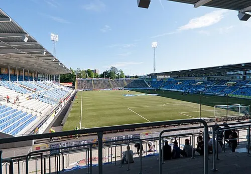 Idrottsparken Landmark, Norrköping socken12 km SE
-
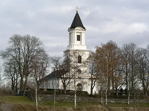 Borgs kyrka Attraction, Norrköping socken9.9 km SE
-
Östgötateatern Attraction, Norrköping socken11 km SE
-
Esterön Island, Östergötland County18 km E
Sources & licences
Data last updated: · 2 independent sources