Östra Ed
Located in Valdemarsviks Kommun, Östergötland County Coordinates: 58°01′59″ N 16°40′00″ E
- Population
- 202
- 202
- Local time
- UTC+01:00
- Europe/Stockholm · UTC+01:00
- Airports
- NRK Norrköping Airport66 km
- LPI Linköping City Airport71 km
About Östra Ed
Östra Ed is a municipality. Location: Valdemarsviks Kommun, Östergötland County. Population: 202. The best months to visit are June–August. The nearest airport is Norrköping Airport (66 km). Nearby sights include Lilla Kalvö and Kolmosö.
Climate of Östra Ed
Best months for sightseeingBest months for sightseeing: June–August.
This month · November
A cold month
Day 5° · Night 1° · Rain 52 mm
- Hottest month
- July (day 22°)
- Coldest month
- February (night -5°)
- Wettest month
- July (67 mm)
- Driest month
- May (32 mm)
Bars: average monthly low and high temperature. Below: precipitation. Monthly averages for 1970–2000 at about 18 km resolution, adjusted for elevation. Highlighted months are mild and relatively dry. Source: WorldClim 2.1 (CC BY 4.0).
Show values as a table
| Month | Jan | Feb | Mar | Apr | May | Jun | Jul | Aug | Sep | Oct | Nov | Dec |
|---|---|---|---|---|---|---|---|---|---|---|---|---|
| Average high (°C) | 1° | 1° | 4° | 9° | 15° | 19° | 22° | 21° | 16° | 11° | 5° | 2° |
| Average low (°C) | -4° | -5° | -2° | 0° | 5° | 10° | 12° | 12° | 8° | 5° | 1° | -3° |
| Precipitation (mm) | 44 | 34 | 36 | 37 | 32 | 53 | 67 | 55 | 63 | 49 | 52 | 57 |
How to get to Östra Ed
The nearest airport is Norrköping Airport (NRK), 66 km to the north as the crow flies. For international flights: Linköping City Airport (LPI) (71 km). The nearest large city is Jönköping, 151 km to the west.
Airports
- Norrköping Airport (NRK) Norrköping 66 kmnorth
- Linköping City Airport (LPI) Linköping 71 kmnorthwest
- Stockholm Skavsta Airport (NYO) Nyköping 85 kmnorth
Nearby large cities
- Jönköping Population: 112.8K 151 kmwest
- Örebro Population: 156K 162 kmnorthwest
- Stockholm Population: 1.5M 166 kmnortheast
- Sollentuna Population: 139.6K 172 kmnortheast
- Västerås Population: 127.8K 176 kmnorth
Straight-line distances; road distances are longer. Airport data: OurAirports.
Day trips from Östra Ed
Within 100 km: 5 historic and cultural sites, 40 natural sites, 231 lakes, rivers and coasts.
0–25 km69 places
- Hersö Island 15 kmS
- Ängsholmen Island 15 kmS
- Ormö Island 10 kmNE
- Rotsö Island 24 kmS
25–60 km129 places
- Arpsund Island 44 kmNE
- Porsholmen Island 49 kmS
- Lindö Island 37 kmS
- Bockholmen Island 39 kmS
60–100 km78 places
- Granholmen Island 73 kmNW
- Enskär Island 86 kmNE
- Björkskär Island 92 kmNE
- Näset Natural site 94 kmS
Straight-line distances.
Nearby attractions & nature
Everything nearby-
Lilla Kalvö Island, Kalmar County4.7 km SE
-
Kolmosö Natural site, Östergötland County6.5 km SE
-
Ormö Island, Tryserum socken9.5 km NE
-
Bergholmen Island, Kalmar County9.6 km S
-
Tjuvkyrkeberget Mountain, Västervik Municipality9.1 km W
-
Horsö Island, Kalmar County10 km SE
-
Kalven Natural site, Östergötland County12 km N
-
Häfsö Island, Kalmar County11 km SE
Other cities and towns in Valdemarsviks Kommun
-
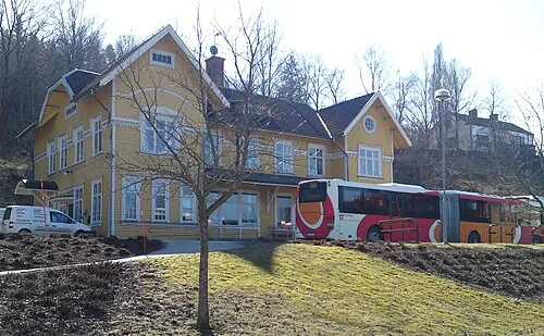 Valdemarsvik City, Valdemarsviks Kommun19 km N
-
Valdemarsvik Municipality, Valdemarsviks Kommun19 km N
-
Gryt Municipality, Valdemarsviks Kommun22 km NE
-
Ringarum Municipality, Valdemarsviks Kommun31 km N
Sources & licences
Data last updated: