Gnesta
Located in Gnesta Municipality, Södermanland County Coordinates: 59°02′51″ N 17°18′43″ E
- Population
- 5,772
- 5.8K
- Elevation
- 19 m
- above sea level
- Local time
- UTC+01:00
- Europe/Stockholm · UTC+01:00
- Airports
- NYO Stockholm Skavsta Airport37 km
- BMA Stockholm-Bromma Airport50 km
About Gnesta
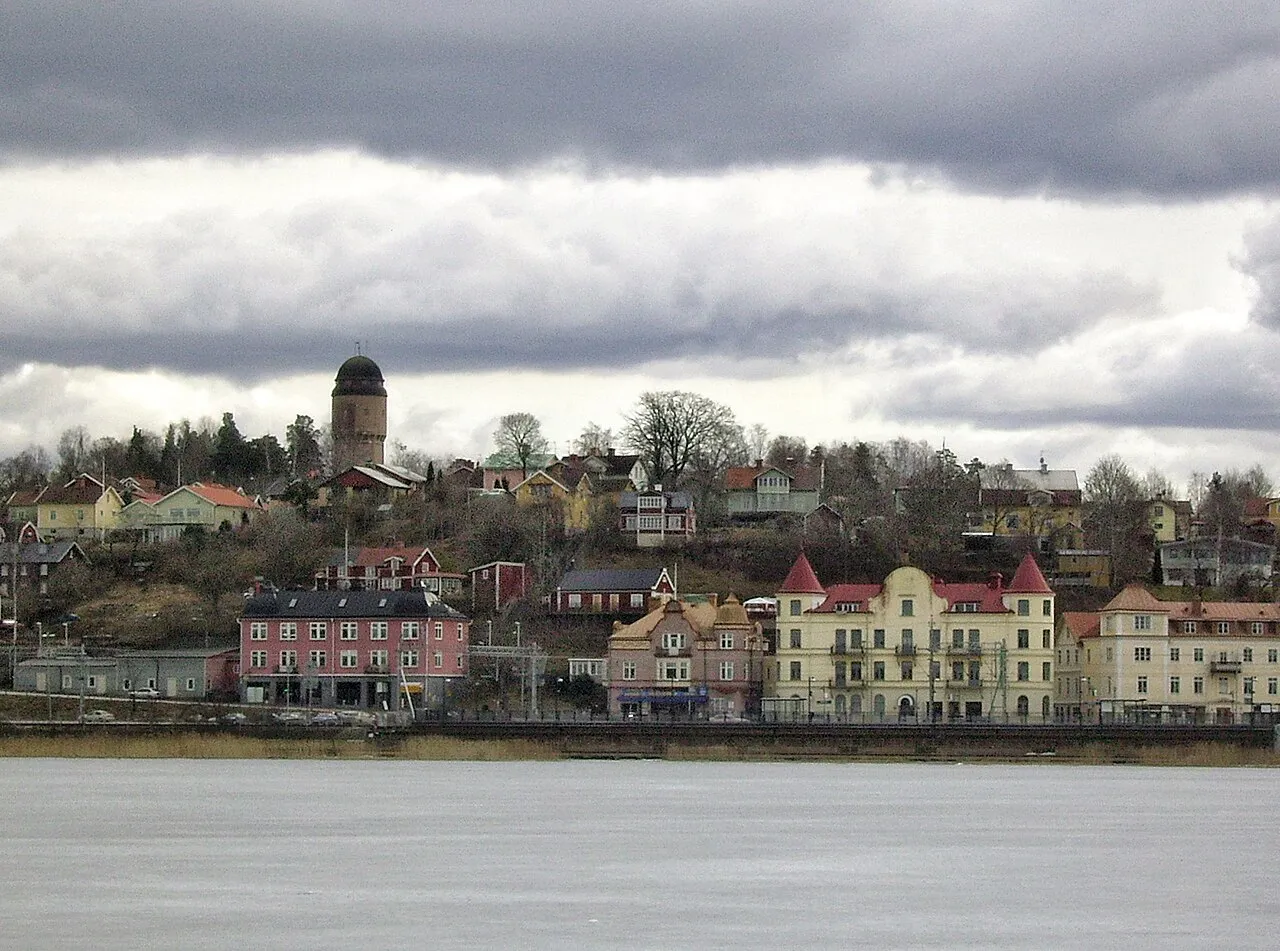
Gnesta is a city. Location: Gnesta Municipality, Södermanland County. Population: 5,772. Elevation: 19 m.
Gnesta (Swedish pronunciation: [ˈgněːsta]) is a bimunicipal locality and the seat of Gnesta Municipality, Södermanland County, Sweden. The population was 6,376 as of 2020. Gnesta is in Södermanland, on the border with Stockholm County. The Stockholm commuter rail has a terminus in Gnesta. The 2009 film adaptation of Stieg Larsson's book The Girl with the Dragon Tattoo was shot in Gnesta, which represented the fictional Hedestad and Hedeby Island.
Source: Wikipedia · CC BY-SA 4.0
At a glance
- Area
- 4.2 km²
Source: Wikidata
Photos of Gnesta
-

Unknown author Unknown author · Public domain -

Forza1000 · CC BY-SA 4.0 -

Mikael Knut Nilsson · CC BY-SA 4.0 -

Mikael Knut Nilsson · CC BY-SA 4.0 -

AleWi · CC BY-SA 4.0


Travel notes for Gnesta
From Wikivoyage
Gnesta is a town in Södermanland in Sweden. The town itself has around 5,500 inhabitants; half the population of the municipality, Gnesta kommun.
Understand+
Gnesta was built at the main rail line between Stockholm and Gothenburg. Nowadays, much of the population commutes to Stockholm or nearby Södertälje.
Gnesta's cityscape is strongly influenced by the railway and the station community that emerged at the end of the 19th century. There are significant buildings from all of Gnesta's eras. This includes the railway station (1907), Gnesta brewery (1903) and the so-called soap factory (1950), designed by Ralph Erskine .
Some scenes of the Swedish film The Girl With the Dragon Tattoo were filmed in Gnesta.
Get in+
Gnesta is connected to Stockholm via Södertälje with the Stockholm commuter train (SL). Regional trains between Stockholm and Hallsberg (the so-called Sörmlandspilen) stop in Gnesta. Adjacent to the railway is also the town's bus station, from where Länstrafiken operates, e.g. from Nyköping, Flen, Strängnäs and Eskilstuna (on some tours with changes).
Major roads in connection with Gnesta are national highway 57 which connects to E4 to the east and ends in Katrineholm to the west. County road 224 runs in a southern direction and connects to the E4 at Lästringe.
The nearest airport is Skavsta in Nyköping. It is also possible to take the commuter train via Stockholm to Arlanda Airport.
Source: Wikivoyage · CC BY-SA 4.0 · abridged
Population of Gnesta over time
| 1960 | 2,269 | |
|---|---|---|
| 1965 | 2,494 | |
| 1970 | 2,908 | |
| 2010 | 5,562 | |
| 2015 | 5,772 | |
| 2016 | 5,834 | |
| 2017 | 6,016 | |
| 2018 | 6,248 | |
| 2019 | 6,385 | |
| 2020 | 6,376 | |
| 2023 | 6,472 |
Censuses and official estimates; source: Wikidata.
Climate of Gnesta
Best months for sightseeingBest months for sightseeing: June–August.
This month · November
A cold month
Day 5° · Night 0° · Rain 58 mm
- Hottest month
- July (day 21°)
- Coldest month
- February (night -6°)
- Wettest month
- July (71 mm)
- Driest month
- February (29 mm)
Bars: average monthly low and high temperature. Below: precipitation. Monthly averages for 1970–2000 at about 18 km resolution, adjusted for elevation. Highlighted months are mild and relatively dry. Source: WorldClim 2.1 (CC BY 4.0).
Show values as a table
| Month | Jan | Feb | Mar | Apr | May | Jun | Jul | Aug | Sep | Oct | Nov | Dec |
|---|---|---|---|---|---|---|---|---|---|---|---|---|
| Average high (°C) | 0° | 0° | 4° | 9° | 15° | 19° | 21° | 20° | 15° | 10° | 5° | 2° |
| Average low (°C) | -5° | -6° | -3° | 0° | 5° | 10° | 13° | 12° | 8° | 4° | 0° | -4° |
| Precipitation (mm) | 41 | 29 | 34 | 34 | 35 | 55 | 71 | 58 | 63 | 54 | 58 | 52 |
How to get to Gnesta
The nearest airport is Stockholm Skavsta Airport (NYO), 37 km to the southwest as the crow flies. The nearest large city is Stockholm, 53 km to the northeast.
Airports
- Stockholm Skavsta Airport (NYO) Nyköping 37 kmsouthwest
- Stockholm-Bromma Airport (BMA) Stockholm 50 kmnortheast
- Stockholm Västerås Airport (VST) Stockholm / Västerås 72 kmnorthwest
Nearby large cities
- Stockholm Population: 1.5M 53 kmnortheast
- Sollentuna Population: 139.6K 56 kmnortheast
- Västerås Population: 127.8K 77 kmnorthwest
- Örebro Population: 156K 123 kmwest
- Jönköping Population: 112.8K 232 kmsouthwest
Straight-line distances; road distances are longer. Airport data: OurAirports.
Day trips from Gnesta
Within 100 km: 41 historic and cultural sites, 63 natural sites, 839 lakes, rivers and coasts.
0–25 km16 places
- Hånö Island 15 kmW
- Granholm Island 25 kmN
- Hasselön Island 25 kmW
- Korpön Island 11 kmNE
25–60 km299 places
- Granskär Island 47 kmN
- Gubbholmen Island 50 kmE
- Oxholmen Island 50 kmE
- Högholmen Island 60 kmE
60–100 km628 places
- Rindö Island 73 kmNE
- Runmarö Island 87 kmE
- Galtholmen Island 87 kmNE
- Ostkanten Island 91 kmNE
Straight-line distances.
Nearby attractions & nature
Everything nearby-
Korpön Island, Stockholm County11 km NE
-
Hånö Island, Södermanland County15 km W
-
Marön Island, Södermanland County13 km SW
-
Yngsön Island, Stockholm County14 km N
-
Mörkön Island, Södertälje Municipality22 km E
-
Ledarön Island, Södertälje Municipality19 km E
-
Älgön Island, Södermanland County21 km W
-
Fridö Island, Hölö socken21 km SE
Sources & licences
Data last updated: · 2 independent sources