Oxelösund
Located in Oxelösund Municipality, Södermanland County Coordinates: 58°40′14″ N 17°06′05″ E
- Population
- 11,157
- 11.2K
- Elevation
- 11 m
- above sea level
- Local time
- UTC+01:00
- Europe/Stockholm · UTC+01:00
- Airports
- NYO Stockholm Skavsta Airport17 km
- NRK Norrköping Airport50 km
About Oxelösund
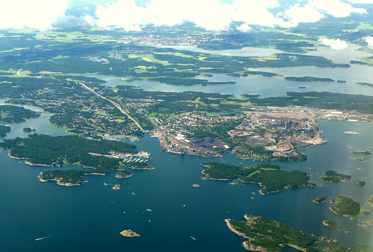
Oxelösund is a city. Location: Oxelösund Municipality, Södermanland County. Population: 11,157. Elevation: 11 m.
Oxelösund is a locality and the seat of Oxelösund Municipality in Södermanland County, Sweden with 11,488 inhabitants in 2018. It is located less than 15 kilometres (9.3 mi) south from the city centre of its larger neighbour, Nyköping, with the two urban areas forming a wider agglomeration of nearly 50,000 people.
Source: Wikipedia · CC BY-SA 4.0
At a glance
- Area
- 12.3 km²
Source: Wikidata
Photos of Oxelösund
-

United Kingdom Hydrographic Office · Public domain -

Esby · CC BY-SA 3.0 -

Bene Riobó · CC BY-SA 4.0 -

bengt-re from Sweden · CC BY 2.0 -

Tulipasylvestris · CC0


Travel notes for Oxelösund
From Wikivoyage
Oxelösund is a town in Södermanland, at Sweden's coast to the Baltic Sea. Here there is, among other things, a church that looks like a lighthouse, a secret underground fort from the days of the Cold War, a sculpture park on the theme of faith and old archipelago settlements dating back to the 17th century. It is a rather young city, with 11,000 inhabitants, built around the port and the steel mill, in the vicinity of Nyköping.
Understand+
Oxelösund has a fairly short history. While its natural harbor has been used for at least 500 years, the settlement was founded in 1900. When it became necessary to build a railroad to transport products from mining and smelting region of Bergslagen in central Sweden directly to the Baltic Sea, the choice fell on Oxelösund.
Industrial Group Traffic AB Grängesberg-Oxelösund (TGO; best known as Granges) formed in 1873 the railway company OFWJ (Oxelösund Flen-Västmanlands Railway), later TGOJ (Traffic Grängesberg-Oxelösunds railways). The company bought almost the entire Oxelösund Peninsula, which then belonged to the estates of the Stjärnholm Castle, to be able to build the facilities they needed. The existing of Oxelösund was at this time entirely insignificant - it had grown up thanks to the port, railway and steelworks which was added somewhat later (1913).
At the beginning of the 1950s Oxelösund was a typical Swedish town with wooden houses and lush gardens. As one of the last communities in Sweden Oxelösund became city in 1950. The local population then totalled 5200 people. The business community was strongly influenced by the industry, and the largest employer was the iron works with about 700 workers.
A milestone in the resort development became Granges Group's decision in 1955 to buy a majority share in Oxelösund Ironworks AB (SSAB Oxelösund today).
Old Oxelösund was removed to make space for the new steelworks but there are still a few houses left offering the glimpse of 1920s. A brand new center was built as was a highway from Nyköping into the city (Highway 53). In 1957 the characteristic St. Botvids Church was inaugurated. Overall, Oxelösund today is dominated by the 20th-century transformation of the port, ironworks and a homogeneous 1950s buildings.
In 1962 a coastal artillery battery was built on the Femöre peninsula to defend the important harbor.
Get in+
By plane:
The nearest airport is Nyköping Skavsta Airport about 20 km from Oxelösund. From the airport there are buses to Oxelösund. Stockholm-Arlanda Airport, Sweden's main international airport, is 150 km north of Oxelösund.
By bus:
Sörmlandstrafiken operates the route Nyköping-Oxelösund. It is possible to take line 515 from the airport to[Nyköping bus station and change on to 715 to Oxelösund.
You can pay the driver by credit card, but they don't take cash.
By train:
There is no rail scheduled to Oxelösund. At larger events a special antique train is operated on the tack to Oxelösund. It is also possible to charter train through the Association of Sörmlands Veteran Railway (FSVJ - Föreningen Sörmlands Veteranjärnväg).
By car:
15 km from the Nyköping on 2-lane Highway (Route 53) straight out to sea. E4 to Nyköping, Norrköping and Stockholm.
By boat:
In the summertime it is possible to ride a passenger boat between Nyköping and Oxelösund. If you arrive with your own boat, there are two marinas in the vicinity of the central Oxelösund.
By bike:
From Nyköping there are bike paths that take you through Stjärnholm to central Oxelösund and Jogersö.
Source: Wikivoyage · CC BY-SA 4.0 · abridged
Population of Oxelösund over time
| 1960 | 9,376 | |
|---|---|---|
| 1965 | 13,377 | |
| 1970 | 15,085 | |
| 2015 | 11,157 | |
| 2016 | 11,373 | |
| 2017 | 11,455 | |
| 2018 | 11,488 | |
| 2019 | 11,405 | |
| 2020 | 11,420 | |
| 2023 | 11,485 |
Censuses and official estimates; source: Wikidata.
Climate of Oxelösund
Best months for sightseeingBest months for sightseeing: June–August.
This month · November
A cold month
Day 5° · Night 0° · Rain 56 mm
- Hottest month
- July (day 21°)
- Coldest month
- February (night -5°)
- Wettest month
- July (62 mm)
- Driest month
- February (28 mm)
Bars: average monthly low and high temperature. Below: precipitation. Monthly averages for 1970–2000 at about 18 km resolution, adjusted for elevation. Highlighted months are mild and relatively dry. Source: WorldClim 2.1 (CC BY 4.0).
Show values as a table
| Month | Jan | Feb | Mar | Apr | May | Jun | Jul | Aug | Sep | Oct | Nov | Dec |
|---|---|---|---|---|---|---|---|---|---|---|---|---|
| Average high (°C) | 1° | 1° | 4° | 8° | 14° | 19° | 21° | 20° | 15° | 10° | 5° | 2° |
| Average low (°C) | -5° | -5° | -2° | 1° | 6° | 10° | 13° | 12° | 8° | 4° | 0° | -3° |
| Precipitation (mm) | 37 | 28 | 31 | 30 | 32 | 49 | 62 | 57 | 62 | 50 | 56 | 49 |
How to get to Oxelösund
The nearest airport is Stockholm Skavsta Airport (NYO), 17 km to the northwest as the crow flies. The nearest large city is Stockholm, 92 km to the northeast.
Airports
- Stockholm Skavsta Airport (NYO) Nyköping 17 kmnorthwest
- Norrköping Airport (NRK) Norrköping 50 kmwest
- Linköping City Airport (LPI) Linköping 88 kmwest
Nearby large cities
- Stockholm Population: 1.5M 92 kmnortheast
- Sollentuna Population: 139.6K 97 kmnortheast
- Västerås Population: 127.8K 110 kmnorth
- Örebro Population: 156K 128 kmnorthwest
- Jönköping Population: 112.8K 199 kmsouthwest
Straight-line distances; road distances are longer. Airport data: OurAirports.
Day trips from Oxelösund
Within 100 km: 35 historic and cultural sites, 63 natural sites, 491 lakes, rivers and coasts.
0–25 km35 places
- Enskär Island 21 kmE
- Hargö Island 14 kmSW
- Ringsön Island 22 kmNE
- Örskär Island 20 kmE
25–60 km122 places
- Ekskär Island 50 kmNE
- Norrskär Island 48 kmE
- Lilla Klubben Island 50 kmE
- Brännskär Island 48 kmE
60–100 km432 places
- Granskär Island 89 kmN
- Gubbholmen Island 71 kmNE
- Oxholmen Island 65 kmNE
- Högholmen Island 85 kmNE
Straight-line distances.
Nearby attractions & nature
Everything nearby-
Ljungholmen Island, Oxelösund socken1.9 km SE
-
Jogersö Island, Södermanland County2.1 km W
-
Löshuvud Island, Oxelösund socken2.2 km S
-
Ramnö Island, Oxelösund socken2.7 km SW
-
Kolhalsen Natural site, Södermanland County4 km E
-
Fredön Island, Södermanland County7 km W
-
Marsö Island, Södermanland County7.1 km NE
-
Östra Lökholmen Island, Södermanland County9.7 km E
Sources & licences
Data last updated: · 2 independent sources