Stallarholmen
Located in Strängnäs Municipality, Södermanland County Coordinates: 59°22′00″ N 17°12′00″ E
- Population
- 1,671
- 1.7K
- Elevation
- 3 m
- above sea level
- Local time
- UTC+01:00
- Europe/Stockholm · UTC+01:00
- Airports
- VST Stockholm Västerås Airport41 km
- BMA Stockholm-Bromma Airport42 km
About Stallarholmen
Stallarholmen is a village. Location: Strängnäs Municipality, Södermanland County. Population: 1,671. Elevation: 3 m.
Stallarholmen is a locality situated in Strängnäs Municipality, Södermanland County, Sweden, with 1,623 inhabitants in 2010. Stallarholmen, located on Lake Mälaren, is situated partly on the mainland and partly on the island of Selaön, Sweden's largest freshwater island. The island and the mainland are connected via a bridge built in the mid 20th century. The etymology of the name Stallarholmen may be related to stables ("stall") and small islands ("holme").
Source: Wikipedia · CC BY-SA 4.0
At a glance
- Area
- 2.4 km²
Source: Wikidata
Population of Stallarholmen over time
| 1960 | 761 | |
|---|---|---|
| 1965 | 946 | |
| 1970 | 1,098 | |
| 2015 | 1,671 | |
| 2016 | 1,702 | |
| 2017 | 1,720 | |
| 2018 | 1,770 | |
| 2019 | 1,788 | |
| 2020 | 1,864 | |
| 2023 | 2,141 |
Censuses and official estimates; source: Wikidata.
Climate of Stallarholmen
Best months for sightseeingBest months for sightseeing: June–August.
This month · November
A cold month
Day 5° · Night 0° · Rain 49 mm
- Hottest month
- July (day 22°)
- Coldest month
- February (night -6°)
- Wettest month
- July (68 mm)
- Driest month
- February (25 mm)
Bars: average monthly low and high temperature. Below: precipitation. Monthly averages for 1970–2000 at about 18 km resolution, adjusted for elevation. Highlighted months are mild and relatively dry. Source: WorldClim 2.1 (CC BY 4.0).
Show values as a table
| Month | Jan | Feb | Mar | Apr | May | Jun | Jul | Aug | Sep | Oct | Nov | Dec |
|---|---|---|---|---|---|---|---|---|---|---|---|---|
| Average high (°C) | 1° | 0° | 4° | 9° | 16° | 20° | 22° | 21° | 15° | 10° | 5° | 2° |
| Average low (°C) | -5° | -6° | -3° | 0° | 5° | 10° | 12° | 12° | 8° | 4° | 0° | -3° |
| Precipitation (mm) | 34 | 25 | 30 | 35 | 32 | 53 | 68 | 56 | 55 | 48 | 49 | 42 |
How to get to Stallarholmen
The nearest airport is Stockholm Västerås Airport (VST), 41 km to the northwest as the crow flies. The nearest large city is Sollentuna, 43 km to the east.
Airports
- Stockholm Västerås Airport (VST) Stockholm / Västerås 41 kmnorthwest
- Stockholm-Bromma Airport (BMA) Stockholm 42 kmeast
- Stockholm-Arlanda Airport (ARN) Stockholm 52 kmnortheast
Nearby large cities
- Sollentuna Population: 139.6K 43 kmeast
- Västerås Population: 127.8K 46 kmnorthwest
- Stockholm Population: 1.5M 50 kmeast
- Örebro Population: 156K 114 kmwest
- Jönköping Population: 112.8K 250 kmsouthwest
Straight-line distances; road distances are longer. Airport data: OurAirports.
Day trips from Stallarholmen
Within 100 km: 37 historic and cultural sites, 61 natural sites, 890 lakes, rivers and coasts.
0–25 km59 places
- Granskär Island 12 kmN
- Hamnskär Island 13 kmSE
- Hammarskär Island 13 kmNE
- Granholmen Island 13 kmE
25–60 km86 places
- Hånö Island 40 kmS
- Flaten Island 39 kmNW
- Näckholm Island 25 kmNE
- Lillön Island 28 kmE
60–100 km843 places
- Rindö Island 68 kmE
- Runmarö Island 90 kmE
- Husarö Island 95 kmE
- Galtholmen Island 84 kmE
Straight-line distances.
Nearby attractions & nature
Everything nearby-
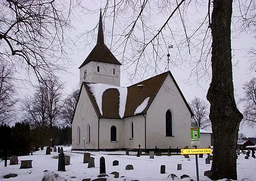 Selaön Island, Södermanland County3.7 km N
-
Björkholm Island, Södermanland County8.3 km SE
-
Lilla Askholmen Island, Södermanland County8.5 km E
-
Köttholmen Island, Södermanland County8.7 km E
-
Långholmen Island, Södermanland County9.4 km SE
-
Götön Island, Södermanland County9.5 km E
Sources & licences
Data last updated: · 2 independent sources