Norrtälje
Located in Norrtälje Municipality, Stockholm County Coordinates: 59°45′29″ N 18°42′18″ E
- Population
- 19,365
- 19.4K
- Elevation
- 13 m
- above sea level
- Local time
- UTC+01:00
- Europe/Stockholm · UTC+01:00
- Airports
- ARN Stockholm-Arlanda Airport45 km
- BMA Stockholm-Bromma Airport62 km
About Norrtälje
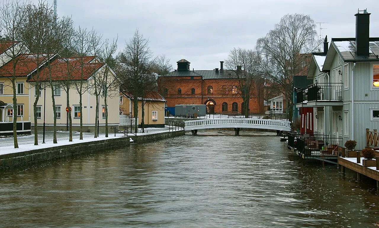
Norrtälje is a city. Location: Norrtälje Municipality, Stockholm County. Population: 19,365. Elevation: 13 m.
Norrtälje is a locality and the seat of Norrtälje Municipality, Stockholm County, Sweden with 22,018 inhabitants in 2020. It is one of the largest towns in Roslagen.
Source: Wikipedia · CC BY-SA 4.0
At a glance
- Area
- 11.3 km²
Source: Wikidata
Photos of Norrtälje
-

Bengt Nyman from Vaxholm, Sweden · CC BY 2.0 -

Bror Jörgen Petersson · CC0 -

Bror Jörgen Petersson · CC0 -
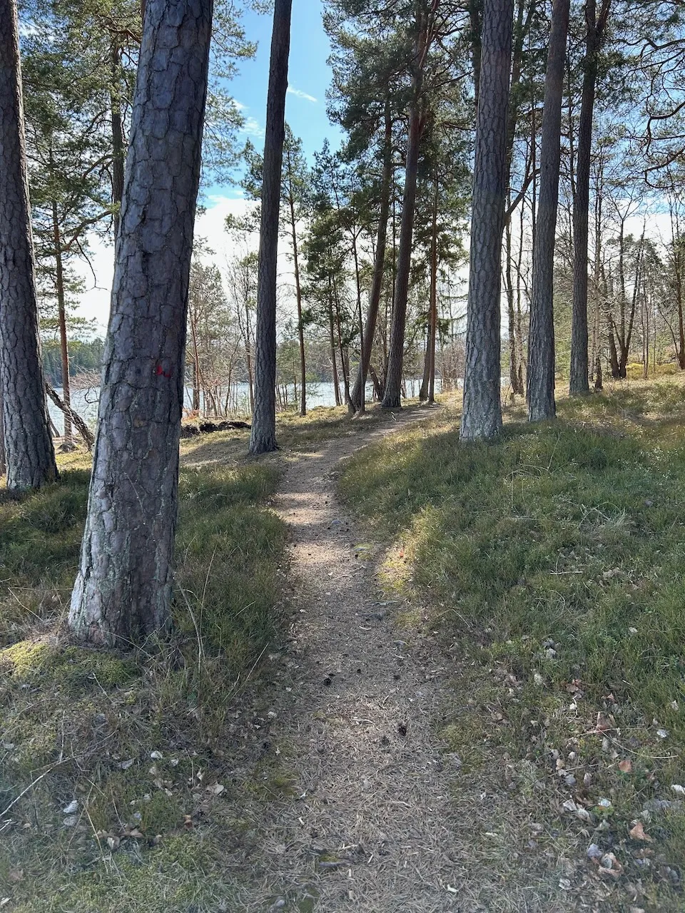
Furusundsskaten Salgo60 · CC0


Travel notes for Norrtälje
From Wikivoyage
Norrtälje, archaic spelling Norrtelje, is a town in northern Stockholm County, and the gateway to the northern parts of Stockholm archipelago. The ports of Kapellskär and Grisslehamn have international ferry connections.
Norrtälje municipality, Norrtälje kommun, makes up much of the traditional Roslagen region, together with Öregrund and Tierp in Uppsala County. The municipality has 57,000 permanent residents, and tens of thousands of summer guests.
The islands south of Norrtälje, such as Blidö and Furusund, are seen as part of Stockholm archipelago.
Get in+
By plane:
By train:
By car:
The E18 from Stockholm or by ferry (see below) from Finland or Estonia.
By bus:
Norrtälje is served by SL, the public transportation carrier of Stockholm County. See that article for details about ticketing.
From Stockholm by bus 676 from Tekniska Högskolan (served by the Stockholm Metro) and from Uppsala central station bus 677 connect to Norrtälje's bus station. Line 631 and 631X connect the centre and the port of Kapellskär, line 637 the centre and Grisslehamn. Note that tickets for the buses must be bought before boarding. Travel time from Stockholm centre to Kapellskär (including transfer) is 1h 45min.
By boat:
Finland and Estonia are one time zone ahead of Sweden.
The 1MISSING WIKILINK Port of Kapellskär in the east is served by frequent ferry services.
Mariehamn, Åland, with three services a day by Viking Line,
Naantali, mainland Finland (some via Långnäs, Åland), by Finnlines, and
Paldiski, Estonia by DFDS Seaways.
The Paldiski line does not accept pedestrians; an accompanying vehicle is necessary to board. The Naantali one does not accepts pedestrians from Åland in the summer season.
Also the port in 2 Grisslehamn in the north has a connection from Åland.
Eckerö, Åland, by Eckerölinjen, two to three times daily (€5 for an adult, €10 for a car), two hours from Eckerö to Grisslehamn. You can get from Mariehamn to Eckerö by the bus line 1 (€4.40).
Source: Wikivoyage · CC BY-SA 4.0 · abridged
Population of Norrtälje over time
| 1960 | 8,653 | |
|---|---|---|
| 1965 | 10,591 | |
| 1970 | 12,735 | |
| 2005 | 16,263 | |
| 2010 | 17,275 | |
| 2015 | 19,365 | |
| 2016 | 19,668 | |
| 2017 | 20,322 | |
| 2018 | 21,188 | |
| 2019 | 21,615 | |
| 2020 | 22,018 | |
| 2023 | 23,606 |
Censuses and official estimates; source: Wikidata.
Climate of Norrtälje
Best months for sightseeingBest months for sightseeing: June–August.
This month · November
A cold month
Day 4° · Night 0° · Rain 65 mm
- Hottest month
- July (day 21°)
- Coldest month
- February (night -6°)
- Wettest month
- July (74 mm)
- Driest month
- February (28 mm)
Bars: average monthly low and high temperature. Below: precipitation. Monthly averages for 1970–2000 at about 18 km resolution, adjusted for elevation. Highlighted months are mild and relatively dry. Source: WorldClim 2.1 (CC BY 4.0).
Show values as a table
| Month | Jan | Feb | Mar | Apr | May | Jun | Jul | Aug | Sep | Oct | Nov | Dec |
|---|---|---|---|---|---|---|---|---|---|---|---|---|
| Average high (°C) | 0° | -1° | 3° | 8° | 14° | 19° | 21° | 20° | 15° | 10° | 4° | 1° |
| Average low (°C) | -5° | -6° | -4° | 0° | 4° | 9° | 12° | 11° | 8° | 4° | 0° | -4° |
| Precipitation (mm) | 42 | 28 | 33 | 39 | 33 | 50 | 74 | 66 | 62 | 58 | 65 | 53 |
How to get to Norrtälje
The nearest airport is Stockholm-Arlanda Airport (ARN), 45 km to the west as the crow flies. The nearest large city is Sollentuna, 56 km to the southwest.
Airports
- Stockholm-Arlanda Airport (ARN) Stockholm 45 kmwest
- Stockholm-Bromma Airport (BMA) Stockholm 62 kmsouthwest
- Mariehamn Airport (MHQ) Mariehamn 78 kmnortheast
Nearby large cities
- Sollentuna Population: 139.6K 56 kmsouthwest
- Stockholm Population: 1.5M 60 kmsouthwest
- Västerås Population: 127.8K 122 kmwest
- Örebro Population: 156K 205 kmwest
- Jönköping Population: 112.8K 343 kmsouthwest
Straight-line distances; road distances are longer. Airport data: OurAirports.
Day trips from Norrtälje
Within 100 km: 38 historic and cultural sites, 77 natural sites, 1,053 lakes, rivers and coasts.
0–25 km149 places
- Högholmen Natural site 13 kmE
- Hamnholmen Island 21 kmE
- Bredholmen Island 14 kmSE
- Norrholmen Island 15 kmS
25–60 km576 places
- Rindö Island 43 kmSW
- Runmarö Island 53 kmS
- Husarö Island 29 kmS
- Lillö Island 57 kmSE
60–100 km443 places
- Norrön Island 61 kmN
- Granskär Island 87 kmW
- Gubbholmen Island 92 kmS
- Högholmen Island 80 kmS
Straight-line distances.
Nearby attractions & nature
Everything nearby-
Enholmen Island, Stockholm County7.7 km E
-
Marholmen Natural site, Stockholm County9 km SE
-
Gummarön Natural site, Stockholm County9.6 km E
-
Måsholmen Natural site, Stockholm County9.7 km SE
-
Högholmen Island, Stockholm County9.5 km SE
-
Gymsaren Natural site, Stockholm County11 km S
-
Arnö Island, Stockholm County10 km S
-
Djurlingsö Island, Stockholm County10 km SE
Sources & licences
Data last updated: · 2 independent sources