- Population
- 9,074
- 9.1K
- Elevation
- 16 m
- above sea level
- Local time
- UTC+01:00
- Europe/Stockholm · UTC+01:00
- Airports
- ARN Stockholm-Arlanda Airport12 km
- BMA Stockholm-Bromma Airport32 km
About Sigtuna
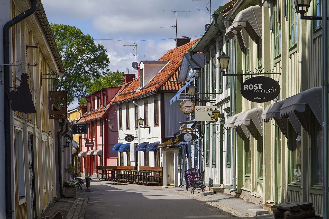
Sigtuna is a city. Location: Sigtuna Municipality, Stockholm County. Population: 9,074. Elevation: 16 m.
Sigtuna is a locality in the west of in the eponymous Sigtuna Municipality, in Stockholm County, Sweden. It counted 9,689 inhabitants in 2020. The seat of the municipality is a locality to the east, Märsta. Sigtuna is for historical reasons still often referred to as a stad. Sigtuna is on Skarven, a bay alongside Upplands-Bro and part of Lake Mälaren.
Source: Wikipedia · CC BY-SA 4.0
Photos of Sigtuna
-

Arild Vågen · CC BY-SA 3.0 -

Arild Vågen · CC BY-SA 4.0 -

Arild Vågen · CC BY-SA 3.0


Travel notes for Sigtuna
From Wikivoyage
Sigtuna is a city in Sigtuna Municipality in Stockholm County, north of Stockholm's northern suburbs.
The city of Sigtuna was Sweden's capital from the 10th to the 13th centuries and has 8,000 residents.
Understand+
Sigtuna is located on the shores of Lake Mälaren, but the plains around Sigtuna were below sea level from the Ice Age until the beginning of common era. The land was fertile, and became densely populated during the Viking Age, leaving a heritage of runestones, graves and monuments, while Lake Mälaren was part of the Baltic Sea.
According to tradition Sigtuna was founded in 980 AD by king Erik Segersäll (the Victorious). The founding of Sigtuna is considered an important step in unifying Sweden into one centralized kingdom. It replaced Birka as the most important trade node in the region, and as an early Christian centre it competed with the pagan Uppsala for religious supremacy. Erik's son and successor Olaf Skötkonung constructed a mint in Sigtuna, and thereby became the first king to mint coins in Sweden. With a royal mint and a bishop, Sigtuna was effectively the capital of Sweden until power shifted towards Stockholm and Uppsala in the 13th century. The city was raided by "pagans from the East" in 1187, and a few years later in 1190 the archdiocese was moved to Uppsala.
However, Sigtuna prevailed, and in 1237 the first Dominican monastery in Sweden was built there. Sigtuna's decline accelerated in the 16th century due to the Protestant Reformation, as power and wealth moved from the convent in Sigtuna to the king in Stockholm. Between 1648 and 1666 the city suffered three city fires and was eventually abandoned. In 1700 the population of Sigtuna was only 108 people.
Sigtuna's population was down at the hundreds for 250 years, until the city was revived in the 1910s as a nationalist project. Even though many of the buildings look traditional, most of them are from the early 20th century. However, due to the conservative spirit in which the city was reconstructed, it did not experience the same heavy urban renewal that many other Swedish cities did in the 1950s and 60s.
Tourist office:
Get in+
By plane:
1 Stockholm-Arlanda Airport (ARN IATA) is located in Sigtuna Municipality and is by far the largest airport in Sweden. For public transport between Arlanda and Sigtuna, bus 579 goes directly, while bus 583 connects Arlanda with Märsta where you have to change to bus 570 or 575.
By public transit:
The local public transportation operator in Stockholm County is SL.
There is no train station in Sigtuna; the closest one is in Märsta some 7 km east of Sigtuna. Sigtuna is reached from Märsta station by local buses 570 or 575. These buses are synchronised with the local commuter trains between Stockholm and Märsta.
By boat:
Strömma has a tourist ferry line between Stockholm and Sigtuna, with a stopover at Skokloster Palace in Håbo.
By car:
Route 263 passes through Sigtuna and continues towards Enköping in the West and connects to the highway E4 in the east. The E4, in turn, carries traffic between Uppsala in the North and Stockholm in the South.
Source: Wikivoyage · CC BY-SA 4.0 · abridged
Population of Sigtuna over time
| 1960 | 2,581 | |
|---|---|---|
| 1965 | 3,234 | |
| 1970 | 4,214 | |
| 2005 | 7,204 | |
| 2010 | 8,444 | |
| 2015 | 9,074 | |
| 2016 | 9,224 | |
| 2017 | 9,312 | |
| 2018 | 9,592 | |
| 2019 | 9,508 | |
| 2020 | 9,698 | |
| 2023 | 10,699 |
Censuses and official estimates; source: Wikidata.
Climate of Sigtuna
Best months for sightseeingBest months for sightseeing: June–August.
This month · November
A cold month
Day 4° · Night -1° · Rain 52 mm
- Hottest month
- July (day 22°)
- Coldest month
- February (night -6°)
- Wettest month
- July (73 mm)
- Driest month
- February (25 mm)
Bars: average monthly low and high temperature. Below: precipitation. Monthly averages for 1970–2000 at about 18 km resolution, adjusted for elevation. Highlighted months are mild and relatively dry. Source: WorldClim 2.1 (CC BY 4.0).
Show values as a table
| Month | Jan | Feb | Mar | Apr | May | Jun | Jul | Aug | Sep | Oct | Nov | Dec |
|---|---|---|---|---|---|---|---|---|---|---|---|---|
| Average high (°C) | 0° | 0° | 3° | 9° | 16° | 20° | 22° | 20° | 15° | 10° | 4° | 2° |
| Average low (°C) | -6° | -6° | -3° | 0° | 5° | 9° | 12° | 11° | 7° | 4° | -1° | -4° |
| Precipitation (mm) | 35 | 25 | 30 | 34 | 33 | 52 | 73 | 60 | 55 | 48 | 52 | 42 |
How to get to Sigtuna
The nearest airport is Stockholm-Arlanda Airport (ARN), 12 km to the east as the crow flies. The nearest large city is Sollentuna, 25 km to the southeast.
Airports
- Stockholm-Arlanda Airport (ARN) Stockholm 12 kmeast
- Stockholm-Bromma Airport (BMA) Stockholm 32 kmsoutheast
- Stockholm Västerås Airport (VST) Stockholm / Västerås 62 kmwest
Nearby large cities
- Sollentuna Population: 139.6K 25 kmsoutheast
- Stockholm Population: 1.5M 38 kmsoutheast
- Västerås Population: 127.8K 66 kmwest
- Örebro Population: 156K 148 kmwest
- Jönköping Population: 112.8K 291 kmsouthwest
Straight-line distances; road distances are longer. Airport data: OurAirports.
Day trips from Sigtuna
Within 100 km: 38 historic and cultural sites, 91 natural sites, 1,156 lakes, rivers and coasts.
0–25 km24 places
- Ärtskär Island 20 kmSW
- Näckholm Island 19 kmW
- Myrskär Island 16 kmSW
- Lagnö Island 23 kmSW
25–60 km255 places
- Rindö Island 45 kmSE
- Granskär Island 31 kmSW
- Kalvholmen Island 57 kmSE
- Byttholmen Island 52 kmSE
60–100 km1,006 places
- Runmarö Island 70 kmSE
- Husarö Island 65 kmE
- Norrön Island 90 kmNE
- Galtholmen Island 60 kmSE
Straight-line distances.
Nearby attractions & nature
Everything nearby-
Broholmen Island, Stockholm County2.1 km W
-
Munkholmen Island, Upplands-Bro Municipality12 km SE
-
Foderholmen Island, Upplands-Bro Municipality19 km S
-
Myrskär Island, Uppsala County16 km SW
-
Granholmen Island, Kalmar socken17 km SW
-
Lindskär Island, Låssa socken17 km S
-
Eldgarnsön Island, Ekerö Municipality21 km S
-
Östra Högholmen Island, Låssa socken17 km S
Sources & licences
Data last updated: · 2 independent sources