Forshaga
Located in Forshaga Municipality, Värmland County Coordinates: 59°31′31″ N 13°28′53″ E
- Population
- 6,361
- 6.4K
- Elevation
- 63 m
- above sea level
- Local time
- UTC+01:00
- Europe/Stockholm · UTC+01:00
- Airports
- KSD Karlstad Airport12 km
- TYF Torsby Airport76 km
About Forshaga
Forshaga is a city. Location: Forshaga Municipality, Värmland County. Population: 6,361. Elevation: 63 m.
Forshaga is a locality and the seat of Forshaga Municipality, Värmland County, Sweden, with 11,520 inhabitants in 2025.
Source: Wikipedia · CC BY-SA 4.0
At a glance
- Area
- 5.6 km²
Source: Wikidata
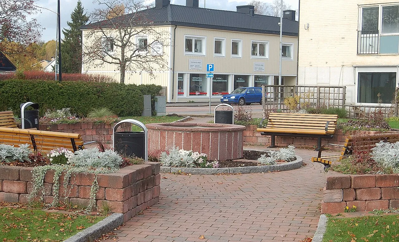
Photos of Forshaga
-

AleWi · CC BY-SA 4.0 -

Janee · CC BY-SA 3.0 -

Janee · CC BY-SA 3.0


Travel notes for Forshaga
From Wikivoyage
Värmland, archaic spelling Wermland, is a province (landskap) in the Svealand region in Sweden. It borders the provinces of Västergötland, Dalsland, Dalarna, Västmanland and Närke. It also borders Norway (Östfold and Hedmark) in the west and Sweden's largest lake, Vänern.
Understand+
A mountain range along the Swedish-Norwegian border is called the Fjäll (though the word fjäll is used in middle Sweden for any type of mountain, cognate to northern English 'fell'). Typical for the Fjäll mountains are their rounded tops, usually lacking any well defined peaks. The upper part of the mountains usually rises above the tree-line and only shrubs grow there.
Get in+
By plane:
Karlstad Airport (KSD IATA) has daily flights to Stockholm and Copenhagen. Tickets are purchased from the airline Skyways. Another option is to fly to Oslo airport (Gardermoen) and go to Sweden from there.
Torsby Airport (TYF IATA), Hagfors Airport (HFS IATA).
By rail:
SJ connects Värmland's cities with the rest of Sweden. On the website you can also buy tickets to Oslo in Norway, which is about three hours from Karlstad.
By car:
The main arteries are the E18 road, which connects Karlstad with Stockholm and Oslo, and road 45 (Inlandsvägen) leading south to Gothenburg. Road 45 crosses the E18 just west of Karlstad.
Source: Wikivoyage · CC BY-SA 4.0 · abridged
Population of Forshaga over time
| 2010 | 6,229 | |
|---|---|---|
| 2015 | 6,361 | |
| 2016 | 6,390 | |
| 2017 | 6,457 | |
| 2018 | 6,439 | |
| 2019 | 6,439 | |
| 2020 | 6,448 | |
| 2023 | 6,433 |
Censuses and official estimates; source: Wikidata.
Climate of Forshaga
Best months for sightseeingBest months for sightseeing: June–August.
This month · November
A cold month
Day 4° · Night -2° · Rain 74 mm
- Hottest month
- July (day 22°)
- Coldest month
- February (night -8°)
- Wettest month
- August (75 mm)
- Driest month
- February (34 mm)
Bars: average monthly low and high temperature. Below: precipitation. Monthly averages for 1970–2000 at about 18 km resolution, adjusted for elevation. Highlighted months are mild and relatively dry. Source: WorldClim 2.1 (CC BY 4.0).
Show values as a table
| Month | Jan | Feb | Mar | Apr | May | Jun | Jul | Aug | Sep | Oct | Nov | Dec |
|---|---|---|---|---|---|---|---|---|---|---|---|---|
| Average high (°C) | -2° | -1° | 4° | 9° | 16° | 20° | 22° | 20° | 15° | 10° | 4° | 0° |
| Average low (°C) | -8° | -8° | -5° | 0° | 5° | 9° | 11° | 10° | 6° | 3° | -2° | -7° |
| Precipitation (mm) | 46 | 34 | 43 | 44 | 44 | 64 | 72 | 75 | 72 | 70 | 74 | 56 |
How to get to Forshaga
The nearest airport is Karlstad Airport (KSD), 12 km to the southwest as the crow flies. The nearest large city is Örebro, 102 km to the east.
Airports
- Karlstad Airport (KSD) Karlstad 12 kmsouthwest
- Torsby Airport (TYF) Torsby 76 kmnorth
- Örebro Airport (ORB) Örebro 95 kmeast
Nearby large cities
- Örebro Population: 156K 102 kmeast
- Oslo Population: 1.1M 160 kmwest
- Västerås Population: 127.8K 174 kmeast
- Drammen Population: 106K 186 kmwest
- Jönköping Population: 112.8K 198 kmsouth
Straight-line distances; road distances are longer. Airport data: OurAirports.
Day trips from Forshaga
Within 100 km: 1 historic or cultural site, 20 natural sites, 60 lakes, rivers and coasts.
0–25 km5 places
- Yttre Sållaren Island 23 kmSE
- Östra Korsön Island 24 kmS
- Kärrholmen Island 23 kmSE
- Inre Sållaren Island 21 kmSE
25–60 km27 places
- Bärön Island 33 kmSW
- Elgön Island 53 kmNE
- Härö Island 35 kmSE
- Knipan Island 37 kmSW
60–100 km49 places
- Kållandsö Island 98 kmS
- Håberget Mountain 98 kmN
- Djurö Island 73 kmS
- Dillö Island 89 kmS
Straight-line distances.
Nearby attractions & nature
Everything nearby-
Glofsön Island, Värmland County18 km SE
-
Inre Sållaren Island, Värmland County21 km SE
-
Yttre Sållaren Island, Värmland County23 km SE
-
Kärrholmen Island, Värmland County23 km SE
-
Östra Korsön Island, Värmland County24 km S
Sources & licences
Data last updated: · 2 independent sources