Skellefteå socken
Located in Skellefteå landsförs., Skellefteå Kommun Coordinates: 64°47′03″ N 20°40′48″ E
- Elevation
- 106 m
- above sea level
- Local time
- UTC+01:00
- Europe/Stockholm · UTC+01:00
- Airports
- SFT Skellefteå Airport26 km
- LYC Lycksele Airport97 km
About Skellefteå socken
Skellefteå socken is a village. Location: Skellefteå landsförs., Skellefteå Kommun. Elevation: 106 m. The best months to visit are June–August. The nearest airport is Skellefteå Airport (26 km). Nearby sights include Skellefteå Kraft Arena and Kågön.
Climate of Skellefteå socken
Best months for sightseeingBest months for sightseeing: June–August.
This month · November
A cold month
Day -1° · Night -7° · Rain 57 mm
- Hottest month
- July (day 20°)
- Coldest month
- January (night -13°)
- Wettest month
- July (81 mm)
- Driest month
- February (31 mm)
Bars: average monthly low and high temperature. Below: precipitation. Monthly averages for 1970–2000 at about 18 km resolution, adjusted for elevation. Highlighted months are mild and relatively dry. Source: WorldClim 2.1 (CC BY 4.0).
Show values as a table
| Month | Jan | Feb | Mar | Apr | May | Jun | Jul | Aug | Sep | Oct | Nov | Dec |
|---|---|---|---|---|---|---|---|---|---|---|---|---|
| Average high (°C) | -5° | -5° | 0° | 5° | 12° | 18° | 20° | 18° | 12° | 5° | -1° | -4° |
| Average low (°C) | -13° | -12° | -9° | -4° | 2° | 7° | 10° | 8° | 4° | -1° | -7° | -11° |
| Precipitation (mm) | 42 | 31 | 36 | 31 | 38 | 58 | 81 | 69 | 60 | 56 | 57 | 43 |
How to get to Skellefteå socken
The nearest airport is Skellefteå Airport (SFT), 26 km to the southeast as the crow flies. For international flights: Luleå Airport (LLA) (108 km). The nearest large city is Umeå, 108 km to the south.
Airports
- Skellefteå Airport (SFT) Skellefteå 26 kmsoutheast
- Lycksele Airport (LYC) Lycksele 97 kmwest
- Luleå Airport (LLA) Luleå 108 kmnortheast
Nearby large cities
- Umeå Population: 130.2K 108 kmsouth
Straight-line distances; road distances are longer. Airport data: OurAirports.
Day trips from Skellefteå socken
Within 100 km: 1 historic or cultural site, 44 natural sites, 66 lakes, rivers and coasts.
0–25 km5 places
- Kågön Natural site 20 kmE
- Oxholmen Island 19 kmNE
- Rannerskäret Island 21 kmE
- Ostnäset Natural site 23 kmE
25–60 km36 places
- Långskuttun Island 33 kmSE
- Lill-Blåbärsholmen Island 49 kmNE
- Burön Natural site 30 kmSE
- Degerön Natural site 26 kmSE
60–100 km70 places
- Lulhällan Island 85 kmN
- Bastaholmen Island 82 kmNE
- Innerstholmen Island 82 kmNE
- Fingermanholmen Island 67 kmNE
Straight-line distances.
Nearby attractions & nature
Everything nearby-
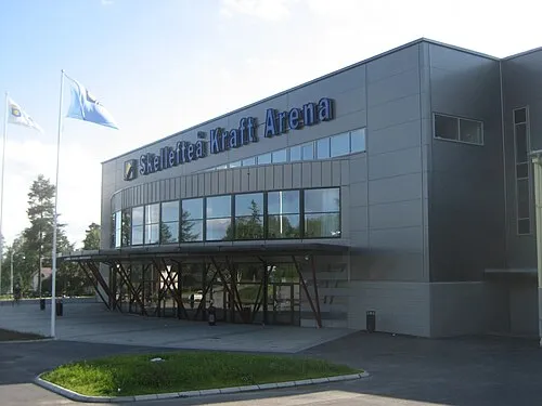 Skellefteå Kraft Arena Landmark, Skellefteå stad socken14 km E
-
Kågön Natural site, Västerbotten County20 km E
-
Ostnäset Natural site, Västerbotten County23 km E
-
Oxholmen Island, Västerbotten County19 km NE
-
Rannerskäret Island, Västerbotten County21 km E
Sources & licences
Data last updated: