Södra Råda socken
Located in Amnehärad, Gullspång Municipality Coordinates: 59°00′42″ N 14°10′36″ E
- Elevation
- 93 m
- above sea level
- Local time
- UTC+01:00
- Europe/Stockholm · UTC+01:00
- Airports
- ORB Örebro Airport55 km
- KSD Karlstad Airport68 km
About Södra Råda socken
Södra Råda socken is a village. Location: Amnehärad, Gullspång Municipality. Elevation: 93 m. The best months to visit are June–August. The nearest airport is Örebro Airport (55 km). Nearby sights include Furuholmen and Labacksnäset.
Climate of Södra Råda socken
Best months for sightseeingBest months for sightseeing: June–August.
This month · November
A cold month
Day 4° · Night 0° · Rain 68 mm
- Hottest month
- July (day 21°)
- Coldest month
- February (night -6°)
- Wettest month
- August (72 mm)
- Driest month
- February (34 mm)
Bars: average monthly low and high temperature. Below: precipitation. Monthly averages for 1970–2000 at about 18 km resolution, adjusted for elevation. Highlighted months are mild and relatively dry. Source: WorldClim 2.1 (CC BY 4.0).
Show values as a table
| Month | Jan | Feb | Mar | Apr | May | Jun | Jul | Aug | Sep | Oct | Nov | Dec |
|---|---|---|---|---|---|---|---|---|---|---|---|---|
| Average high (°C) | 0° | 0° | 4° | 9° | 16° | 19° | 21° | 20° | 15° | 10° | 4° | 1° |
| Average low (°C) | -5° | -6° | -3° | 1° | 6° | 10° | 12° | 12° | 8° | 4° | 0° | -4° |
| Precipitation (mm) | 49 | 34 | 40 | 43 | 42 | 64 | 71 | 72 | 71 | 63 | 68 | 59 |
How to get to Södra Råda socken
The nearest airport is Örebro Airport (ORB), 55 km to the northeast as the crow flies. For international flights: Linköping City Airport (LPI) (110 km). The nearest large city is Örebro, 66 km to the northeast.
Airports
- Örebro Airport (ORB) Örebro 55 kmnortheast
- Karlstad Airport (KSD) Karlstad 68 kmnorthwest
- Linköping City Airport (LPI) Linköping 110 kmsoutheast
Nearby large cities
- Örebro Population: 156K 66 kmnortheast
- Jönköping Population: 112.8K 137 kmsouth
- Västerås Population: 127.8K 151 kmnortheast
- Gothenburg Population: 608.5K 195 kmsouthwest
- Oslo Population: 1.1M 219 kmnorthwest
Straight-line distances; road distances are longer. Airport data: OurAirports.
Day trips from Södra Råda socken
Within 100 km: 3 historic and cultural sites, 10 natural sites, 67 lakes, rivers and coasts.
0–25 km8 places
- Hemön Island 24 kmSW
- Furuholmen Island 4 kmNW
- Furholmarna Island 19 kmNW
- Ekön Island 12 kmSW
25–60 km33 places
- Djurö Island 44 kmW
- Dillö Island 40 kmSW
- Korsholmen Island 60 kmW
- Härö Island 35 kmNW
60–100 km39 places
- Kållandsö Island 71 kmSW
- Bärön Island 62 kmNW
- Elgön Island 84 kmN
- Lillön Island 61 kmNE
Straight-line distances.
Nearby attractions & nature
Everything nearby-
Furuholmen Island, Värmland County4.2 km NW
-
Labacksnäset Natural site, Värmland County4.9 km NE
-
Lövnäsudden Natural site, Värmland County7.5 km NW
-
Ekön Island, Västra Götaland County12 km SW
-
Anneholmen Island, Västra Götaland County12 km SW
-
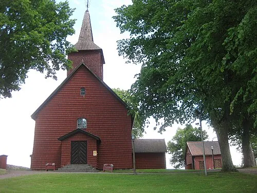 Älgarås kyrka Attraction, Älgarås socken24 km S
Sources & licences
Data last updated: